Join us at our 2nd Annual Blizzard Ball

Forecast for the Provo Area Mountains

Drew Hardesty
Issued by Drew Hardesty on
Saturday morning, December 11, 2021
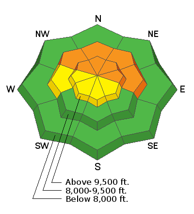
Dangerous avalanche conditions exist in the backcountry.
The avalanche danger is CONSIDERABLE on all steep northwest to east facing slopes at the mid and upper elevations. This terrain is to be avoided. Accidents occur on days like today,
You can trigger 1-2' deep avalanches today while on, above, below, or adjacent to steep terrain.
Riding conditions are good on low angle terrain with no overhead hazard.
Low
Moderate
Considerable
High
Extreme
Learn how to read the forecast here
Special Announcements
This week is the third annual Avalanche Awareness Week in Utah. A lot is going on with over 20 different events around the state. You can find all the events HERE.
Batteries for Beacons runs through Dec 19. Get free batteries for your transceiver and a chance to win 1 of 10 Black Diamond Rescue Kits, 1 of 3 Mammut Barryvox transceivers, or 1 of 3 BCA Tracker transceivers. Stop at a participating shop, fill out our survey and get a free set of batteries. Don't need batteries, but still want a chance to win? Simply fill out the survey to be registered.
Weather and Snow
Skies are clear with mountain temperatures in the single digits and low teens. Winds are light to moderate from the southwest.
Storm totals are roughly 12-16" with nearly 2.0" of snow water equivalent.
Snow depths are now 2-3' up high and riding conditions are vastly improved.

The Outlook -
For today, we'll see increasing high clouds with light to moderate southwest winds. Temperatures will rise to the low 20s F by the afternoon.
As this storm fades from memory, our attention turns to the next storm churning in the Pacific. We'll see warming temperatures and increasing southwest winds Sunday and Monday ahead of what looks to be a decent snowfall event Tuesday/Wednesday. Southwest winds ahead of the storm are forecast to average 50-60mph.
Recent Avalanches
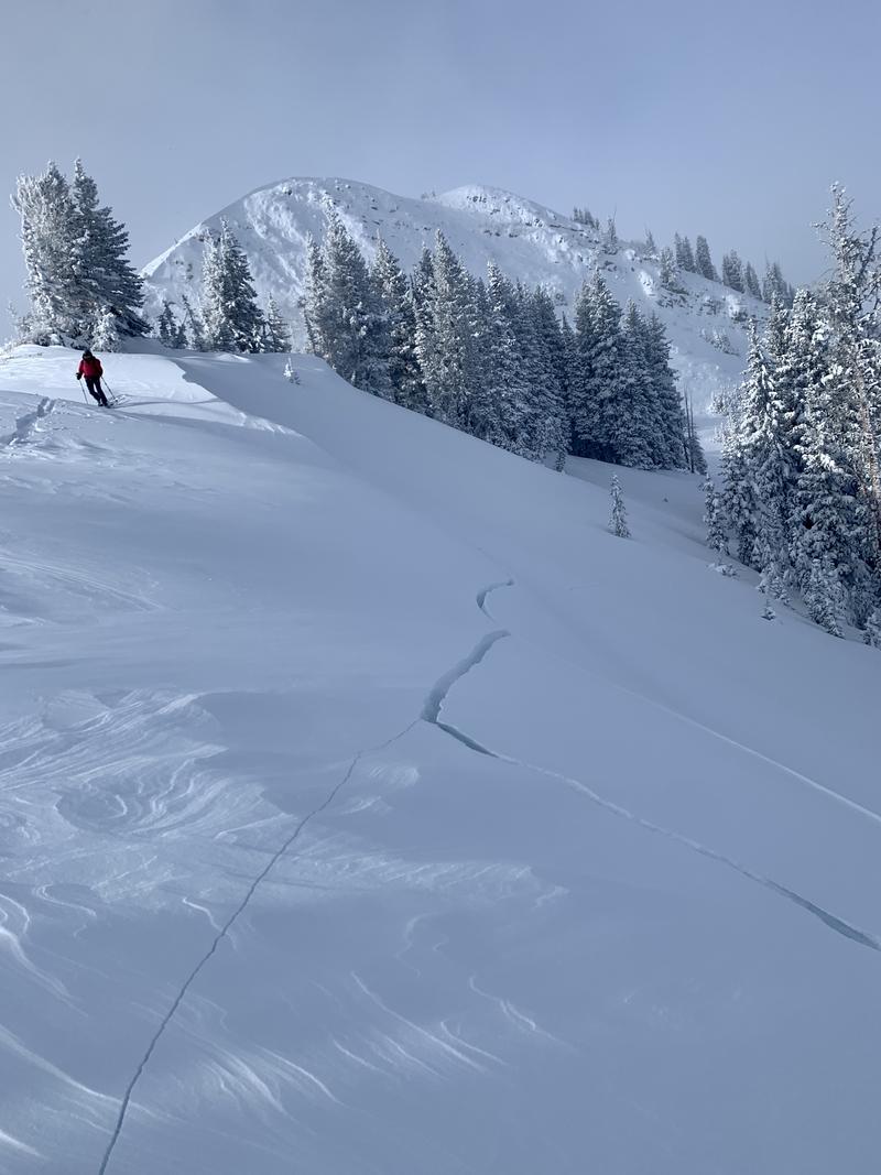
We didn't hear of any avalanches in the Provo mountains, but I expect that they mirrored dangerous avalanche conditions from the Salt Lake Mountains. We heard about numerous human triggered avalanches 1-2' deep and up to 1000' wide yesterday. Cracking and collapsing were the rule and not the exception.
This was our experience in the SLC mountains yesterday: When you experience significant cracking and collapsing 200 yards from the trailhead (see video below), it's clear that all steep terrain that held old snow from October is off and to avoided.
Ad
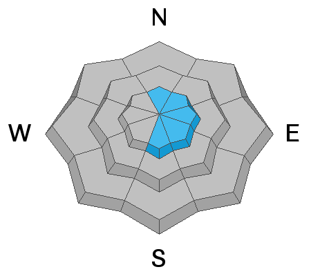
Avalanche Problem #1
New Snow
Type
Location
Likelihood
Size
Description
Loud booming collapse and shooting cracks yesterday on the PC ridgeline
All the signs of dangerous avalanche conditions will be less evident today than yesterday, but conditions remain equally dangerous. Our primary issue is the interface of the recent storm snow on the old snow surface. One can easily dig down and see weak, sugary faceted snow at this interface and this combination of one to avoid.
For now, I am avoiding being on or below all steep west to north to east facing terrain at the mid and upper elevations.
Avalanche Problem #2
Wind Drifted Snow
Type
Location
Likelihood
Size
Description
Wind drifts remain prevalent on north to east to south facing slopes, but are generally scattered around the compass. These drifts are likely to be more stubborn than yesterday and may break well above the rider on the slope.
Additional Information
Danger Trend: I expect increasing avalanche danger and a fresh batch of wind slabs from the stronger southwest winds tomorrow through Tuesday.
General Announcements

This information does not apply to developed ski areas or highways where avalanche control is normally done. This forecast is from the U.S.D.A. Forest Service, which is solely responsible for its content. This forecast describes general avalanche conditions and local variations always occur.