A beautiful day is in store with sunny skies, light to moderate NW winds, and temps climbing up into the mid 30's at 10,000'. Sunny skies continue through Monday with temps climbing higher each day. A weak system to the north will bring breezy conditions on Monday followed by clouds and a slight chance of snow Monday night into Tues. Dry and warmer weather returns for the remainder of the week.
Snowpack Discussion
More than a foot of new snow has stacked up over the past few days which is certainly enough to create avalanche concerns. Southerly winds on Thursday blew the snow around forming unstable drifts on leeward slopes, primarily on upper elevation northerly aspects. Soft slab avalanches within the recent snow remain possible on steep slopes on all aspects that have more than about 8" of new snow. And finally, with daytime heating, the new snow will be very susceptible to loose wet avalanches on sun exposed slopes. Be alert to signs of loose, wet snow instability including rollerballs, pinwheels and sloppy wet snow. Get off of and out from uner steep slopes when these signs are present.
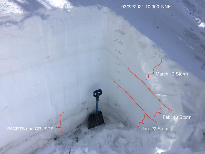
On Monday, Snowpack tests revealed that we still have a poor snowpack structure, but suspect weak layers are far-enough down in the snowpack that it will be difficult to affect them. Last week's storm appears to be bonding well to the old snow. Time and warm temperatures have helped stabilize the snowpack but it is still possible to trigger a deep and dangerous avalanche on a buried persistent weak layer of sugary, faceted snow. This weak layer exists on slopes that face NW-N-E, and thin snowpack areas consisting of steep, rocky terrain are the most likely trigger points. Here is a snapshot of the snowpack near Cooley Pass.