Forecast for the Abajos Area Mountains

Issued by Eric Trenbeath on
Monday morning, February 22, 2021
Monday morning, February 22, 2021
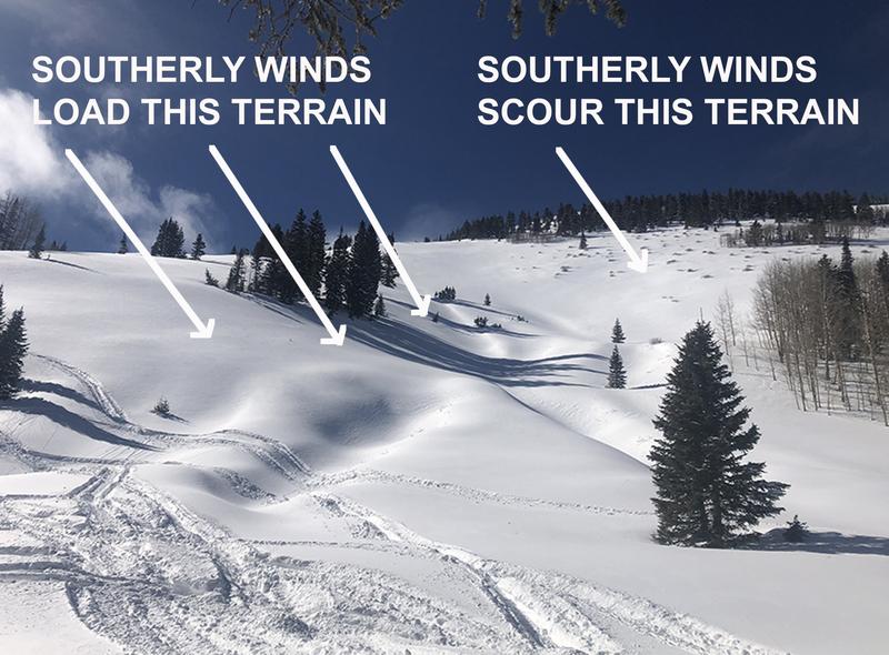
The avalanche danger remains CONSIDERABLE on steep slopes facing NW-NE-SE at mid and upper elevations. In these areas, fresh deposits of wind drifted snow have added stress to buried persistent weak layers, and deep and deep and dangerous human-triggered avalanches up to 4' deep are likely. The avalanche danger is MODERATE on most south-facing slopes and human-triggered avalanches remain possible. As the day heats up, be alert to signs of loose wet instability on sun-exposed slopes such as rollerballs or pinwheels and stay out from under steep slopes if they become wet and sloppy.

Low
Moderate
Considerable
High
Extreme
Learn how to read the forecast here