Forecast for the Abajos Area Mountains

Eric Trenbeath
Issued by Eric Trenbeath on
Sunday morning, February 21, 2021
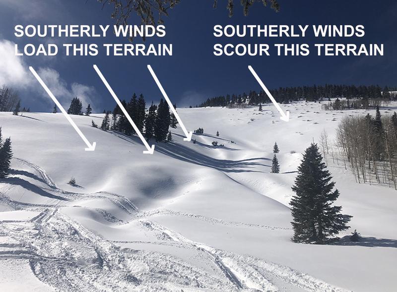
Shifting winds have created fresh, unstable drifts on all aspects above treeline and the avalanche danger is CONSIDERABLE on slopes steeper than 30 degrees that have recent deposits of wind drifted snow. On steep slopes facing NW-NE-SE near and above treeline fresh drifts have added stress to buried persistent weak layers and deep and deep and dangerous human-triggered avalanches up to 4' deep are likely. The avalanche danger is MODERATE on most south-facing slopes near treeline and below and human-triggered avalanches remain possible.
Low
Moderate
Considerable
High
Extreme
Learn how to read the forecast here
Special Announcements
Weather and Snow
Moderate SW winds yesterday shifted to NW last night where they blew in the 20-30 mph range with gusts as high as 45 mph. They've backed off a bit this morning. Today look for sunny skies, decreasing NW winds, and high temps near 20F at 10,000'. Conditions will remain dry through Tues with a slight chance of snow on Wed. Models are now hinting at a possible return to a more active pattern for the desert southwest by the weekend. We'll keep you posted.
Snow totals at Buckboard Flat (8924')
Snow totals at Camp Jackson (8858')
Snowpack Discussion
It was a beautiful day in the mountains on Friday and my partner Kevin Dressel and I took advantage of the last day for powder snow on southerly aspects. By afternoon the strong sun and warm temperatures moistened the snow surface and sun-exposed slopes are now crusted over. Plenty of soft dry powder remains on sheltered, northerly aspects, but you still need to keep your slope angles under 30 degrees to avoid triggering an avalanche. Buried persistent weak layers of loose, sugary snow exist deep in the snowpack and storm snow from last week has added stress to these weak layers. Fresh deposits of wind drifted snow today will add further stress.
Photo below illustrates the type of terrain that should still be avoided. Slope is: 1) steep 2) subject to wind loading 3) northerly facing and therefore harboring layers of weak, sugary, faceted snow.
Under the current conditions, tickling slopes from below can cause avalanches to release from above.
Recent Avalanches
No new avalanche activity has been observed since Brian Murdock reported this avalanche on Horse Head Mountain on Monday. It likely ran naturally sometime during the storm last weekend.
Additional Information
Information on outdoor recreation - The State of Utah created this webpage with information about recreating on both state and federal public lands during the current health crisis.

New to the backcountry (including riding at closed resorts) - Watch the award-winning, 15 minute Know Before You Go video, or take the 5-part, free online-learning series.
General Announcements
This forecast is from the U.S. Forest Service, which is solely responsible for its content. This forecast describes general avalanche conditions and local variations always occur.