Buckboard Snotel is reporting 3" of new snow this morning with no new snow falling at Camp Jackson on the south side of the range. Skies are clear and NW winds are blowing in the 10-20 mph range at upper elevations. Look for sunny skies today with high temps in the upper teens. Northwest flow aloft prevails across the Intermountain region bringing chances of snow to the north while southern Utah looks to remain dry through the weekend.
Snowpack Discussion
Last week's storm cycle nearly doubled our snowpack and depths range from 2'-4' deep on northerly aspects. Coverage on south-facing terrain remains quite thin with some slopes continuing to show bare ground. The sparse coverage makes conditions deceiving, but dangerous human triggered avalanches remain likely in steep, northerly facing slopes. In these areas, the underlying snow, however, is very weak and sugary and is providing an unstable base for slabs that have formed on top. Kevin Dressel was up yesterday and reported unstable conditons with reactive stability tests. See his
report here. Large, destructive and deadly avalanches continue to be reported from adjacent zones. On Monday, a
large avalanche on a NE aspect at 11,500' caught and carried four skiers, three of which are still missing. Yesterday, a
near miss occured on the Skyline at 10,000' on a north-aspect. Both of these events highlight that persistant slab avalanches are sensitive to triggering, and may break wider and farther than you might expect.
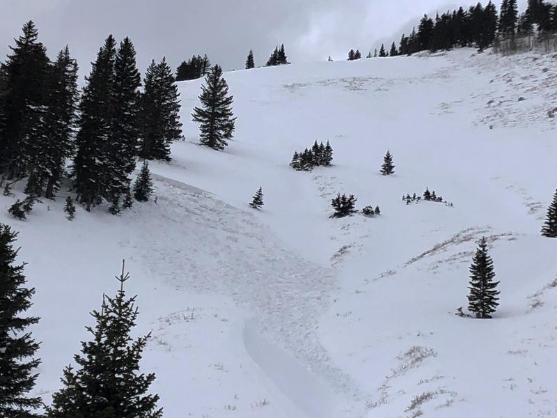
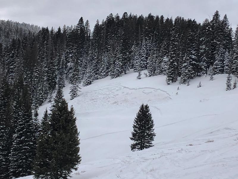
On Friday (1/29/2021), several slab avalanches were observed that failed on weak, sugary snow near the ground on steep, NE aspects. One near North Creek Pass is reported to be snowmobile triggered. Recent avalanches are clear signs of instability.
Mathew Cozart reported observing several avalanches on Sunday (1/31/21). Read his report
here.