

Forecast for the Abajos Area Mountains

Issued by Eric Trenbeath on
Monday morning, February 1, 2021
Monday morning, February 1, 2021
Heavy snowfall over the past week and strong southerly winds have overloaded north-facing slopes and the avalanche danger remains CONSIDERABLE on steep slopes facing W-N-E at mid and upper elevations. Human triggered avalanches are likely in these areas. Cautious route-finding and conservative decision-making are essential. Elsewhere, the avalanche danger is MODERATE and human-triggered avalanches are possible. Stay off of and out from under steep, northerly-facing avalanche terrain.
Low
Moderate
Considerable
High
Extreme
Learn how to read the forecast here
 Special Announcements
With great sadness, the Utah Avalanche Center reports that a 57-year old skier, Kurt Damschroder of Park City, was killed in a backcountry avalanche off of Squaretop Peak, located on the Park City Ridgeline. The preliminary information can be found HERE. Our thoughts go out to those affected by this tragic accident, especially the family and friends of the victim.
It was an active weekend throughout the state. Manti-Skyline forecaster Brett Kobernik has compiled events in this short video.
 Weather and Snow
Southerly winds bumped up a bit overnight and temps have remained quite warm. Today look for high clouds to move in from the SW ahead of a trough approaching the Pacific coast. Southerly winds will be light to moderate, and high temps at 10,000' will be right around freezing. SW flow will continue to feed mid-level moisture into the region through Tuesday bringing more clouds and keeping temperatures warm. Our next shot at snow comes Wed night into Thu as the next Pacific storm system moved into the region.
Snow totals at Buckboard Flat (8924')
Snow totals at Camp Jackson (8858')
Snowpack Discussion
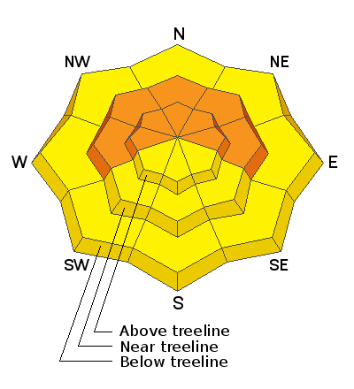
A significant load of snow combined with wind has created dangerous avalanche conditions in the Abajo Mountains. The underlying snowpack is very weak and is comprised of loose, sugary faceted snow. Dense drifts and slabs now overly this poor snowpack structure and conditions are unstable. In our travels yesterday in the La Sals, the impacts of Wednesday's wind event were evident and can be expected to be found in the Abajos as well. In areas below treeline, last weekend's storm snow is less wind-affected. Near treeline, depth is variable and much of the snow has been stiffened by the wind. In these areas, the snow is more supportive and we experienced less cracking and collapsing than we had expected. In areas that have wind-drifted snow, the snowpack is considerably deeper with a moderately dense slab (4F to 1F hardness) overlying weak basal facets (F hardness) above the October and November crusts. Above treeline, large wind drifts and significant cross loading were easily observed on leeward aspects, ranging from west to north to east. Poor snowpack structure still plagues our mountains, with numerous persistent weak layers buried both underneath recent snow, as well as near the bottom of the snowpack. Strong winds have built stiff slabs on these weak layers and may be triggered by the weight of a skier or rider, especially in places where the slab is thin and weak.
 Recent Avalanches
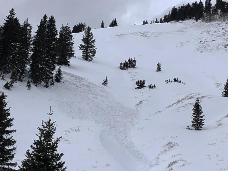
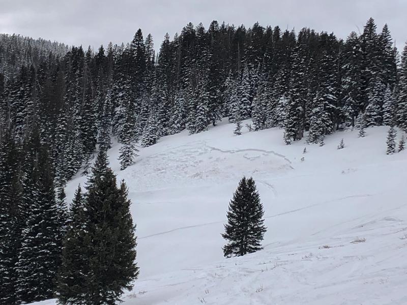
In my travels Friday I observed a couple of slab avalanches that failed on weak, sugary snow near the ground on steep, NE aspects. One near North Creek Pass is reported to be snowmobile triggered. Recent avalanches are clear signs of instability.
Mathew Cozart reported observing several avalanches yesterday. Read his report here.
Additional Information
Information on outdoor recreation - The State of Utah created this webpage with information about recreating on both state and federal public lands during the current health crisis.
New to the backcountry (including riding at closed resorts) - Watch the award-winning, 15 minute Know Before You Go video, or take the 5-part, free online-learning series.
General Announcements
This forecast is from the U.S. Forest Service, which is solely responsible for its content. This forecast describes general avalanche conditions and local variations always occur.