I regret to inform everyone that recovery efforts are ongoing for an avalanche victim who was caught and buried near Square Top Mountain in Wasatch Range yesterday. More details as they come. Yesterday was quite active throughout the state with two more accidents reported. See this video from forecaster Brett Kobernik on the Manti-Skyline.
The mountains picked up a few more inches of snow on Friday night. Northwesterly winds were mostly light yesterday though they've increased slightly this morning. We should see some clouds move into the area tonight and into Monday as mid-level trough moves in toward the Pacific coast. This approaching system will bring us a chance for snow on Wednesday but models are currently showing some disagreement on the storm track.
Snowpack Discussion
A significant load of snow combined with wind has created dangerous avalanche conditions in the Abajo Mountains. The underlying snowpack is very weak and is comprised of loose, sugary faceted snow. Dense drifts and slabs now overly this poor snowpack structure and conditions are unstable. In our travels yesterday in the La Sals, the impacts of Wednesday's wind event were evident and can be expected to be found in the Abajos as well. In areas below treeline, last weekend's storm snow is less wind-affected. Near treeline, depth is variable and much of the snow has been stiffened by the wind. In these areas, the snow is more supportive and we experienced less cracking and collapsing than we had expected. In areas that have wind-drifted snow, the snowpack is considerably deeper with a moderately dense slab (4F to 1F hardness) overlying weak basal facets (F hardness) above the October and November crusts. Above treeline, large wind drifts and significant cross loading were easily observed on leeward aspects, ranging from west to north to east. Poor snowpack structure still plagues our mountains, with numerous persistent weak layers buried both underneath recent snow, as well as near the bottom of the snowpack. Strong winds have built stiff slabs on these weak layers and may be triggered by the weight of a skier or rider, especially in places where the slab is thin and weak.
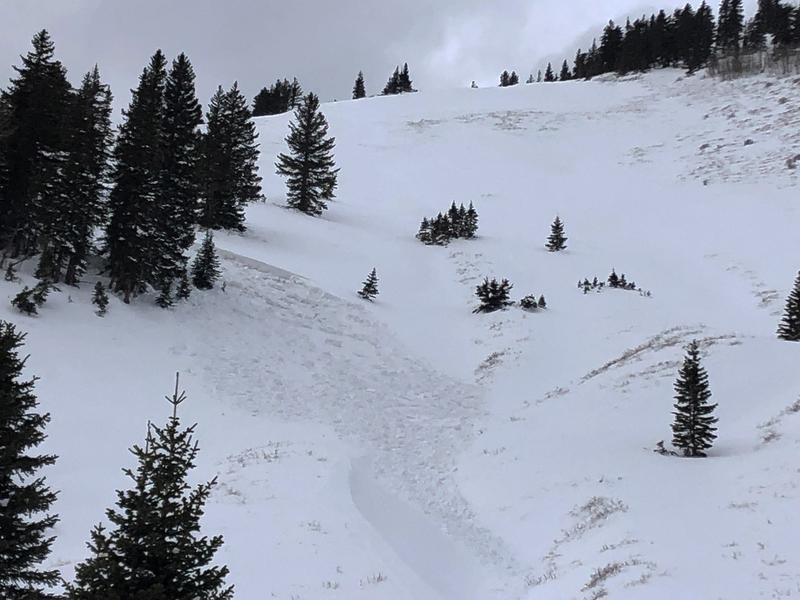
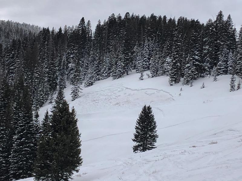
In my travels Friday I observed a couple of slab avalanches that failed on weak, sugary snow near the ground on steep, NE aspects. Recent avalanches are clear signs of instability. Check back for more details on these slides.
Mathew Cozart reported observing several avalanches yesterday. Read his report
here.