Do you have the essential avalanche rescue gear (transceiver, probe, and shovel) and do you know how to use them?
Watch this video to see how the three pieces of equipment work together.
Yesterday's storm produced 6"-8" of fairly dense new snow. Moderate to strong SW winds blew most of the day. They backed off slightly overnight. Today look for developing snow showers as the next Pacific low tracks through the region. It doesn't appear to be a big hitter but we'll take what we can get - 2"-4" are likely today with another 2"-4" tonight. Yet another system is poised to move through on Monday. It's not looking as favorable as it once was but we should still some snow.
Snowpack Discussion
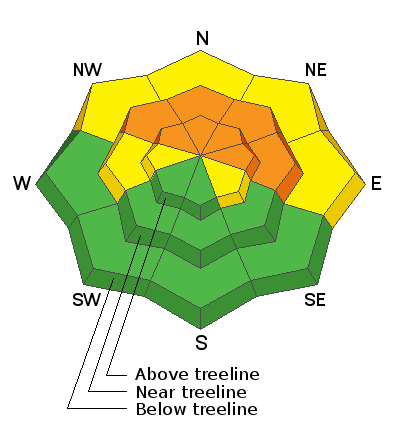
I found very sensitive conditions in my travels yesterday as new and wind drifted snow had formed a dense, cohesive slab on top of the weak, sugary, faceted snow underneath. Red flag signs of instability such as shooting cracks and collapsing were rampant. Things are deceiving out there, at first glance it doesn't appear that there is enough snow for avalanches. But on steep, northerly aspects where there is enough snow, conditions are ripe. Steep, north through east facing terrain should be avoided for the foreseeable future.
The video below illustrates the red flag signs of instability I observed.


