Forecast for the Skyline Area Mountains

Brett Kobernik
Issued by Brett Kobernik on
Thursday morning, January 21, 2021
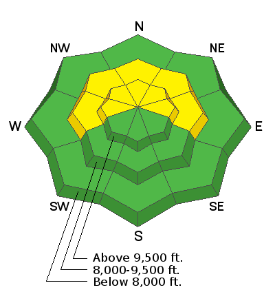
An overall MODERATE avalanche danger still exists. Small human triggered avalanches are possible especially where fresh drifts have formed. The most likely spots would be upper elevation very steep slopes that face west, north and east.
It is likely that the avalanche conditions will get more dangerous this weekend if we get any significant amount of snow.
Low
Moderate
Considerable
High
Extreme
Learn how to read the forecast here
Weather and Snow
Current Conditions: Overnight temperatures were in the low to mid 20s and there was light to moderate speed west southwest wind. The snowpack is a disaster. It is shallow, weak, and punchy. Riding conditions are horrible in all but the most sheltered terrain. Snowmobiles are still very limited to where they can travel. There are not many options off the main roads.
Mountain Weather: Today we'll see partly cloudy skies with high temperatures in the upper 20s and light to moderate southwest wind that might increase in speed a bit later today. A good sized storm is drifting down the California coast and will feed some moisture into Utah in a southwest flow starting Friday night. This type of storm system can be erratic so there's a lot of uncertainty still. I'm sticking with 4 to 7 inches of new snow by Sunday.
Ad