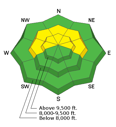
Forecast for the Skyline Area Mountains

Issued by Brett Kobernik on
Wednesday morning, January 20, 2021
Wednesday morning, January 20, 2021
The danger is MODERATE. Small human triggered avalanches are possible especially where fresh drifts have formed. The most likely spots would be upper elevation very steep slopes that face west, north and east.
KEEP IN MIND: The snowpack on the Skyline is very weak and avalanche conditions are bound to get dangerous if we see a change in the weather pattern with snow storms moving through.

Low
Moderate
Considerable
High
Extreme
Learn how to read the forecast here


