Forecast for the Skyline Area Mountains

Brett Kobernik
Issued by Brett Kobernik on
Wednesday morning, January 13, 2021
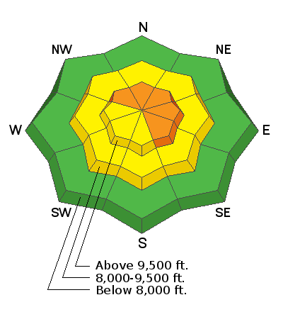
Windy conditions will increase the likelihood of human triggered avalanches on many aspects but especially on more easterly facing steep slopes. The avalanche danger is rated at CONSIDERABLE. Watch for cracking of the snow surface which is an indicator of unstable snow. Loud "whoomping" noise underfoot is also a red flag.
Low
Moderate
Considerable
High
Extreme
Learn how to read the forecast here
Weather and Snow
Current Conditions: Highs on Tuesday made it up into the upper 30s in many locations. Temperatures remained mild overnight with many stations hovering around freezing. The wind has started to increase from the northwest and is already pretty blustery along the ridges.
Mountain Weather: STRONG NORTHWEST WIND will be the dominant weather feature for the next couple of days. It looks very windy from now into Friday. Wind will drop in speed Friday afternoon but looks like it increases again over the weekend. We'll see cloudy skies today and possibly some minor snow flurries. Temperatures will remain pretty mild staying around 30˚F. The next few days look mostly sunny.
Ad
Avalanche Problem #1
Persistent Weak Layer
Type
Location
Likelihood
Size
Description
Windy conditions starting today will most likely drift snow onto numerous slopes. Many of these slopes are going to contain weak sugary faceted snow. The new wind load on top of the weak faceted snow will make triggering an avalanche more likely. The most likely locations will be on more easterly facing slopes but continue to use caution on all aspects as the wind can erratically form drifts all over the place.