Forecast for the Skyline Area Mountains

Brett Kobernik
Issued by Brett Kobernik on
Monday morning, December 28, 2020
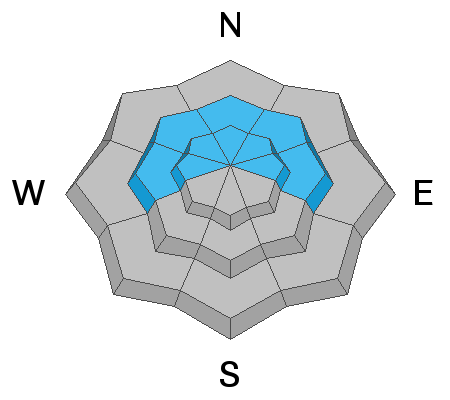
New snow will increase the avalanche danger today. Human triggered avalanches are likely on upper elevation northwest through east facing slopes steeper than 30˚. The danger is CONSIDERABLE. The danger may reach HIGH if we receive more snow than I anticipate.
Low
Moderate
Considerable
High
Extreme
Learn how to read the forecast here
Weather and Snow
Current Conditions: Wind is from the east as a storm slides in to our south. Wind speeds are light to moderate in speed. Temperatures are in the mid teens.
Mountain Weather: A decent sized storm will drift through to our south and bring our zone some snow. Totals don't look huge but we should pick up 3 to 6 inches. East flow will continue today and the east side of the Skyline may get favored for snowfall. Often, places like Ferron Canyon do well during east flow. Highs today will get to around 20˚F and wind will be from the east for most of the day. The next storm moves through Thursday which should bring a few more inches of snow. Currently, weather models are hinting at a very active weather pattern next week with lots of snow possible.
Ad
Avalanche Problem #1
Persistent Weak Layer
Type
Location
Likelihood
Size
Description
We have a layer of weak faceted snow near the ground. This layer will continue to produce dangerous avalanche conditions during and after each storm for the foreseeable future. It is imperative to give this situation due respect. This buried faceted snow is the cause of the majority of avalanche fatalities.