Forecast for the Skyline Area Mountains

Brett Kobernik
Issued by Brett Kobernik on
Tuesday morning, December 29, 2020
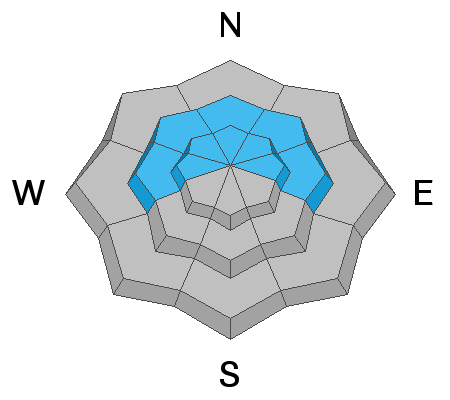
The avalanche danger is CONSIDERABLE today above 8000' on steep slopes that face west, north and east. Human triggered avalanches are likely in this terrain. Weak faceted snow near the ground is prone to failing with the additional new snow we received overnight and a person as a trigger.
Low
Moderate
Considerable
High
Extreme
Learn how to read the forecast here
Weather and Snow
Current Conditions: The storm flow increased and switched from the east around to the northwest bringing more snowfall. We are in the 4 to 8 inch range with the central Skyline (Pleasant Creek through Ephraim Canyon) doing the best. Temperatures are in the low to mid teens and the wind speed is still fairly light.
Mountain Weather: Snowfall will let up this morning and we may see some sun this afternoon. Temperatures will remain in the low teens. Wind will remain light from the northwest. The next storm moves through Thursday but doesn't look like it will produce much snow.
Ad
Avalanche Problem #1
Persistent Weak Layer
Type
Location
Likelihood
Size
Description
The new snow adds weight on top of the weak snow near the ground. This will make avalanche conditions more touchy today. I expect to hear the snowpack collapse today as I travel around on skis. I will be avoiding steep slopes especially that face northwest, north and northeast.