Forecast for the Skyline Area Mountains

Brett Kobernik
Issued by Brett Kobernik on
Monday morning, December 21, 2020
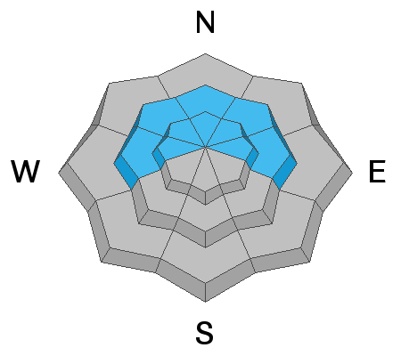
A CONSIDERABLE avalanche danger exists in mid and upper elevation more northerly facing terrain. Human triggered avalanches breaking into weak faceted snow near the ground are likely. Continue to avoid northerly facing steep slopes.
Low
Moderate
Considerable
High
Extreme
Learn how to read the forecast here
Weather and Snow
Current Conditions: Warm air has moved in and will remain through today. Temperatures are in the upper 20s to low 30s. Wind is light to moderate from the west.
Mountain Weather: It'll be warm today with high temperatures well into the 30s at many mountain locations. Wind will remain light today and gradually shift more southerly in direction. The storm for Tuesday doesn't look too impressive for our area. As a matter of fact, I don't think we'll see any snow at all. The next chance for snow is looking like this weekend.
Ad
Avalanche Problem #1
Persistent Weak Layer
Type
Location
Likelihood
Size
Description
A Persistent Weak Layer of faceted (sugary) snow near the ground will continue to be our main avalanche concern for the foreseeable future. This old snow from November will fail and collapse under the newer snow from December. It will get less sensitive but it's going to remain in place and be an issue for the next storms. This situation is nothing to screw around with.