Forecast for the Skyline Area Mountains

Brett Kobernik
Issued by Brett Kobernik on
Sunday morning, December 20, 2020
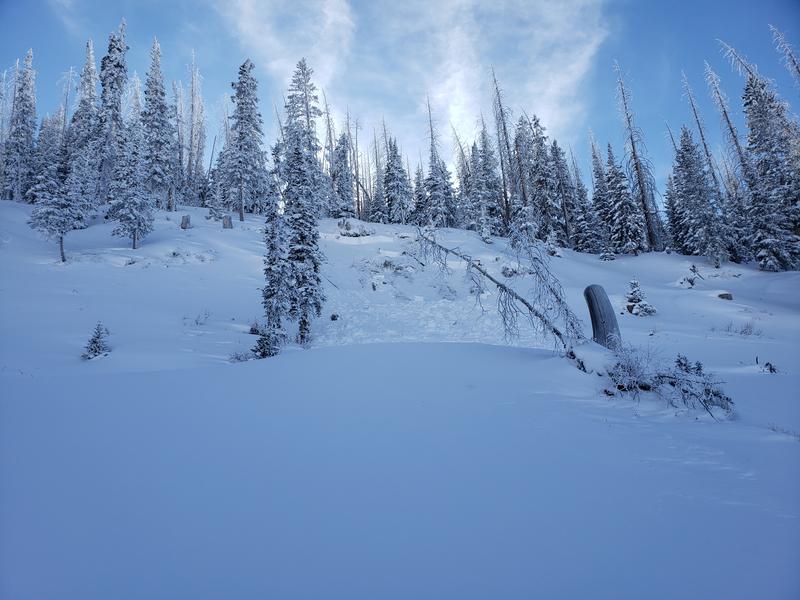
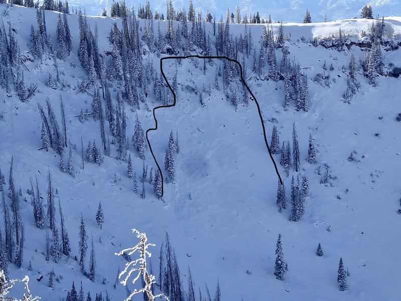
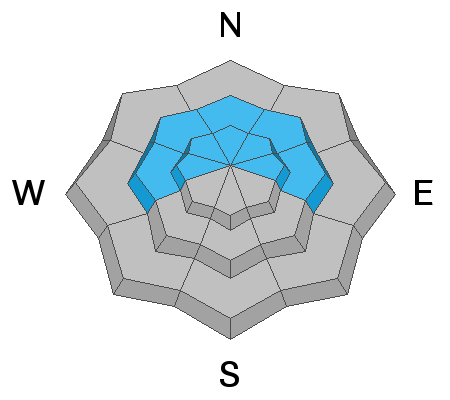
DANGEROUS AVALANCHE CONDITIONS CONTINUE ON THE SKYLINE. A CONSIDERABLE avalanche danger exists today especially on steeper mid and upper elevation northerly facing slopes. Human triggered avalanches in this terrain are very likely. Collapsing and cracking of the snowpack is Mother Nature yelling at you that it's unstable.
Low
Moderate
Considerable
High
Extreme
Learn how to read the forecast here
Weather and Snow
Current Conditions: West southwest wind picked up on Saturday and was drifting snow along the higher terrain. Overall snow depths range from one foot to almost three feet across the range. Travel conditions have improved with the snow settling and consolidating but it is still very shallow for serious winter recreation. Temperatures are around 20˚F and the southwest wind is moderate in speed with some higher speed gusts along the upper ridges.
Mountain Weather: We have a couple more days of nice weather with quite mild temperatures especially Monday with highs into the 30s. Wind will be light to moderate in speed today and lighter on Monday. The next chance of snow is Tuesday night when a small storm will move through. Weather models seem all over the place with how much snow we'll get. I'm thinking two to 6 inches is a good bet right now.
Recent Avalanches
There was one human triggered avalanche reported from Ephraim Canyon in the Scotty's area on Saturday. It happened mid day. It was remotely triggered from a distance as snowmobilers were riding by below it. It was a small pocket but remotely triggering an avalanche clearly demonstrates how sensitive the snowpack is right now.
Photo: Scott Watson
With the clear weather I was able to get up high and view some natural avalanche activity from during the storm in Spring City Canyon. I would categorize the activity as localized and not widespread. MANY slopes have not avalanched. They are primed waiting for a trigger.
Photo: Brett Kobernik
Ad
Avalanche Problem #1
Persistent Weak Layer
Type
Location
Likelihood
Size
Description
Recent avalanche activity and continued collapsing or "whoomping" of the snowpack are "Red Flags" and clearly demonstrate how dangerous the snowpack is. Weak snow near the ground under all the new snow from this week has created ripe conditions for avalanches. This problem will continue to plague us for a while. This is why we call the sugary faceted weak snow a "Persistent Weak Layer".
It's fairly easy to figure out which slopes are dangerous. If you dig down to the ground and find loose sugary old snow, don't get on steep slopes. If there is no old snow present, the slope will be safe.