


Forecast for the Moab Area Mountains

Issued by Brett Kobernik on
Thursday morning, February 27, 2020
Thursday morning, February 27, 2020
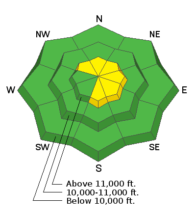
No big change in conditions Wednesday. Recently formed wind slabs will be a bit more stubborn today. A person could still trigger one on steep slopes. The avalanche danger remains MODERATE in the upper elevations where recent deposits of wind drifted snow exist.
Low
Moderate
Considerable
High
Extreme
Learn how to read the forecast here
 Special Announcements
A new version of the UAC IOS application is now available on the Apple App Store. This version fixes many of the issues that occur when running IOS 13.
Road Conditions: The most recent snow has been well packed in by traffic. The road is slick and icy in places.
Grooming report: LUNA (Lower Utah Nordic Alliance) groomed all trails on Monday. Thanks Matt!
 Weather and Snow
24 Hour Snow 0" Weekly Snow 3" Base Depth in Gold Basin 48" Wind N 18 mph G22 Temp 10F
Weather: It was a much nicer day on Wednesday compared to Tuesday. Skies were clear, temperatures were warmer and the wind was a lot slower. We should see another nice day today with slightly warmer temperatures (around 30˚F), mostly clear skies and light to moderate speed northwest wind. Friday looks similar with even slightly warmer temperatures yet. The next chance for snow looks like Sunday into Monday with a small storm moving through that might bring a few inches of snow.
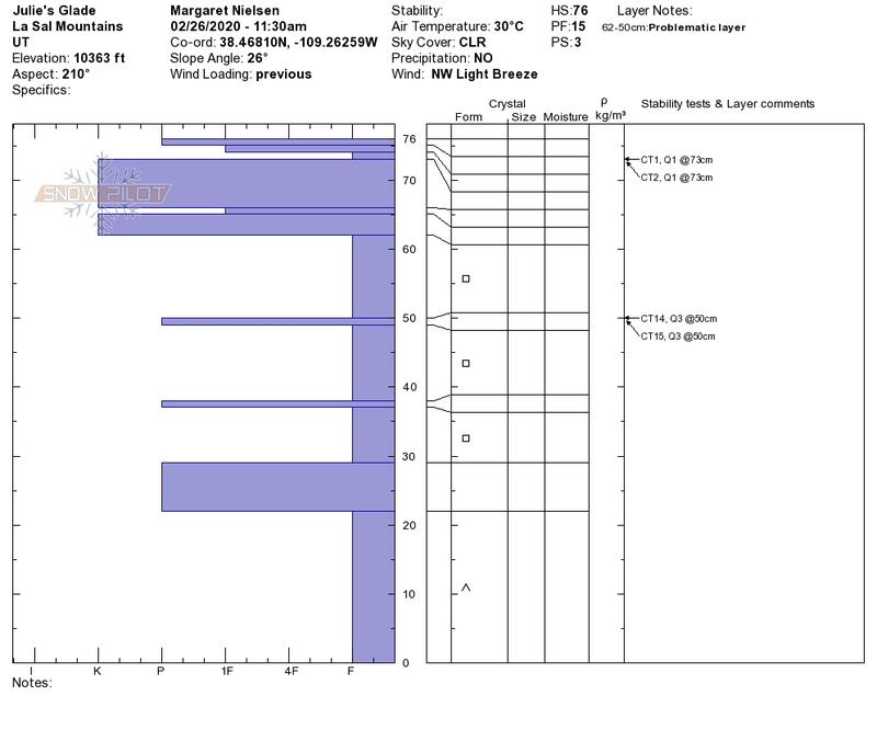
Snowpack: I don't have much more to add to my snowpack assessment from yesterday's forecast. I would like to point out a very nice snow profile that Maggie Nielsen (image below) documented and sent in. This is very much like what I found around the range on Tuesday. This is a "textbook" example of a poor snowpack structure. On a side note, I spent the day in the Abajo Mtns on Wednesday and the pack is slightly deeper and is much more supportable without all the punchy weak snow deep in the pack.
Wind, temperature, humidity on Pre Laurel Peak (11,700')
Storm totals at Gold Basin Study Plot (10,000').
Snotel site near Geyser Pass Trailhead (9600').
NWS weather forecast

Avalanche Problem #1
Wind Drifted Snow
Type
Location
Likelihood
Size
Description
Continue to use caution in the higher terrain where wind drifted snow exists on steep slopes. The worst case scenario is you may trigger something in steep, radical terrain and get swept into rocks or trees. Cracking within the snow surface is an indicator that things are sensitive. "Whoomping" or sudden collapsing of the snowpack is also a red flag.
General Announcements
Check out the avalanche beacon training park at the Geyser Pass Trailhead and practice your rescue skills!
This forecast is from the U.S. Forest Service, which is solely responsible for its content. This forecast describes general avalanche conditions and local variations always occur.