


Forecast for the Moab Area Mountains

Issued by Eric Trenbeath on
Saturday morning, February 8, 2020
Saturday morning, February 8, 2020
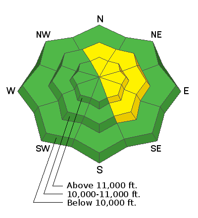
It's becoming more difficult to trigger an avalanche but an isolated or MODERATE danger for human triggered avalanches involving wind drifted snow still exists. The danger is greatest on upper elevation slopes facing N-NE-SE. Wind drifts are recognizable by their smooth, rounded appearance, and they may sound or feel hollow like a drum. In areas where the underlying snow is shallow and weak, a triggered wind drift may cause a deeper and more dangerous avalanche. Choose terrain carefully and avoid steep slopes with recent deposits of wind drifted snow.
Low
Moderate
Considerable
High
Extreme
Learn how to read the forecast here
 Special Announcements
Are you looking to improve your avalanche skills? We are offering a Backcountry 101: Introduction to Avalanches class on February 15-16 in Moab. Click here to register A huge thanks to Moab Gear Trader for sponsoring this course. Please visit them for all your winter backcountry needs.
Road Conditions: Grand County has plowed and widened the road. A big thanks to them for keeping access open this winter!
Grooming report: Matt from LUNA (Lower Utah Nordic Alliance) groomed on Wednesday. Thanks Matt!
 Weather and Snow
24 Hour Snow 0" Weekly Snow 10" Base Depth in Gold Basin 50" Wind WNW 10-15 mph Temp 15F
Weather: Sunny and breezy conditions are on tap for the mountains today. Look for southerly winds to blow in the 10-15 mph range with high temps in the mid 30's. Increasing clouds and wind tonight will usher in the next small storm system that may produce a few inches of snow on Sunday. Unfortunately, there isn't much else on the horizon for the upcoming week.
Snowpack: Strong and shifting winds throughout the week have worked over the snow surface in exposed terrain leading to what observer Nate Ament described as "a complex patchwork of variable snow surfaces and wind deposits on multiple aspects." Kona and his human Jason Ramsdell were out and about yesterday. They reported variable conditions but a pleasant tour. Read their report here.
Underneath the surface, the snowpack is taking the form of a mid-season continental snowpack on an average year, with varying depths and strengths minus the depth hoar. In most areas above about 10,500', the pack is deep and strong with a depth of 4'-5'. But sun and wind-exposed slopes, and rocky areas right around treeline and below have shallower and weaker snow. In most cases, these weaker snow areas are not yet a problem. Isolated concerns exist in areas of steep, rocky, or sparsely wooded extreme terrain where wind drifted snow has been added to the underlying weak snow.
Wind, temperature, humidity on Pre Laurel Peak (11,700')
Storm totals at Gold Basin Study Plot (10,000').
Snotel site near Geyser Pass Trailhead (9600').
NWS weather forecast
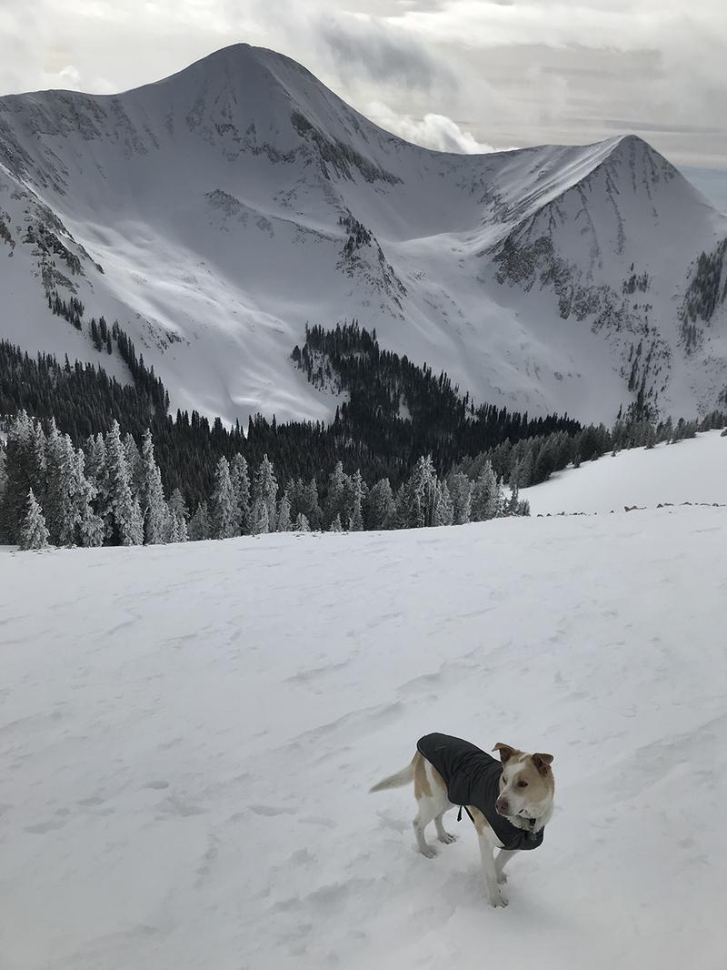
Kona reported variable snow conditions but he had a great time anyway and so can you! Jason Ramsdell photo.
 Recent Avalanches
Our repeat running favorite in Tele Gold pulled out again sometime during Monday's storm. For details see this report from Brian Hays.

Avalanche Problem #1
Wind Drifted Snow
Type
Location
Likelihood
Size
Description
Wind slabs are becoming more difficult to trigger and they have become quite stiff and hard in most locations. They are also isolated, often existing adjacent to wind-scoured surfaces with subtle terrain features making all the difference. Look for them on the lee sides of terrain features such as sub-ridges and rock buttresses. Steep convexities and blind break-overs well downslope are also likely areas to encounter a rogue wind slab. Approach steep terrain with caution, and suspect areas that sound or feel hollow like a drum.
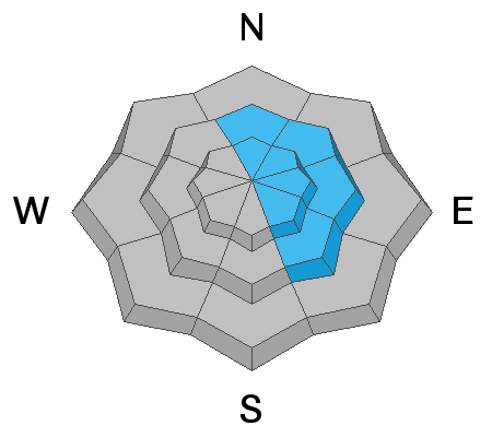
Avalanche Problem #2
Normal Caution
Type
Location

Likelihood
Size
Description
Areas with weak snow are developing in our snowpack but I don't feel that they are widespread enough, or are under enough of a load at this time to constitute a persistent weak layer problem. Nevertheless, it may be possible to trigger an avalanche down to some weak snow, particularly in areas where there is an overriding wind slab. Weak snow can be found on many aspects and elevations where the snowpack is shallow, but the most likely area for you to encounter a problem is on very steep, rocky, or sparsely wooded, north and easterly facing terrain just below treeline where the snowpack is less than about 4' deep. Under any conditions, this type of terrain should be approached with caution. Upper elevation, SE facing slopes also remain suspect.
General Announcements
My radio interview on KZMU about the history of backcountry skiing in the La Sals, avalanche accidents, and unique snowpack has been saved in perpetuity. You can listen to it here.
Check out the avalanche beacon training park at the Geyser Pass Trailhead and practice your rescue skills!
This forecast is from the U.S. Forest Service, which is solely responsible for its content. This forecast describes general avalanche conditions and local variations always occur.