Forecast for the Provo Area Mountains

Nikki Champion
Issued by Nikki Champion on
Wednesday morning, January 22, 2020
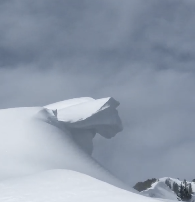
Today a MODERATE danger exists on all upper elevation slopes where triggering a fresh slab of wind drifted snow is possible. Look for signs of wind drifted snow and use caution in steeper terrain.
As you lose elevation, you lose most of the problem. Low and mid-elevation slopes with no steep terrain above or adjacent to them have a LOW avalanche danger where generally safe riding conditions exist.
Continue to observe safe travel protocol. Practice with your rescue gear.
Low
Moderate
Considerable
High
Extreme
Learn how to read the forecast here
Special Announcements
We are very sad to report an avalanche fatality from Saturday above Farmington Canyon. An 18-year-old male snowmobiler was caught, fully buried and killed. The final report is available HERE. Our deepest condolences go out to the friends, family, rescuers, and everyone affected by this tragic accident.
Weather and Snow
Snow lightly started falling early this morning. Total snowfall since yesterday morning is currently 1-3 inches.
Mountain temperatures remain warm and are hovering in the mid to upper 20s F this morning. Winds have increased overnight, at ridgetops they are currently averaging 15-25 mph with gusts 30-40 mph from the west-south-west
Today a weather system will brush by the area and the mountains will pick up another 2-4 inches of snow in the morning, turning into showers by the afternoon. Skies will be overcast all day and temperatures will remain in the upper 20s to low 30s F. Winds will switch from west southwest to the west-northwest and average 20-30 mph, with gusts up to 50 mph at the highest of elevations.
A mixed bag of riding conditions exist, but one can still find some soft turns in the wind and sun-protected terrain.
Recent Avalanches
No new avalanche activity reported in the backcountry yesterday.
However, in the Salt Lake area mountains, the most significant avalanche reported Sunday was in Mill B South of Big Cottonwood Canyon. The third of a party of three, while traversing high along the Mill B South and Mineral Fork ridgeline, triggered and was briefly caught and carried in an estimated 12-18" deep and 100' wide soft slab avalanche. These avalanches are on steep west to southwest facing slopes at 10,200'.
Yesterday, I went out and looked at this avalanche on Mill B South. It appears that the initial avalanche did step down to a crust facet interface that formed sometime earlier in the year. While we haven't seen any other activity on this layer recently, this proves that the poor snowpack structure is still out there.
I mention this because of the uncertain nature of this type of avalanche and a few observations from the Provo mountains. I suspect this layering is limited in scope and distribution but backcountry skiers/riders should be aware of this event.
Video from yesterday talking about Mill B South Avalanche.
Ad
Avalanche Problem #1
Wind Drifted Snow
Type
Location
Likelihood
Size
Description
The main things to watch for today are soft slabs of wind drifted snow.
With a few new inches of snow, increased winds, and a change of wind direction in our future I would expect to see fresh slabs of wind drifted snow at all upper elevation slopes. These new drifts of wind drifted will be primarily found on steep, east-facing terrain but you could expect to see isolated wind drifts on all ends of the compass.
Avoid all slopes with signs of wind drifted snow, such as cracking, rounded and pillow-shaped deposits, and a hollow sound as you travel across it.
CORNICE: We previously had several days of strong winds that created large and sensitive cornices along the exposed ridgelines. Today these cornices will continue to grow. Large cornices often collapse and break much further back than expected, so be sure to give them a wide berth when traveling along the exposed ridgelines.
Photo of large cornice from this past week. (McIntyre)
General Announcements
This information does not apply to developed ski areas or highways where avalanche control is normally done. This forecast is from the U.S.D.A. Forest Service, which is solely responsible for its content. This forecast describes general avalanche conditions and local variations always occur.