Forecast for the Skyline Area Mountains

Brett Kobernik
Issued by Brett Kobernik on
Monday morning, January 6, 2020
A MODERATE avalanche danger exists on upper elevation steep slopes that face north through east. This means human triggered avalanches are possible. Avoid steep wind loaded slopes and you'll avoid trouble today. Outside of wind affected terrain the avalanche danger is much lower.
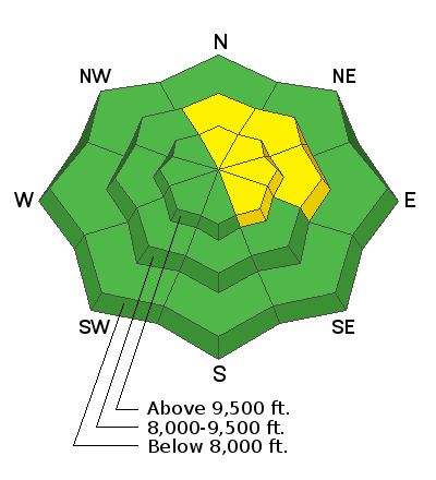
Low
Moderate
Considerable
High
Extreme
Learn how to read the forecast here
Weather and Snow
The wind was again the headline on Sunday. It increased to strong speeds from the west along the ridgetops mid day. Amazingly, once again, it was really most pronounced along the highest terrain and was much more tolerable a little lower off the ridgelines. There were no doubt some fresh drifts that formed but no backcountry travelers noted much sensitivity of these fresh drifts. Most folks found riding conditions to be very good.
Light snow flurries occurred in the afternoon on Sunday but didn't really add up to anything.
Ad
Additional Information
This forecast is from the U.S. Forest Service, which is solely responsible for its content. This forecast describes general avalanche conditions and local variations always occur.