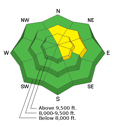
Apologies for dropping the ball on publishing Saturday's forecast on time. I made an error after compiling the forecast and didn't realize it until late in the day. Please feel free to contact me through our main menu
About->Contact if you are not seeing a daily forecast published by 7:30am. I do make mistakes from time to time so please alert me if you see anything odd.
Saturday brought very mild temperatures with highs in the mid 30s and a period of strong southerly wind. Riding conditions were damaged in many areas but many areas were also spared. There was some snow getting transported and some fresh drifts were forming. Overall, the snowpack remains fairly stable. You can find shallow areas where the snowpack is not all that strong. We really need to see some more storms soon or the snowpack will deteriorate further and become weaker. Below is a one minute review of the past week:
Weather: Today will start out pretty nice but we'll see increasing southerly wind during the day. We'll also see increasing clouds ahead of a weak storm system that will move through tonight bringing a chance of snow. I'm only expecting a trace to a couple of inches of snow accumulation. The next chance for snow is a storm shaping up for Wednesday through Thursday. Currently this doesn't look like a huge snow producer either but it looks like it'll give us a bit more than tonight's storm.


