Forecast for the Skyline Area Mountains

Brett Kobernik
Issued by Brett Kobernik on
Thursday morning, December 26, 2019
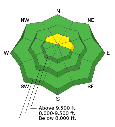
The majority of the terrain along the Skyline has a LOW avalanche danger today. A MODERATE danger exists along the upper ridgelines on steep slopes that face northwest through east. Human triggered avalanches are possible where recently formed fresh drifts are present. Only put one person on a steep slope at a time and don't regroup in avalanche runout zones.
Low
Moderate
Considerable
High
Extreme
Learn how to read the forecast here
Weather and Snow
The Skyline picked up a total of 9 inches of snow on Christmas day. The wind speed has been light over the last 24 hours. Temperatures have dropped into the teens.

The weather looks unsettled for the foreseeable future although no significant snow accumulation is expected. We'll see mostly cloudy skies with the chance for light snow over the next couple of days. Temperatures are going to remain fairly cold with highs in the upper teens.
Ad
Additional Information
This forecast is from the U.S. Forest Service, which is solely responsible for its content. This forecast describes general avalanche conditions and local variations always occur.