Forecast for the Skyline Area Mountains

Brett Kobernik
Issued by Brett Kobernik on
Tuesday morning, December 10, 2019
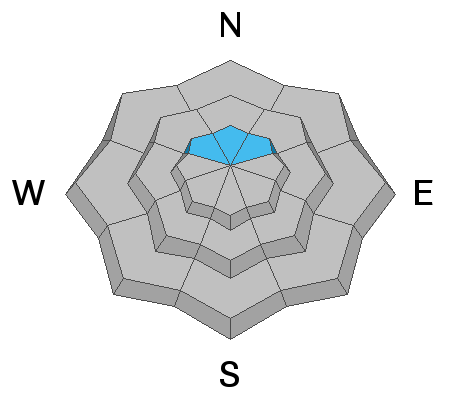
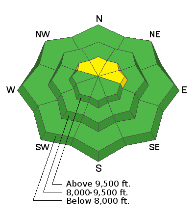
No big change since Monday. The overall avalanche danger remains MODERATE. By far the biggest concern is on slopes approaching 40 degrees above about 9000 feet that face northwest, north, and northeast where an avalanche could break into old weak sugar snow near the ground.
Low
Moderate
Considerable
High
Extreme
Learn how to read the forecast here
Weather and Snow
During my travel in Ephraim Canyon on Monday, I noted that the wind had definitely been active in drifting snow. I did not note any cracking within the new snow. I was able to find a few inches of weak sugar snow near the ground on the high north facing slopes. Snowpit tests would fail on it and it would propagate on that layer. Results were stubborn but clean. This indicates that triggering something is less likely right now but definitely still possible. I walked around on skis a little bit to see if I would experience any collapsing and I did not.
Recent Avalanches
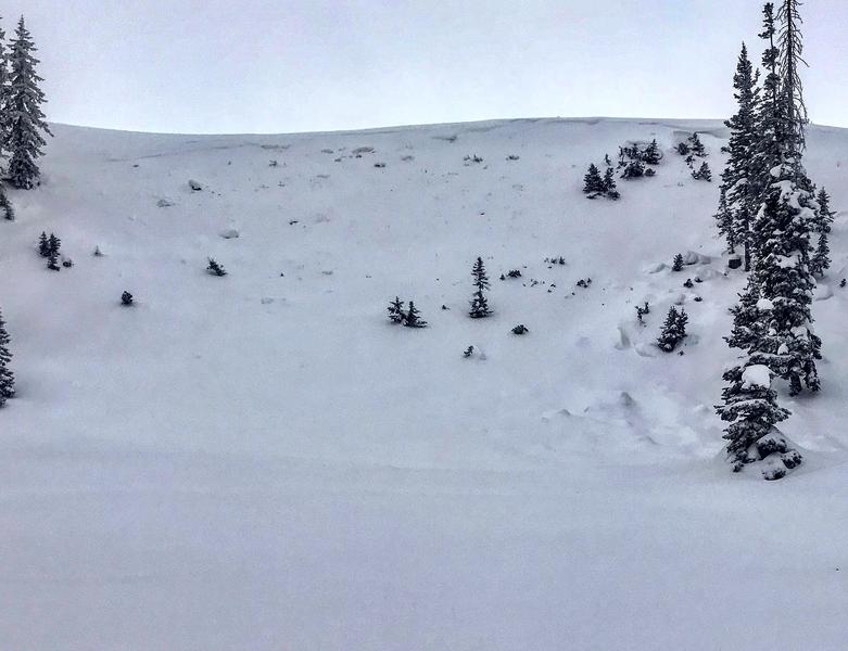
I noticed one small avalanche that looked like it was triggered by a snowmobiler a few days back. It had been blown in with new snow but the snowmobile tracks at the bottom and the fracture line at the top told the story. It was on a high elevation north facing slope just above Philadelphia Flats in Ephraim Canyon. It definitely broke into the weak sugar snow near the ground. This is consistent with everything I've seen so far this season.
Ad
Avalanche Problem #1
Persistent Weak Layer
Type
Location
Likelihood
Size
Description
High elevation slopes approaching 40 degrees that face northwest, north and northeast should be avoided because they are holding weak sugar snow near the ground that could collapse and avalanche.
Additional Information
This forecast is from the U.S. Forest Service, which is solely responsible for its content. This forecast describes general avalanche conditions and local variations always occur.