Forecast for the Skyline Area Mountains

Brett Kobernik
Issued by Brett Kobernik on
Wednesday morning, December 11, 2019
ANTICIPATE A RISING AVALANCHE DANGER THIS WEEKEND DURING THE UPCOMING STORM.
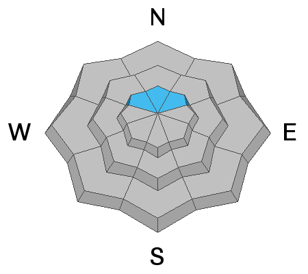
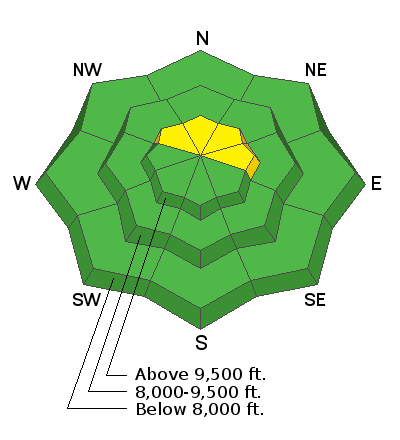
Today the avalanche danger is LOW to MODERATE. Human triggered avalanches are possible on slopes approaching 40 degrees in steepness that are above about 9000 and face northwest, north and northeast.
Low
Moderate
Considerable
High
Extreme
Learn how to read the forecast here
Weather and Snow
Overall, the snowpack is amazingly strong for this time of the year. (this is aside from the thin layer of weak sugar snow on the ground, see Avalanche Problem #1 below) It is very supportable and travel is easy on skis, snowboards and snowmobiles. At this point we need more snow to keep strengthening it. If we don't see continued snow, the snowpack will surely deteriorate and turn into weak sugar. The good news is that we have a storm on the way that looks like it will bring 8 to 10 inches of snow to the Skyline.
For more information on the snowpack, check out this excellent backcountry observation from John Pikus.
Ad
Avalanche Problem #1
Persistent Weak Layer
Type
Location
Likelihood
Size
Description
High elevation slopes approaching 40 degrees that face northwest, north and northeast should be avoided because they are holding weak sugar snow near the ground that could collapse and avalanche. I've been looking at east facing slopes to see if they are holding old weak snow from October. There is some present but so far, I haven't seen anything that looks like it would produce avalanches. I would say to use caution on east facing steep slopes and really do your homework before trusting them.
Additional Information
This forecast is from the U.S. Forest Service, which is solely responsible for its content. This forecast describes general avalanche conditions and local variations always occur.