AVALANCHE WARNING!! Tap for info
UDOT PLANNED AVALANCHE CLOSURES!!

Forecast for the Abajos Area Mountains

Eric Trenbeath
Issued by Eric Trenbeath on
Friday morning, January 11, 2019
The avalanche danger remains CONSIDERABLE - new snow, and wind drifted snow have dangerously overloaded a weak snowpack, and human triggered avalanches on steep slopes facing W-N-E are likely if not certain. Signs of instability include collapsing and cracking in the snow surface. Backcountry travelers need to possess excellent route finding skills and know how to avoid steep, avalanche prone terrain.-
Low
Moderate
Considerable
High
Extreme
Learn how to read the forecast here
Special Announcements
We will be offering a Backcountry 101 avalanche course on Feb 8, 9. It's a great way to up your avalanche knowledge with both classroom, and hands on field instruction. Click here for more details and to register.
The new UAC IOS mobile app is now available on the app store. Check out the new "My Weather" feature.
Check out the new free online avalanche course series developed by the Utah Avalanche Center. This is a great way to refresh your skills or prepare you for a Backcountry 101 or Level 1 class.
Weather and Snow
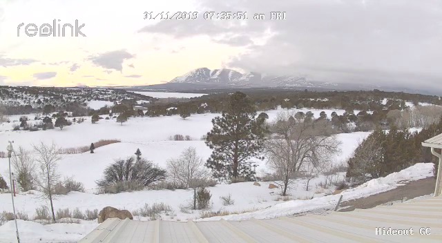
Webcam image courtesy of Kevin Dressel.
Skies are partly cloudy and weak storm system is will bring some isolated showers this morning. Thing should clear out after noon but we;ll see blustery NW winds in the 15-25 mph range. Temps will be in the low 20's. A strong ridge builds over the weekend with what looks like a more active pattern next week.
Last Sunday's storm brought 8"-10" to the mountains. I haven't been down since last weekend but will be headed down today. Conditions remain thin but the last storm has been a big help. A weak layer of loose, sugary snow exists at the base of the snowpack. This layer exists on northerly aspects above about 9500' and is providing an extremely unstable base for the current snow load. Check back tomorrow for a full report.
Snow totals at Buckboard Flat (8924')
Snow totals at Camp Jackson (8858')
Wind, temperature, and humidity on Abajo Peak (11,000')
National Weather Service point forecast.
Recent Avalanches
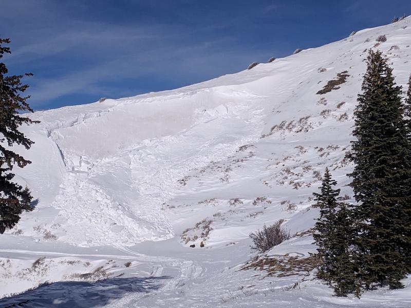
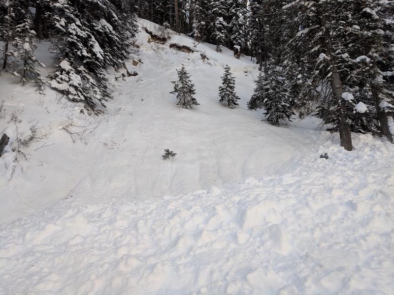
Dustin Randall sent in these pics of sled triggered avalanches that occurred on Monday.
General Announcements
Your information can save lives. If you see anything we should know about, please help us out by submitting snow and avalanche observations HERE. You can also call me at 801-647-8896, or send me an email: eric@utahavalanchecenter.org.
Support the UAC through your daily shopping. When you shop at Smith's, or online at REI, Backcountry.com, Patagonia, NRS, Amazon, eBay by clicking on these links, they donate a portion of your purchase to the UAC. If you sell on eBay, you can have your See our Affiliate Page for more details on how you can support the UAC when you shop
This advisory is from the U.S.D.A. Forest Service, which is solely responsible for its content. This advisory describes general avalanche conditions and local variations always occur.