We will be offering a Backcountry 101 avalanche course on Feb 8, 9. It's a great way to up your avalanche knowledge with both classroom, and hands on field instruction. Click
here for more details and to register.
The new UAC IOS mobile app is now available on the
app store. Check out the new "My Weather" feature.
Check out the new free online
avalanche course series developed by the Utah Avalanche Center. This is a great way to refresh your skills or prepare you for a Backcountry 101 or Level 1 class.
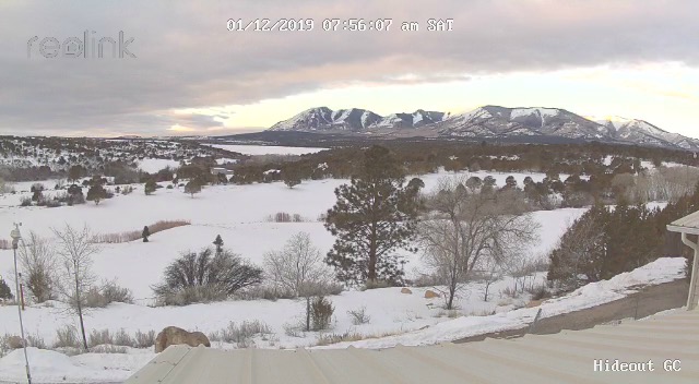
Webcam photo courtesy of Kevin Dressel.
Skies are partly cloudy, northerly winds are light, and mountain temps are in the low teens. A light dusting of snow fell in the mountains yesterday. An anomalous, unsettled weather pattern is over head and we should see mostly cloudy skies developing today and tomorrow with a chance for scattered snow showers. NE winds will average 5-10 mph shifting to SW by the afternoon. This unsettled weather pattern will continue into the first of the week until a series of short wave troughs begin to move through the region starting Tuesday with the strongest wave arriving perhaps on Thursday.
Last Sunday's storm brought 8"-10" to the mountains and conditions are greatly improved though there is still grass sticking out on exposed south facing slopes. A weak layer of loose, sugary, faceted snow exists at the base of the snowpack. This layer exists on northerly aspects and is providing an extremely unstable base for the current snow load. Wind drifted snow has added additional stress to this buried weak layer, and backcountry skiers and riders should avoid steep, wind drifted slopes, particularly those that face the north half of the compass.
Wind, temperature, and humidity on
Abajo Peak (11,000')
The Abajo Mountains experienced a significant round of both human triggered and natural avalanche activity earlier this week.