Forecast for the Moab Area Mountains

Eric Trenbeath
Issued by Eric Trenbeath on
Friday morning, December 21, 2018
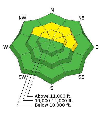
There is an isolated, or MODERATE danger on mid and upper elevation steep slopes that face NW-N-E, and human triggered avalanches breaking down into buried, persistent weak layers are still possible in these areas. Steep, rocky terrain that has a weak shallow snowpack is the most suspect. On upper elevation slopes with an easterly component, there is a MODERATE danger for triggering a stiff slab of wind drifted snow. Suspect slopes with a smooth, rounded appearance or that sound hollow like a drum. Most other terrain has generally LOW danger.
Low
Moderate
Considerable
High
Extreme
Learn how to read the forecast here
Special Announcements
Happy first day of winter! Let's hope it starts to kick in!
Check out the new free online avalanche course series developed by the Utah Avalanche Center. This is a great way to refresh your skills or prepare you for a Backcountry 101 or Level 1 class.
Weather and Snow
High clouds have begun streaming into the area as the first in a series of weak storm systems moves through the region to the north. We'll see wind, and that's been the story for a few days now. Yesterday, ridge top winds from the WNW averaged 25 mph. They quieted down in the evening before shifting to the SW where they are currently averaging 20 mph with gusts to 30. Today we'll see partly sunny skies and continued breezy SW winds. Daytime highs will be around 30 degrees. We're still holding out hope for a decent storm for Christmas, but at this point the magnitude remains uncertain.
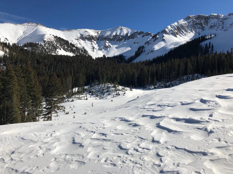
Wind and sun have severely damaged exposed snow surfaces and you'll have to work hard to find soft snow in sheltered locations. Low snow conditions still prevail, and they are getting lower. Be wary of rocks and deadfall lurking just beneath the surface. Base depth in Gold Basin is 28".
For further information check out the most recent observations here.
New snow totals in Gold Basin (10,000')
Snow totals at the Geyser Pass Trailhead (9600')
Wind, temperature, and humidity on Pre Laurel Peak (11,700')
National Weather Service point forecast.
Current snow conditions are pretty rough but it's still beautiful up there!
Ad
Avalanche Problem #1
Persistent Weak Layer
Type
Location
Likelihood
Size
Description
Time and warm temperatures have helped to stabilize the snowpack, but a persistent weak layer of loose, sugary, faceted snow remains. A melt freeze crust of varying strength and thickness exists on top of the October snow. In areas where the snowpack is shallow, faceted snow beneath the crust exists all the way to the ground. If you manage to find the right trigger point in a rocky, shallow area, or above a hidden bush, and you could still trigger a dangerous avalanche 2'-4' deep. For myself, I'll continue to avoid steep, rocky terrain that has a northerly aspect.
Avalanche Problem #2
Wind Drifted Snow
Type
Location
Likelihood
Size
Description
Strong westerly winds over the last week have created stiff slabs of wind drifted snow on top of old in the upper elevations, primarily on slopes with an easterly component. Most of these are pretty welded into place by now but continue to cast a wary eye toward steep slopes, and areas such as cross-loaded gullies that have a smooth rounded appearance, or where the snow feels hollow underneath.
Additional Information
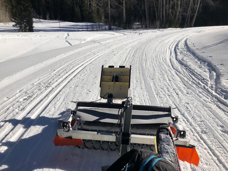
The road into Gold Basin was groomed yesterday. With the current snow conditions, Nordic skiing may the best game in town!
General Announcements
This advisory is from the U.S.D.A. Forest Service, which is solely responsible for its content. This advisory describes general avalanche conditions and local variations always occur.