Join us at our 2nd Annual Blizzard Ball

Forecast for the Uintas Area Mountains

Craig Gordon
Issued by Craig Gordon on
Tuesday morning, January 14, 2025
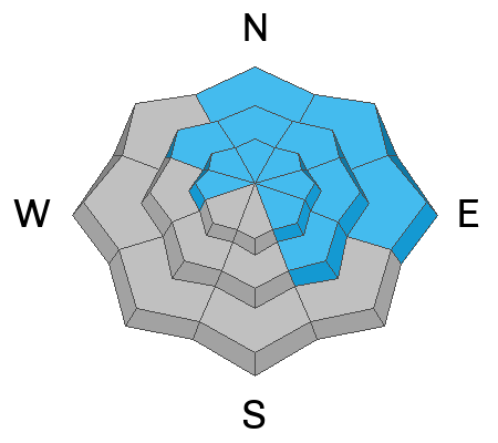
Today you'll find MODERATE danger at and above treeline. Human triggered avalanches are POSSIBLE, especially in the high alpine, wind zone on slopes facing northwest through north through southeast. But there's a catch... any slide triggered has the potential to fail on the mid December weak layer, now buried deeply in our snowpack, and that'll deliver a body-bruising slide that can break up to 4’ deep and hundreds of feet wide. More predictable and potentially less consequential, human-triggered fresh wind drifts are also POSSIBLE on steep, windloaded slopes around the compass.
I'm avoiding today's unruly avalanche dragon by steering clear of steep, upper elevation, shady slopes. Instead, I'm gunnin' and runnin' to south-facing, sunny terrain, out of the wind zone where I'll work on my winter tan, find premium riding, and straightforward avy danger... sounds like a good business model huh?
Low
Moderate
Considerable
High
Extreme
Learn how to read the forecast here
Special Announcements
Receive forecast region-specific text message alerts to receive messages about changing avalanche conditions, watches, and warnings. Sign up and update your preferences HERE.
Weather and Snow
Nowcast- With mostly clear skies overhead this morning, a big, bright, yet waning Wolf Moon casts a uniquely intriguing light on our mountains. Hope you remembered to plug the block heater in last night, 'cause this mornings temperatures start the day in the low single digits, while northerly winds blow in the low 30's near the high peaks, creating windchill values to -20 degrees... ouch!
Forecast- A cold northerly flow slides through the region today, ushering in a few snow flurries with high temperatures barely cracking into the low 20's. Northerly winds blowing in the 20's and 30's keep it crisp along the high ridges. Clear skies overnight allow temperatures to crater into negative territory.
Futurecast- High pressure builds over the region Wednesday and we'll be greeted with gloriously sunny skies and warming temperatures. Rinse and repeat 'til weeks end when there's a suggestion of some storminess, though I think it might be a bit moisture starved. We'll know better in the next few days and keep y'all in the loop.
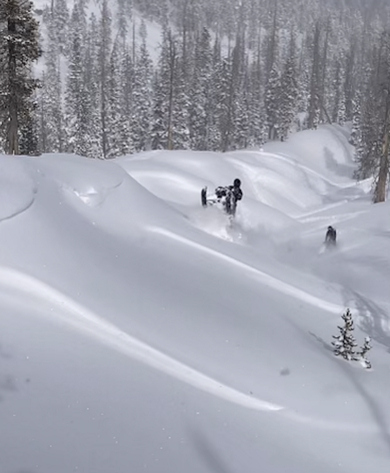
Dan the G-man doing it right and having a blast this weekend, surfing some mellow waves on low angle, low elevation terrain, while scoring a day of 5 star riding... well played sir!
Recent Avalanches
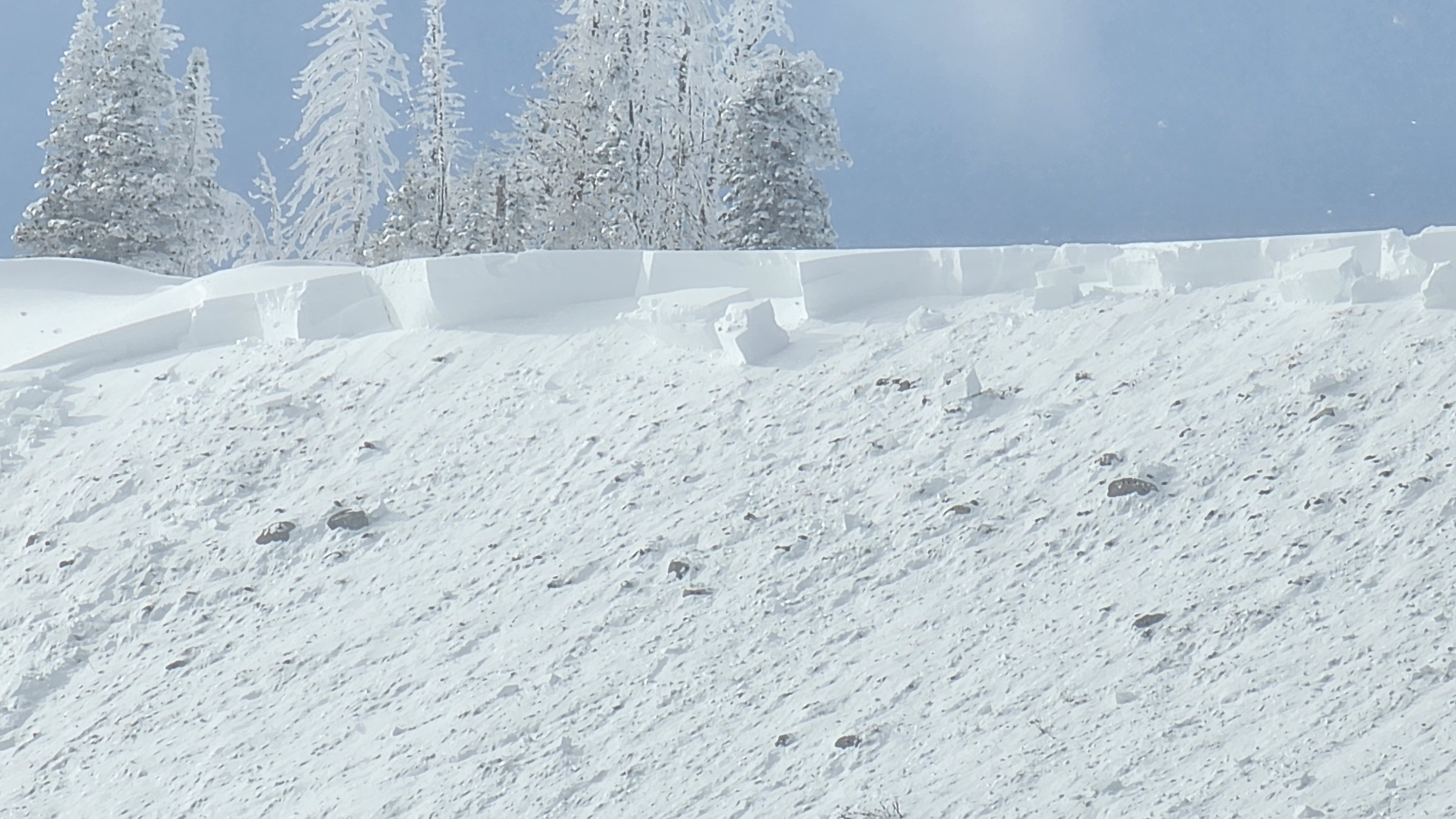
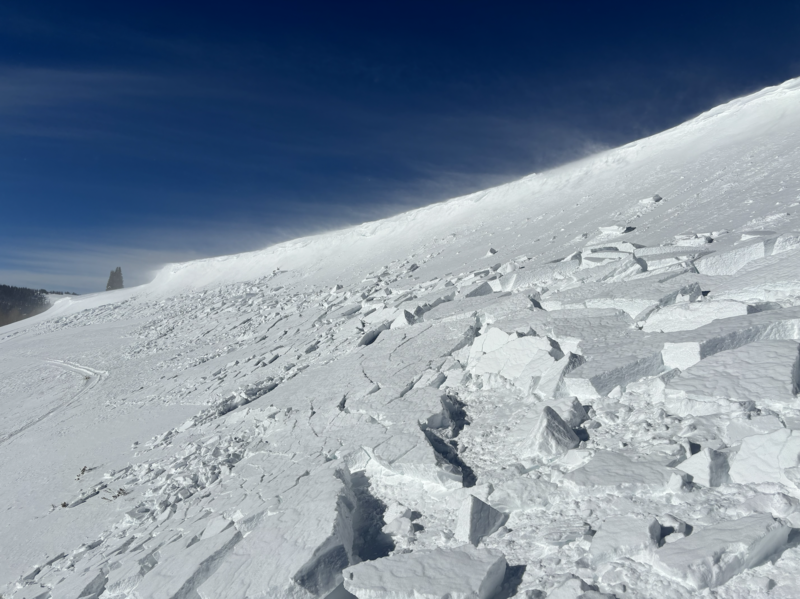
The slide below was triggered on Sunday near the Duchesne Ridge on a heavily wind loaded, northeast facing slope. Breaking 2'-4’ deep and a couple hundred feet wide, this avalanche highlights our problem child... the mid December drought layer now buried in the mid to lower portion of the snowpack.
You can find all travel observations and recent slides from across the range and beyond, here.
Ad
Avalanche Problem #1
Persistent Weak Layer
Type
Location
Likelihood
Size
Description
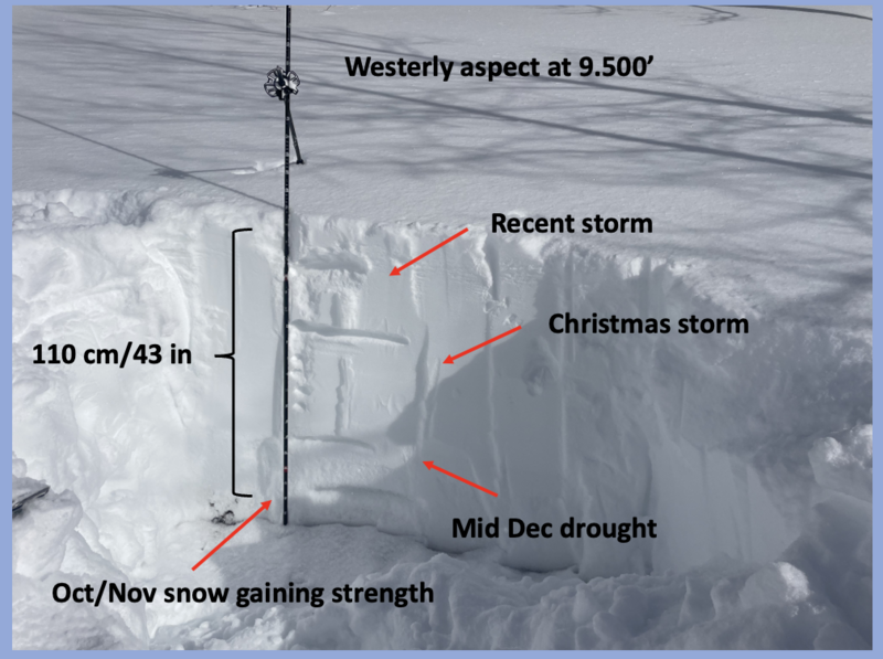
Recent storms have blanketed the western Uinta's and the place is looking mighty white and feeling solid underfoot. But don't let appearances fool you. In fact, we're entering a tricky period in our snowpack's timeline and that's when we tend to get complacent. Even though the Uinta's are starting to feel a bit more predictable, the snowpack is relatively young, kinda like it's in its early 20's. Sure, it's getting comfortable in its own skin for the moment, problem is... it's still a bit unpredictable and kinda quirky. So, while the chances of triggering a deep, dangerous avalanche have decreased slightly, the consequences remain the same. Likely suspect terrain I'm steering clear of are steep, rocky slopes, especially where the pack is slightly thinner and I could still knock the legs out from underneath the snow above me.
The snowpack structure is coming around, but it's a patience game. I'm not jumping into steep, shady terrain and I'm not hiding under the bed either. Instead, I'm ever so slightly and very cautiously, slowly nibbling on the edges of bigger terrain to get a feel for the snowpack and a finger on the pulse of which way we're trending.
Avalanche Problem #2
Wind Drifted Snow
Type
Location
Likelihood
Size
Description
Winds have been all over the place for the past few days, forming sensitive, yet predicable drifts on the leeward side of mid and upper elevation ridges and around terrain features like chutes and gullies. This is a straight-forward avalanche problem... lose the wind and you lose the problem. Simply seek out wind sheltered, mid and lower elevation terrain. You'll avoid the avalanche hazard and score a great day of riding to boot!
General Announcements
The Uinta weather station network was upgraded this summer and all that real-time info is found here. Simply click on the "Western Uinta" tab and then the "Weather Stations" tab to find all your weather needs.
We are always looking for snow and avalanche observations or just general riding conditions. So... if you see something, say something. You can reach our team directly by contacting: Craig at craig@utahavalanchecenter.org, 801-231-2170, or Andrew at andy@utahavalanchecenter.org, or 860-460-8142.
General Information
This forecast is from the U.S.D.A. Forest Service, which is solely responsible for its content. This forecast describes general avalanche conditions and local variations always occur. This forecast was issued on Tuesday, January 14th at 05:00AM and expires 24 hours after it was issued. We will update the forecast by 0700 AM tomorrow. But, in the meantime reach out to us with questions, or if you see anything in your travels.