Forecast for the Uintas Area Mountains

Andrew Nassetta
Issued by Andrew Nassetta on
Sunday morning, March 2, 2025
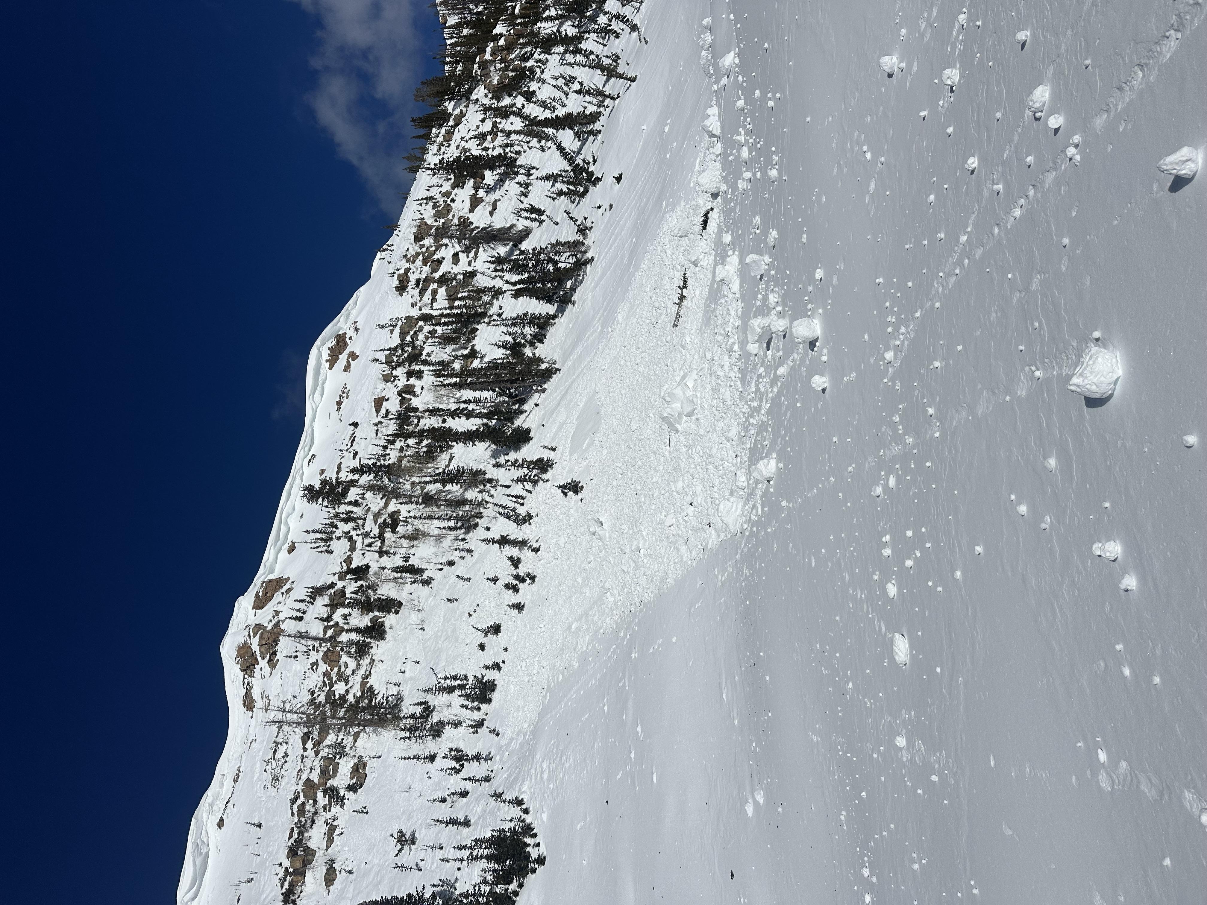
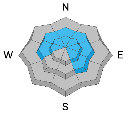
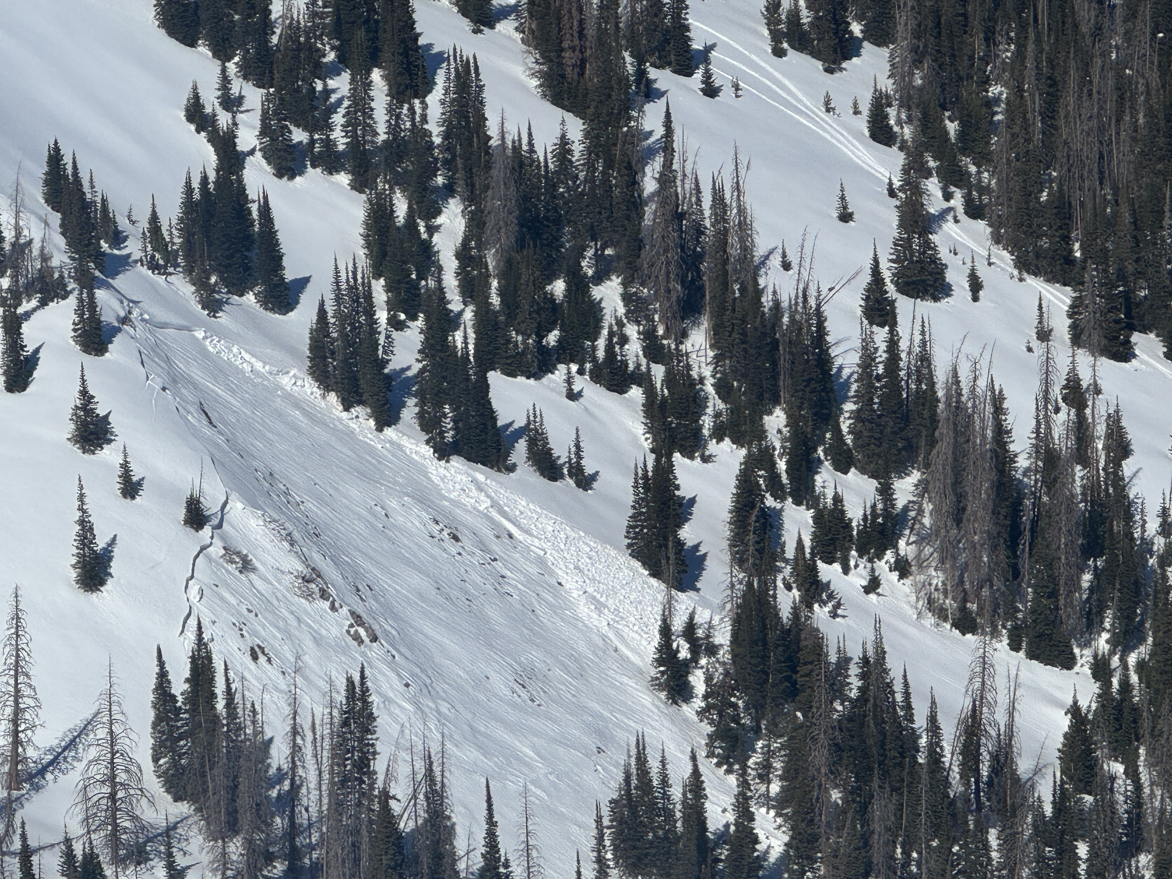
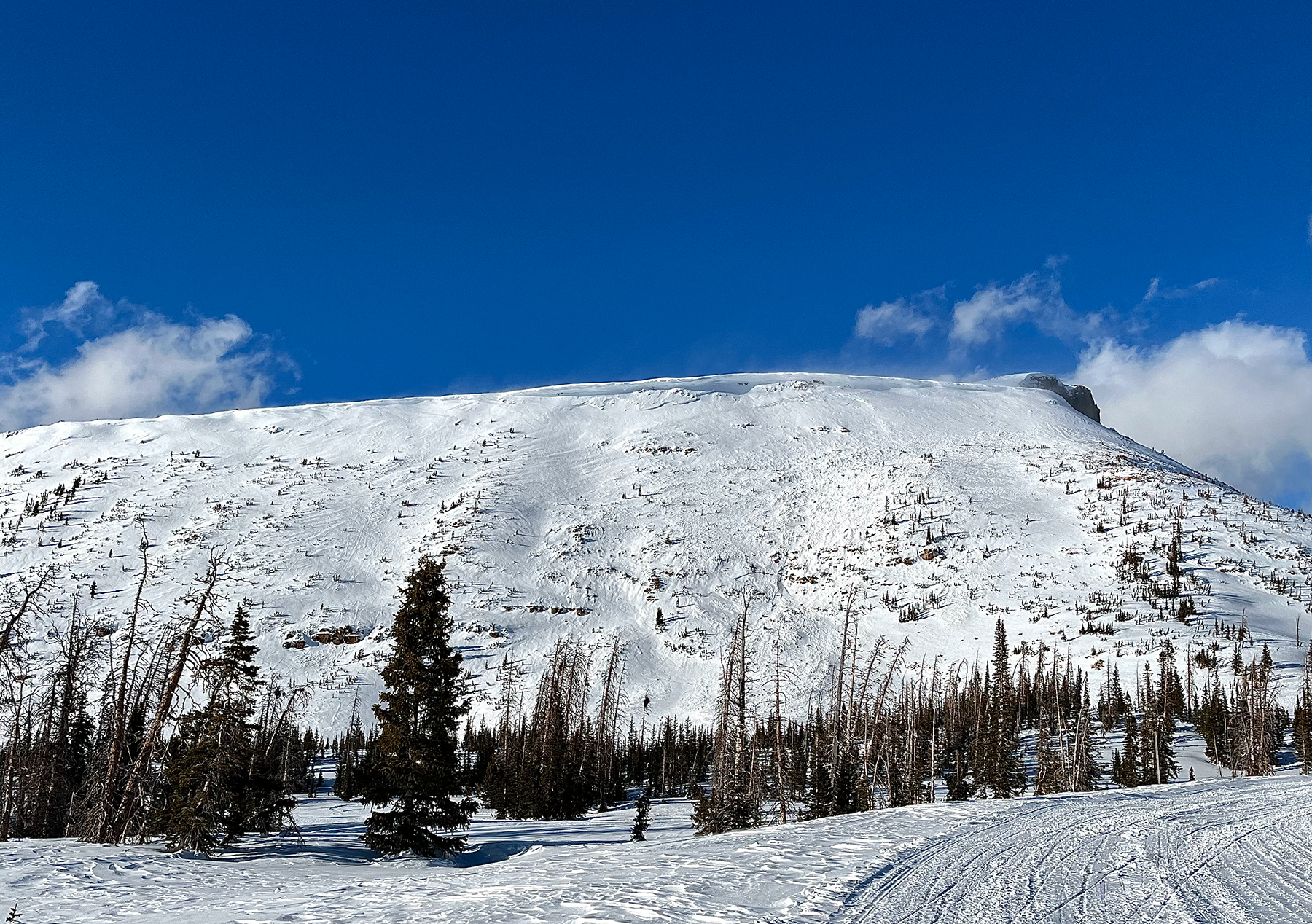
Today's avalanche danger is MODERATE at mid and upper-elevations where it is POSSIBLE for a human to trigger a persistent slab avalanche on faceted snow up to 3' deep and breaking up to a couple hundred feet wide.

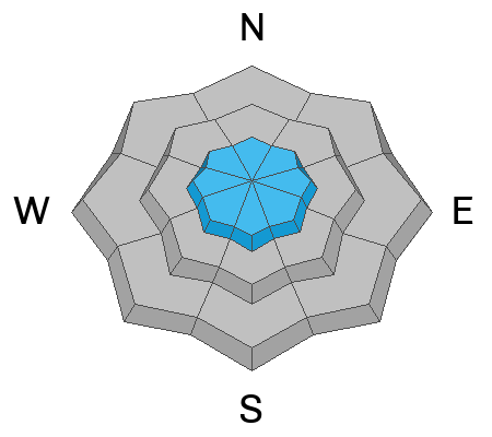
LOW avalanche danger exists at all other aspects and elevations for cornice falls and wet snow activity. Although it is UNLIKELY for us to trigger a cornice or wet snow avalanche first thing today, it could become POSSIBLE as the day heats up.
Low
Moderate
Considerable
High
Extreme
Learn how to read the forecast here
Special Announcements
  • We are excited to announce the launch of our new mobile application available on both Android and IOS. Get all the information you need to plan your backcountry adventure and keep the information at the tip of your fingers while you are out. Install the Android version here and the IOS version here.
  • Join the UAC on Thursday, March 6th at Brewvies in Salt Lake for friends, drinks, prizes, and an action-packed film! Alpine Assassins is a movie about incredible backcountry sledding and adventure. Doors open at 6:30 PM. Get your tickets here.
Weather and Snow
Nowcast This morning kicks off with thin clouds hanging high above and temperatures inverted with our traiheads reading 25℉ and around 30℉ at 10,000' peaks and ridges. Winds have been light overnight from the south southwest, and maxed out with gusts in the high teens near the tall peaks, but are currently blowing lightly from the southeast.
Forecast Expect another stellar spring day with temperatures pushing up near the 40's at our trailheads and in the 30's up high accompanied by increasing clouds as the day rolls on. Winds blow lightly from the south for the early part of the day, and shouldn't have too much of a temper, but look to shift counter clockwise and pick up this afternoon ahead of the incoming low.
Futurecast An active storm cycle begins early Monday through Tuesday night. With hope as a strategy, we can expect 7-12" of snow with up to 1" of water across the range which would be a fantastic reset for the Uinta's!
Recent Avalanches
No avalanches have been reported within in the past 48 hours. Avalanches this past week have been triggered remotely from low on the slope, and occurred naturally from large cornice falls -- Many of these avalanches failing on persistent weak layers buried 1-3' beneath the surface. Check out these avalanches and more beta from across the range and beyond, here.
At the hottest point of the day mid-week, near the Mirror Lake Corridor, DJ observed a natural avalanche on a SE slope at 11k' that was triggered by a cornice fall breaking into weak snow on the cliff band below.
Ad
Avalanche Problem #1
Persistent Weak Layer
Type
Location
Likelihood
Size
Description
Although it feels like spring, the snowpack represents and looks similar to what we usually see in mid-winter. Over the past week we have seen persistent slab avalanches failing naturally, and triggered by humans 1-3' deep and up to a football field wide. Digging down with your shovel or track it is easy to see what is going on. The Uinta's have a snow structure that's complicated and harbors multiple layers of sugary, faceted snow. In the attempt to keep it simple, I turn my attention to the two types of terrain where the chances of triggering an avalanche are more likely, and I try to break them down below:
  • Shallower areas of the snowpack, or that have avalanche repeatedly this season (areas with less than 150cm of snow)
  • Steep, thin and rocky areas where I am more likely to find a trigger point.
Slopes that have similar characteristics to the ones above, are the exact slopes where we've seen recent avalanche activity. As Craig always says, when snowpack is the question terrain is our answer. With that in mind, I am still avoiding slopes with this avalanche problem and practicing patience as every slope will have its day, but some times we just have to wait to play.
This avalanche failed in a shallower area of the snowpack, around 120cm, that had most likely avalanched previously this season and is a repeater, learn more here - Thanks Chad and Michael for the obs and eyes on things!
Avalanche Problem #2
Cornice
Type
Location
Likelihood
Size
Description
Cornices are enormous and beginning to show signs of life with this weeks warm spell. Large pieces of snow are breaking off naturally, and from our additional weight and are breaking further back up the ridge than we might expect.
When traveling on ridgelines, give them respectable space and do your best to stay on rock or any obvious signs of terrestrial ground. Traveling below, keep eyes peeled above you and pay attention during the hottest part of the day. Ya, it stinks having a school bus tumble down a mountain towards you unexpectedly, but it also turns even worse if that school bus triggers an avalanche.
A southeast slope at 11,500' near Bald Mountain where a cornice failed naturally in the top right portion of the slope and triggered an avalanche below into old snow. Thanks for the photo and ob, Spencer!
General Announcements
We are always looking for snow and avalanche observations or just general riding conditions. In the meantime reach out to us with questions, concerns, or if you see anything in your travels! Contact us directly through the info below:
This forecast is from the U.S.D.A. Forest Service, which is solely responsible for its content. This forecast describes general avalanche conditions and local variations always occur. This forecast was issued on Sunday, March 2nd at 05:30 AM and expires 24 hours after it was issued.