Forecast for the Uintas Area Mountains

Craig Gordon
Issued by Craig Gordon on
Saturday morning, March 1, 2025
Heads up... strong sunshine and blistering temperatures may bump the avy hazard up a notch during the heat of the day-
We start off with MODERATE avalanche danger at and above treeline, especially in the windzone on steep, rocky slopes facing the north half of the compass. Human triggered avalanches are POSSIBLE particularly where dense snow overlays a variety of sugary, weak layers. Remember... any avalanche that fails on old snow is gonna throw a wicked curveball at your day, delivering a slide that breaks deeper and wider than you might've bargained for.
LOW avalanche danger is found on lower elevation terrain around the dial and human triggered avalanches are UNLIKELY.
Low
Moderate
Considerable
High
Extreme
Learn how to read the forecast here
Special Announcements
We are excited to announce the launch of our new mobile application available on both Android and IOS. Get all the information you need to plan your backcountry adventure and keep the information at the tip of your fingers while you are out. Install the Android version here and the IOS version here.
Join the UAC on Thursday, March 6th at Brewvies in Salt Lake for friends, drinks, prizes, and an action-packed film! Alpine Assassins is a movie about incredible backcountry sledding and adventure. Doors open at 6:30 PM. Get your tickets here.
Weather and Snow
Nowcast- With clear skies overhead and light northerly winds near the peaks, the rare alignment of seven planets fades into the night scape as high pressure homesteads over the region, delivering a rather strong temperature inversion. The mercury starts its day in the mid 20's near the trailheads while hovering closer freezing along the high ridges. No new snow in a week equates to some rugged conditions, but swaths of soft snow are still found on mid and upper elevation, wind sheltered, shady slopes. Switching aspects to lower and mid elevation sunnies yields a ripening, mid morning corn crop. In either case, it might not be premiere riding and sliding at the moment, but a fair day in the mountains beats a great day collecting receipts for tax day.
Forecast- One more stunning day is on tap so grab it while you can. Look for mostly sunny skies, light northerly winds, and temperatures soaring into the low to mid 40's. Overnight lows dip into the mid and upper 20's.
Futurecast- Sunday brings increasing clouds and southerly wind with a winter storm expected to impact Utah's northern mountains, kicking off the workweek An active storm cycle begins early Monday through Tuesday night. Southwest flow for Monday favors the south half of the range, while cold, northwest flow helps the North Slope from Tuesday into early Wednesday. A foot of snow and an inch of H20 feels like reasonable storm totals.
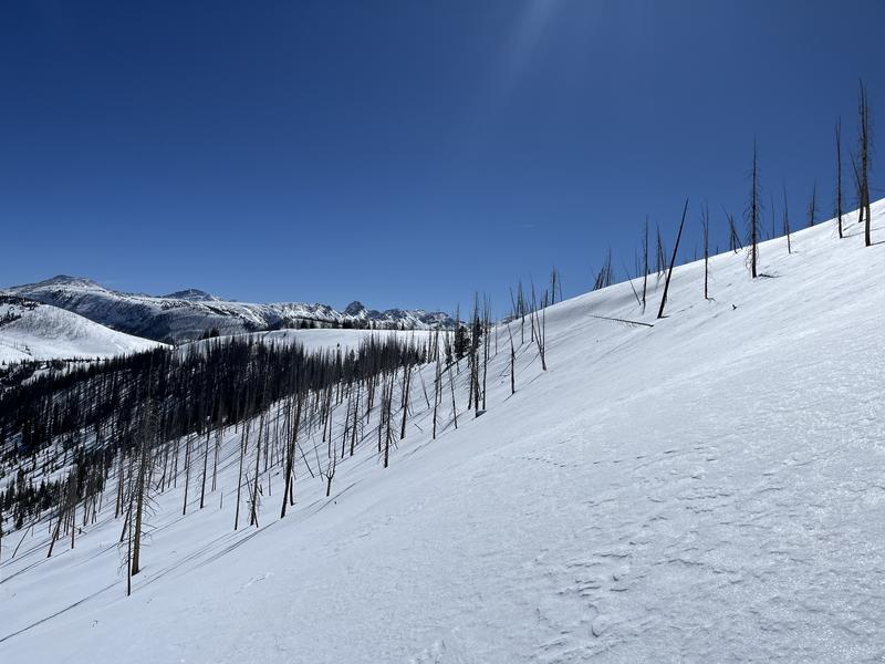
Ted visited the Mill Creek zone Thursday... "Still finding quite nice snow, but the band of soft settled snow is getting a little narrow."
Recent Avalanches
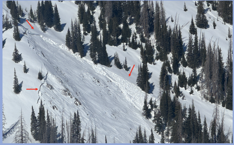
Chad B and Micheal Davis were in the Gold Hill zone yesterday and spotted a couple slides triggered mid week. They note.... "we observed two avalanches that ran on the old snow facets. This is an indication that in places with a deep snowpack, the likelihood of triggering an avalanche has decreased, but in places with a shallow snowpack, there is still a chance of triggering a large avalanche that runs to the ground."
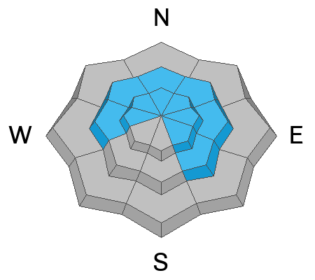
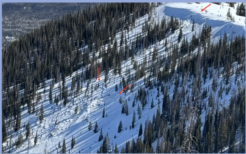
No shortage of recent avalanches last weekend. From the North Slope to the south half of the range, multiple, human triggered slides were reported, ending with a close call near the Buck Knoll. Check out the great video and detailed report, here -- thanks for sharing!
In addition, check out intel from across the range and beyond, here.
Ad
Avalanche Problem #1
Persistent Weak Layer
Type
Location
Likelihood
Size
Description
Beginning as a natural cornice fall and ten initiated an avalanche lower downslope, this is one of the larger slides observed during the mid week avy cycle
Let's face it.... our snowpack is complicated. And though the calendar suggests we're rounding out February and turning the corner into March Madness, the snowpack feels and looks similar to what we usually see in mid January. When I look under the hood I see a tricky snow structure that's complicated and harboring multiple layers of faceted snow. But rather than getting deep in the weeds of snow-geek speak, I turn my attention to the type of terrain that feels sketchy to me and it fits into a couple distinct hoppers. Slopes that have avalanched several times this season (repeaters) or terrain that's remained thin from lack of snow are in the bulls-eye. In fact, these are exactly the types of slopes where we've seen recent avalanche activity. When snowpack is the question... terrain is the answer. I'm in it for the long haul, so I'm simply avoiding steep, shady slopes that look thin and rocky, or still have bushes poking through the snow.
Avalanche Problem #2
Cornice
Type
Location
Likelihood
Size
Description
Cornices have grown ginormous the past few weeks and now that the heat is on, large pieces of snow are breaking off naturally and further back than we might think with our additional weight. In either case, let's give these unpredictable boxcar behemoths the respect they deserve and totally steer clear of 'em, especially during the heat of the day.
General Announcements
We are always looking for snow and avalanche observations or just general riding conditions. In the meantime reach out to us with questions, concerns, or if you see anything in your travels! Contact us directly through the info below:
  • Craig Gordon | Craig@utahavalanchecenter.org, 801-231-2170, or
  • Andrew Nassetta | Andy@utahavalanchecenter.org, 860-460-8142.
This forecast is from the U.S.D.A. Forest Service, which is solely responsible for its content. This forecast describes general avalanche conditions and local variations always occur. This forecast was issued on Saturday, March 1st at 03:30 AM and expires 24 hours after it was issued.