Forecast for the Uintas Area Mountains

Craig Gordon
Issued by Craig Gordon on
Wednesday morning, February 19, 2025
Don't let brilliant sunshine and fresh pow lure you into the avalanche dragons den... it's tricky and deceptively dangerous out there right now-
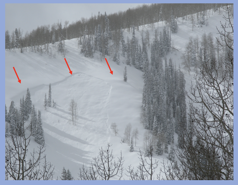
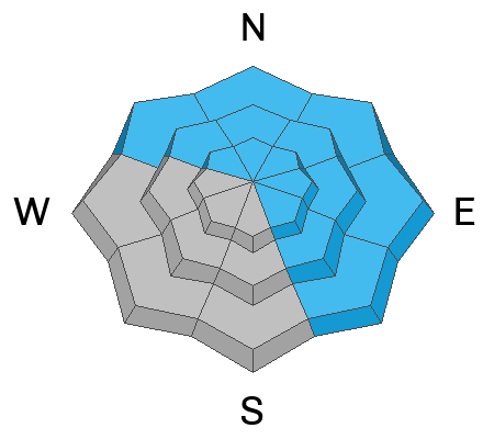
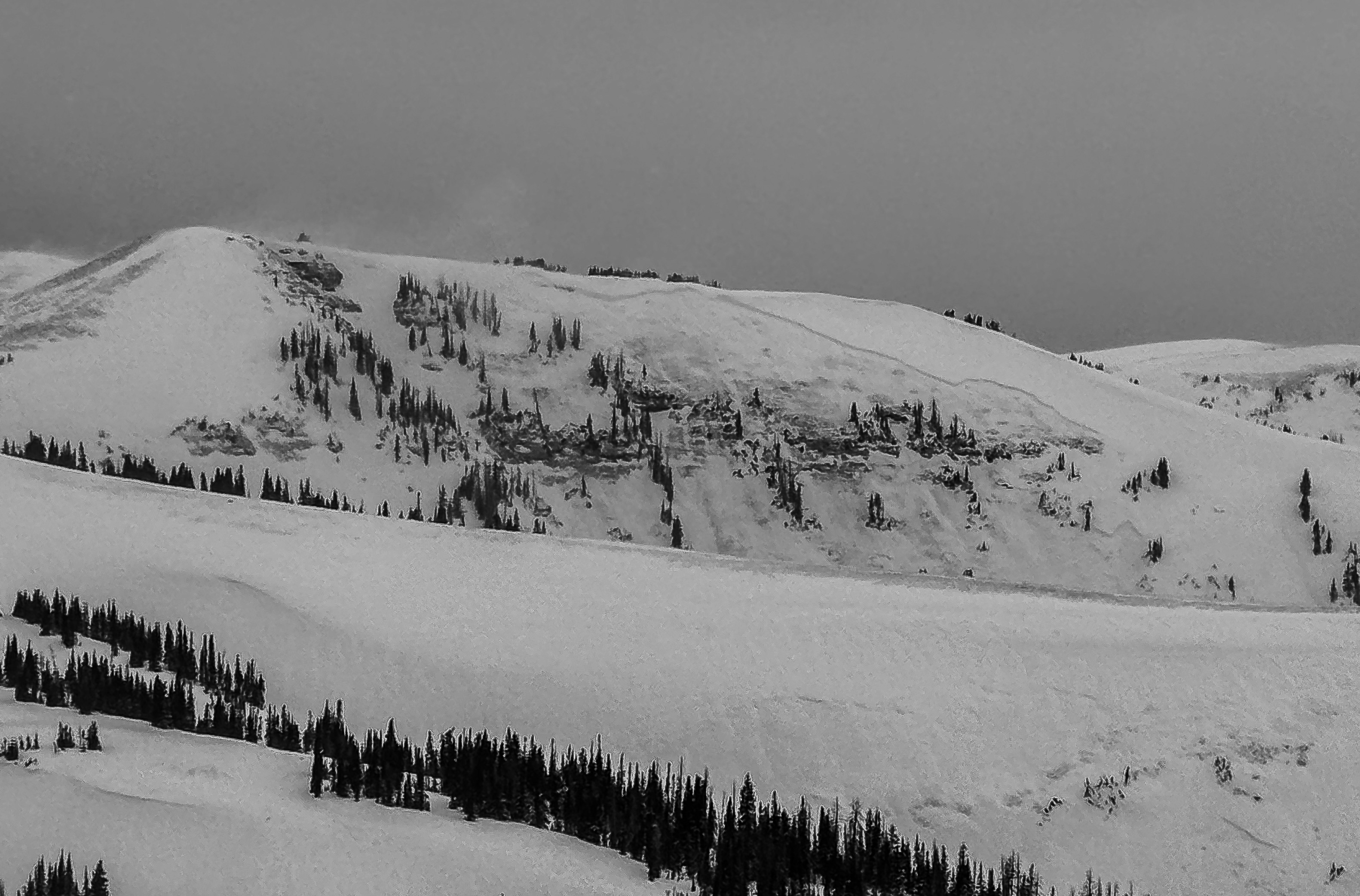
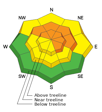
Mid and upper elevation terrain facing the north half of the compass offers CONSIDERABLE avalanche danger today. Human triggered avalanches are LIKELY, especially in steep wind drifted terrain, and particularly slopes with an easterly component to their aspect. Once initiated, avalanches have the potential to fail 2'-6' deep and break hundreds of feet wide.
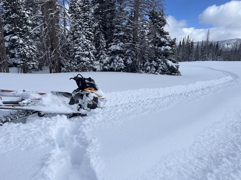
The riding is firing and it's easy to have an absolute blast tagging high quality snow with LOW avalanche danger. Meadow skipping, low angle terrain with no overhead hazard, or my personal fave... working on my tan whilst wiggling turns on mellow south facing slopes and avoiding avalanche terrain altogether... now that's the ticket!
Low
Moderate
Considerable
High
Extreme
Learn how to read the forecast here
Special Announcements
Help the University of Utah understand risk behavior in the backcountry by participating in a 15-minute survey. The U will compensate up to $30 for your time! Please note: responses will not be confidential but will be handled ethically under IRB guidelines
Weather and Snow
Nowcast- A break in the action allows clearing skies overnight with the mercury starting its day in the single digits, while westerly winds blow in the mid 20's near the high peaks. The gift that keeps giving continued it that spirit with another 4"- 8" of uber light snow stacking up across range yesterday. Storm totals since Thursday Feb. 13th are staggering with over 40" of snow and nearly 4" of water weight. On a go anywhere base with a chin ticking, fluffy topper, riding conditions in the Uinta's are five star and firing!
Forecast- Get a dose of Vitamin D while you can. Look for mostly sunny skies this morning with temperatures climbing into the low 30's. West and southwest winds bump into the 30's late in the day, opening the door to increasing clouds and a fast moving storm that gets going right around dinnertime.
Futurecast- A good shot of moisture overnight delivers 6"-10" of snow for Thursday mornings commuter special. This is gonna be the last of the powder party for awhile. Dry, high pressure builds in Friday through the weekend.
Blue skies and deep pow follow this guy around. Our main man Ted Scroggin was near Gold Hill yesterday and reports... "The coverage and the riding conditions are excellent with nice supportable snow and I was pleasantly surprised how easy it was to get around with so much new snow."
Recent Avalanches
Triggered early in the storm cycle in what we might consider a safer terrain option because it's in the trees, today's avalanches may break deeper and wider than we might expect and look very similar to the image above.
Ad
Avalanche Problem #1
Persistent Weak Layer
Type
Location
Likelihood
Size
Description
Chad B and Micheal Davis were in the Mill Hollow and Currant Creek zones yesterday and their pit profile above reflects a common sentiment with terrain that still harbors weak snow and shallow depth. Chad and Mike commented.... "The weak-faceted snow is still untrustworthy.... I feel it would just take a shallow spot to be able to trigger an avalanche on these facets."
Here's where it gets tricky... while many slopes avalanched, there's still plenty more waiting for us to roll along and knock the legs out from underneath. There is no threading the needle. Persistent slab avalanches are unmanageable and the strategy is avoidance. I'm simply avoiding the school of migrating white sharks that are feeding on steep, mid and upper elevation slopes facing the north half of the compass. I refuse to be the guy in the wetsuit that looks like a seal. Eventually the apex predators move on and we'll be good to go... but now is not the time to roll the dice, cause a miscalculation produces a devastating result.
A large destructive avalanche at 10,400' on a northeast slope that occurred naturally a week ago, breaking to the dirt near Chalk Creek.
Avalanche Problem #2
Wind Drifted Snow
Type
Location
Likelihood
Size
Description
24 hour wind run from Windy Peak (10,661') illustrates trends, velocity, and direction in the wind zone.
Yesterday's wind teams up with the recent run of ultra light snow, delivering shallow drifts and growing cornice that are hyper-reactive to our additional weight. Multiple layers of wind drifted snow are now camouflaged with even more fresh snow, making them harder to detect. However, you know the drill... keep your eyes peeled for and avoid fat rounded pillows, cornices, and slopes where the snow looks rippled or textured. And remember, even a relatively small avalanche could get quickly out of hand if it steps-down or fails on weak, faceted snow now buried deeply in our snowpack, and that'll pack a bigger punch than you might expect.
General Announcements
We are always looking for snow and avalanche observations or just general riding conditions. In the meantime reach out to us with questions, concerns, or if you see anything in your travels! Contact us directly through the info below:
  • Craig Gordon | Craig@utahavalanchecenter.org, 801-231-2170, or
  • Andrew Nassetta | Andy@utahavalanchecenter.org, 860-460-8142.
This forecast is from the U.S.D.A. Forest Service, which is solely responsible for its content. This forecast describes general avalanche conditions and local variations always occur. This forecast was issued on Wednesday, February 19th at 04:00 AM and expires 24 hours after it was issued.