Forecast for the Uintas Area Mountains

Craig Gordon
Issued by Craig Gordon on
Tuesday morning, February 18, 2025
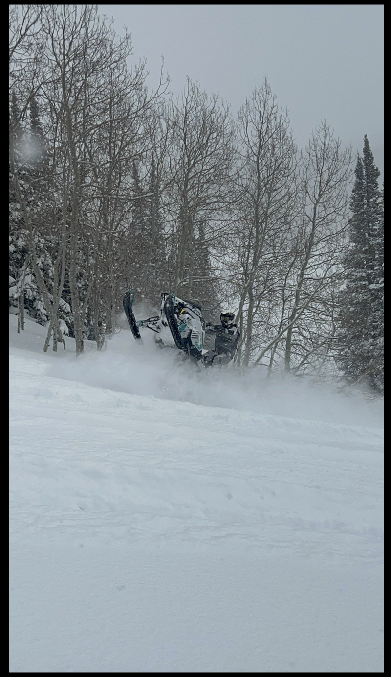
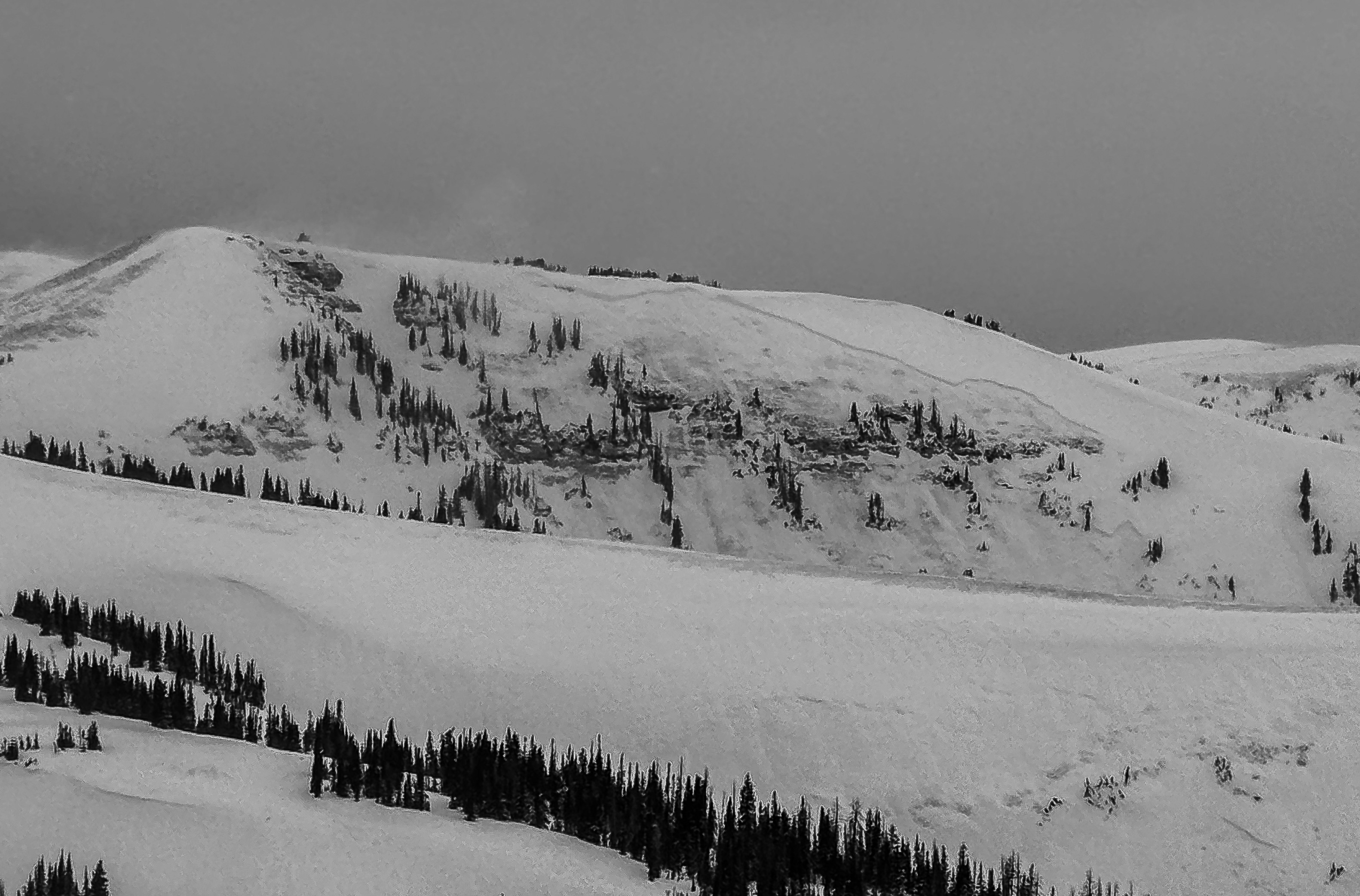
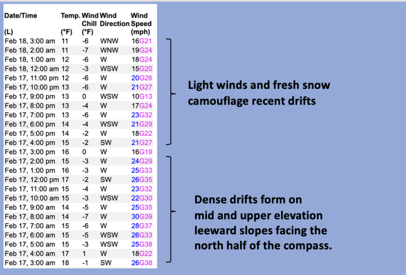
Mid and upper elevation terrain facing the north half of the compass offers CONSIDERABLE avalanche danger today. Human triggered avalanches are LIKELY, especially in steep wind drifted terrain, and particularly slopes with an easterly component to their aspect. Once initiated, avalanches have the potential to fail 2'-6' deep and break hundreds of feet wide. It's not just the big gnarly terrain that's sketchy... smaller, steep slopes near the trailheads like road cuts and creek beds can produce a small slide, catching us off guard, and burying us deeply in a nasty terrain trap like a gully. Terrain with these characteristics require careful consideration.
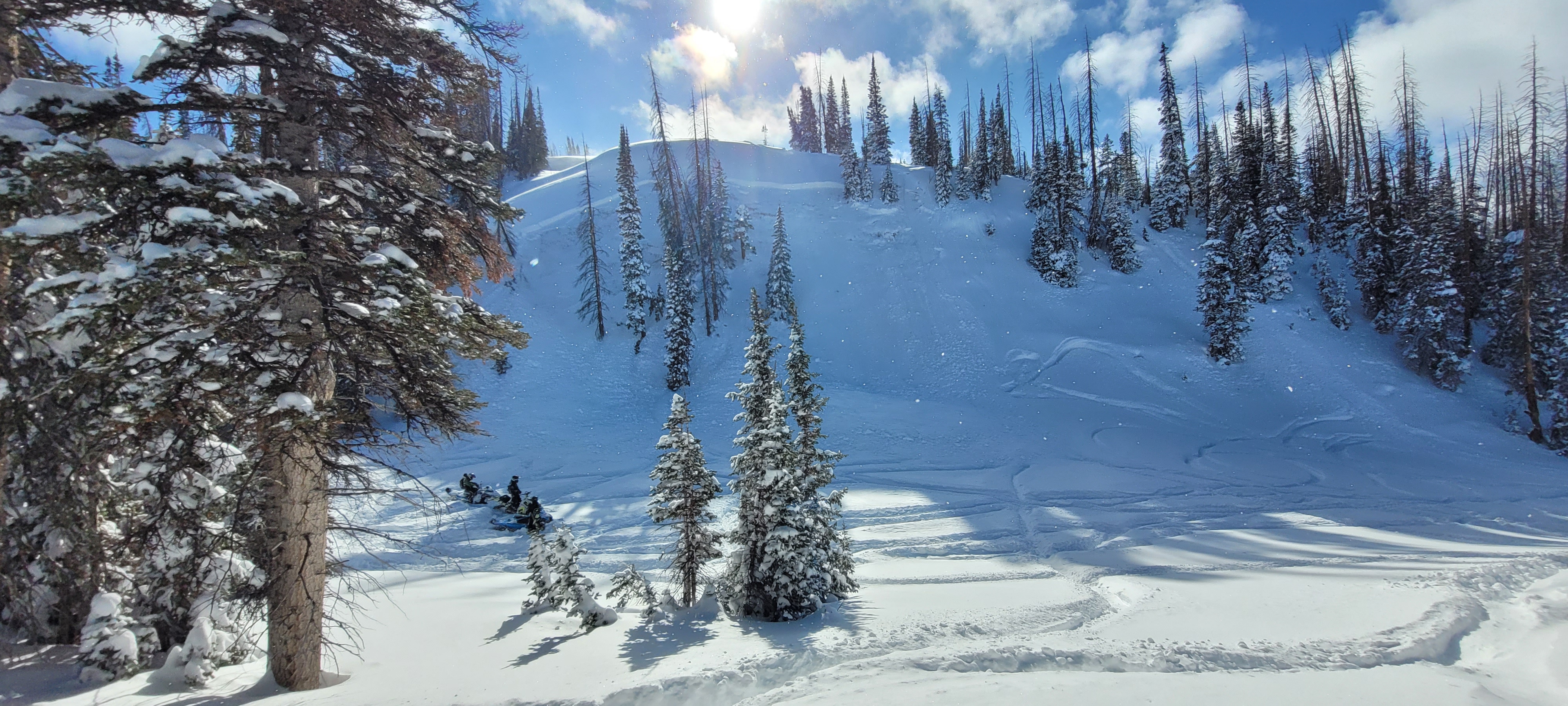
It's tricky and deceptively dangerous out there right now, but I'm not staying home and organizing my sock drawer because the riding is an eleven on a scale to ten! So... I'm having a blast and tagging terrain with no overhead hazard, I'm meadow skipping and wiggling turns on mellow south facing slopes, while avoiding avalanche terrain altogether... and yeah, that keeps my stoke level high. Done, done, and done :)
Low
Moderate
Considerable
High
Extreme
Learn how to read the forecast here
Weather and Snow
Nowcast- Yet another moist impulse slid across the range yesterday, delivering an evenly distributed 5" of low density snow with .30 H2O. Storm totals since Thursday Feb. 20th are staggering with nearly 40" of snow and 3.75" of water weight. At o'dark thirty, mostly cloudy skies produce scattered snow showers while temperatures register in the mid teens. After a brief run in the 30 mph range, westerly winds backed off into the teens overnight. On a go anywhere base with a chin ticking, fluffy topper, ridng conditions in the Uinta's are five star and firing!
Forecast- The back edge of this mornings storm exits the stadium and we'll see partly cloudy skies by about supper time. Temperatures climb into the mid 20's with overnight lows dipping into the teens. West and northwest winds average in the 20's with a few gusts to 40 mph near the high peaks.
Futurecast- A break in the action is on tap for early Wednesday with another storm slated to slide in towards sunset. Looks like a good snow producer and I think 8"-10" of snow feels about right for Thursday's commuter special. Drying out to end the work week.
Really... a wheelie... Jeremy Jolley having a blast and making it look easy :)
Recent Avalanches
Below, a crew was in the process of building a jump near Currant Creek Peak and triggered their LZ from the bottom. Not a huge slope, but a stellar example of terrain that could sneak up on us and get out of hand quick -- Thanks for the photo, Gents! Don't forget to get up to speed by checking out obs, avalanches and trip reports from across the range and beyond, here!
A northeast slope at 9,800' near Currant Creek where the crew intended on having their landing zone.
Ad
Avalanche Problem #1
Persistent Weak Layer
Type
Location
Likelihood
Size
Description
Since Thursday, the Uinta's stacked up nearly four feet of snow with 3.75" H20 and all that weight piled on top of our complex and fragile snowpack. And ya know, for every action, there's an equal and opposite reaction. In fact, this weekend, multiple weak, sugary layers (PWL) buried deep in our pack roared back to life. There's no mystery to the unstable nature of our snow because the biggest clue to avalanches is... avalanches! And we've seen dozens of slopes facing the north half of the compass produce some monster, tree snapping slides.
Here's where it gets tricky... while many slopes avalanched, there's still plenty more waiting for us to roll along and knock the legs out from underneath. There is no threading the needle. Persistent slab avalanches are unmanageable no matter who you are or what trick you have up your sleeve. The strategy is avoidance. I'm simply avoiding the school of migrating white sharks that are feeding on steep, mid and upper elevation slopes facing the north half of the compass. I refuse to be the guy in the wetsuit that looks like a seal. Eventually the apex predators move on and we'll be good to go... but now is not the time to roll the dice, cause a miscalculation produces a devastating result.
A large destructive avalanche at 10,400' on a northeast slope that occurred naturally, breaking to the dirt near Chalk Creek.
Avalanche Problem #2
Wind Drifted Snow
Type
Location
Likelihood
Size
Description
24 hour wind run from Windy Peak (10,661') illustrates trends, velocity, and direction in the wind zone.
The past few days, mid and upper elevation terrain saw west and southwest winds blowing 20-40 mph, creating drifts reactive to our additional weight. Recent drifts are camouflaged with fresh snow, making them harder to detect. However, you know the drill... keep your eyes peeled for and avoid fat rounded pillows, cornices, and slopes where the snow looks rippled or textured. And remember, even a relatively small avalanche could get quickly out of hand if it steps-down or fails on weak, faceted snow now buried deeply in our snowpack, and that'll pack a bigger punch than you might expect.
General Announcements
We are always looking for snow and avalanche observations or just general riding conditions. In the meantime reach out to us with questions, concerns, or if you see anything in your travels! Contact us directly through the info below:
  • Craig Gordon | Craig@utahavalanchecenter.org, 801-231-2170, or
  • Andrew Nassetta | Andy@utahavalanchecenter.org, 860-460-8142.
This forecast is from the U.S.D.A. Forest Service, which is solely responsible for its content. This forecast describes general avalanche conditions and local variations always occur. This forecast was issued on Tuesday, February 18th at 04:00 AM and expires 24 hours after it was issued.