Forecast for the Uintas Area Mountains

Andrew Nassetta
Issued by Andrew Nassetta on
Monday morning, December 30, 2024
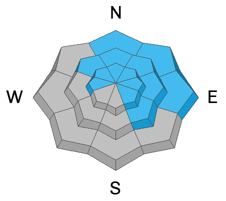
The avalanche danger today is HIGH on mid and upper-elevation slopes with a northerly component. Human-triggered avalanches are VERY LIKELY and today’s avalanches can be triggered from a distance (remotely) and occur naturally. Avalanches are failing near the ground 1-4’ deep, breaking hundreds of feet wide, and running farther down their paths than one might expect.
Remember, travel in avalanche terrain is not recommended today. But if you are heading out, there is fantastic riding in big flat meadows and low-angle slopes that are not surrounded by or connected to any steep terrain or overhead hazard above.
Low
Moderate
Considerable
High
Extreme
Learn how to read the forecast here
Avalanche Warning
What
The avalanche danger for the warning area is HIGH today
When
In effect from 0600 AM MST this morning to 0600 AM MST Tuesday.
Impacts
Multiple days of heavy snow combined with strong winds have created widespread areas of unstable snow. Both human-triggered and natural avalanches are likely.
Weather and Snow
Nowcast
Overnight we added another 4-8” of snow, with roughly .7” of water onto the Uinta snow stake, with Trial Lake taking the top podium spot at 8"! Winds gusted up to 70 MPH on the high peaks last night and have backed off into the 15-20 MPH range. Aside from a biting wind chill up on the high peaks, temperatures trend colder and currently read 20℉ at 8,000' and in the single digits up high at 10,000’.
Forecast
Scattered snow showers continue through the early hours this morning bringing another inch or two of snow into the afternoon. Expect mostly cloudy skies with a high of 20℉ at lower elevations and in the teens at upper elevations. Winds continue from the west in the moderate range, around 15-20 MPH, with gusts into the 30’s at upper elevations and ridgelines.
Futurecast
Light snow is forecasted for Tuesday and is followed by a ridge that develops with the New Year. Things will calm for the remainder of the week. but look promising heading into January.
Recent Avalanches
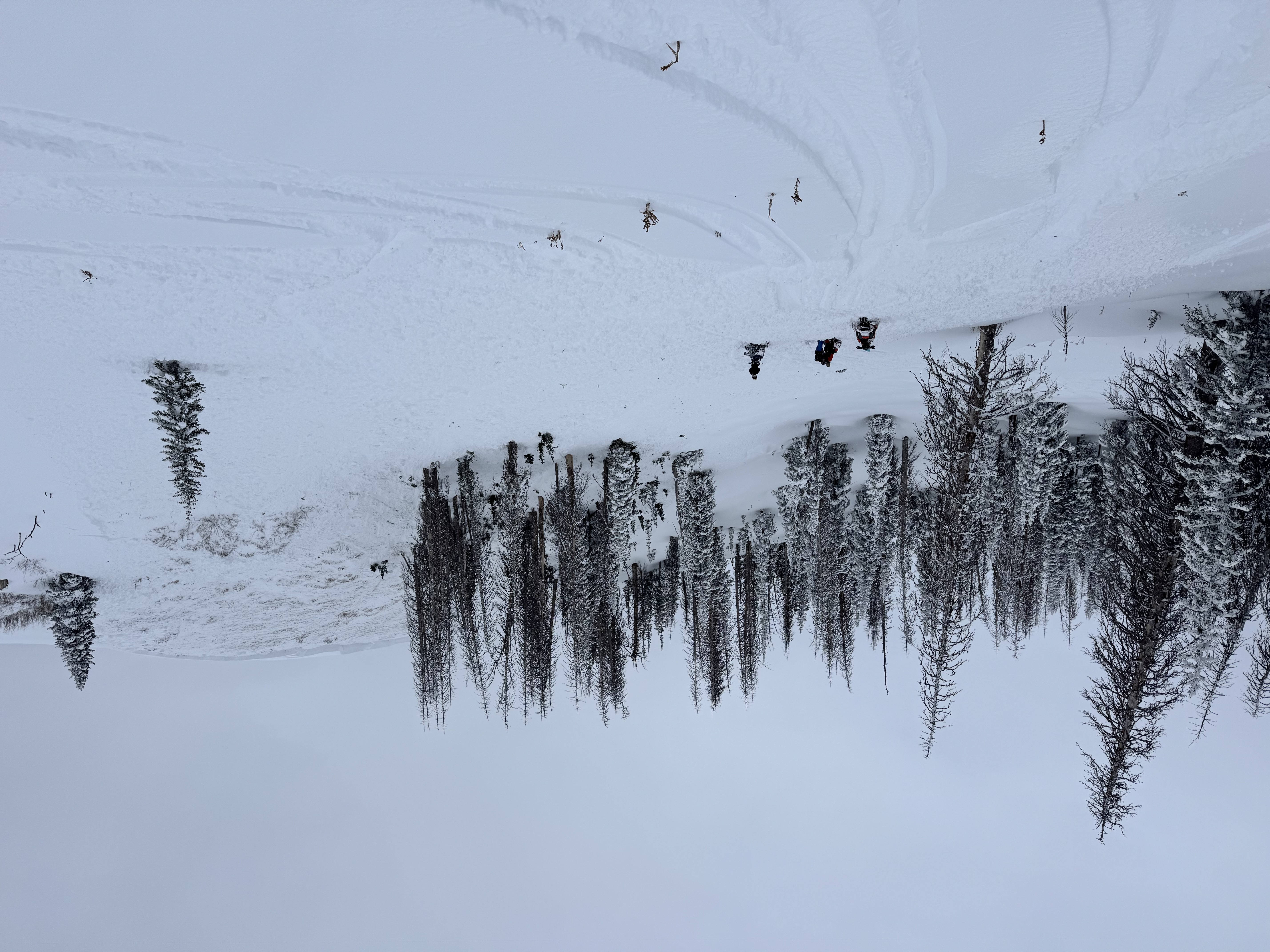
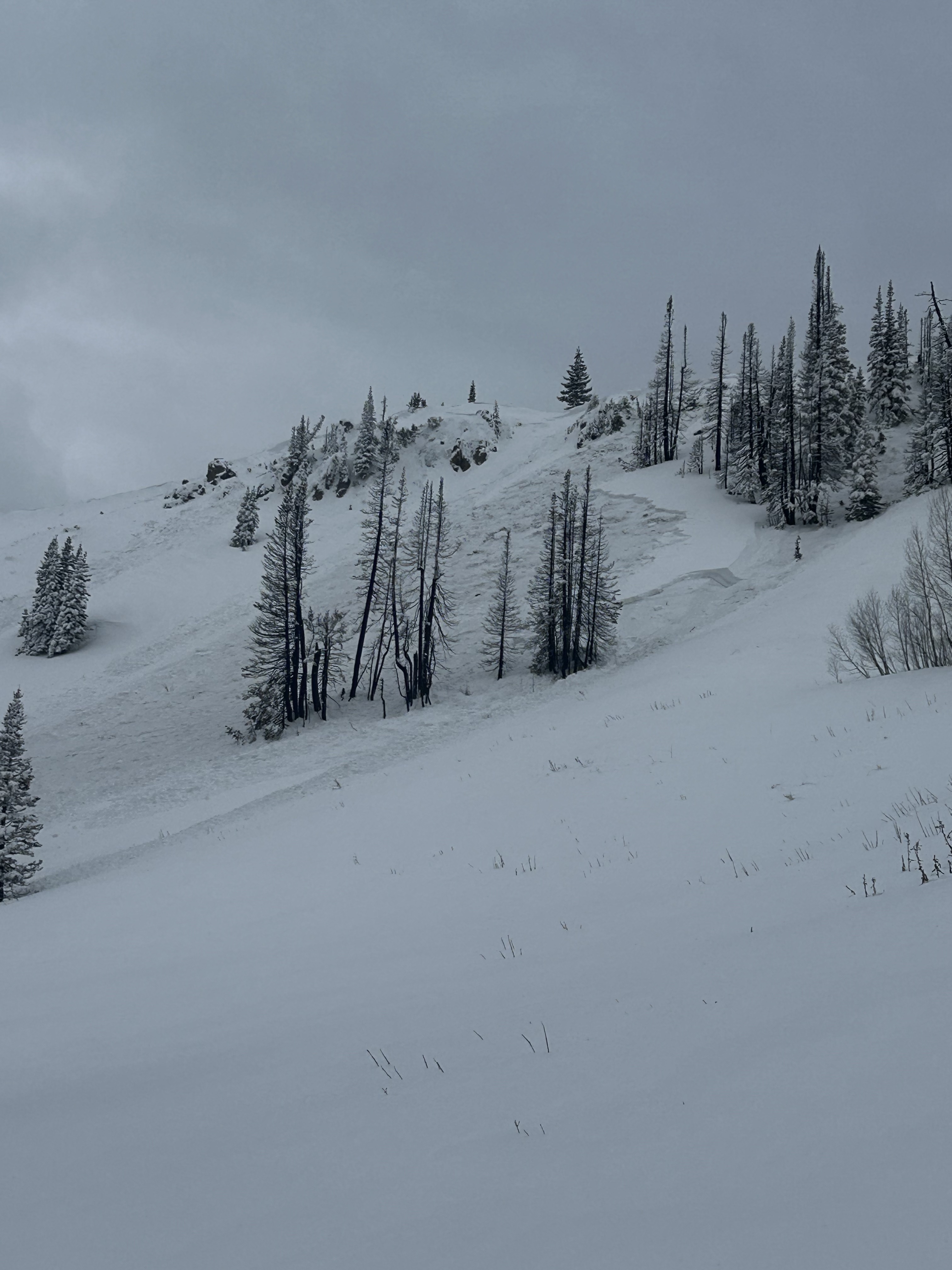
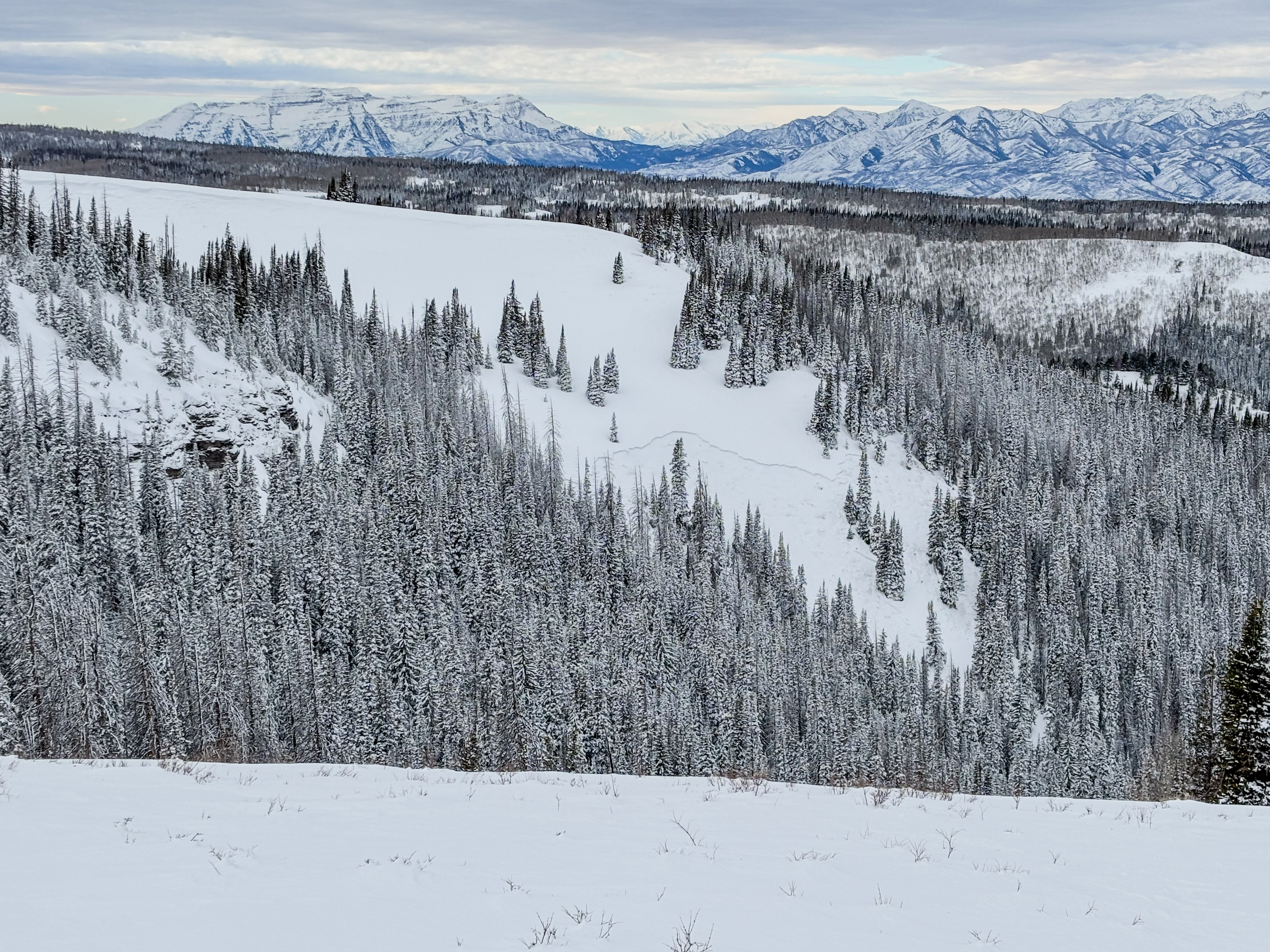
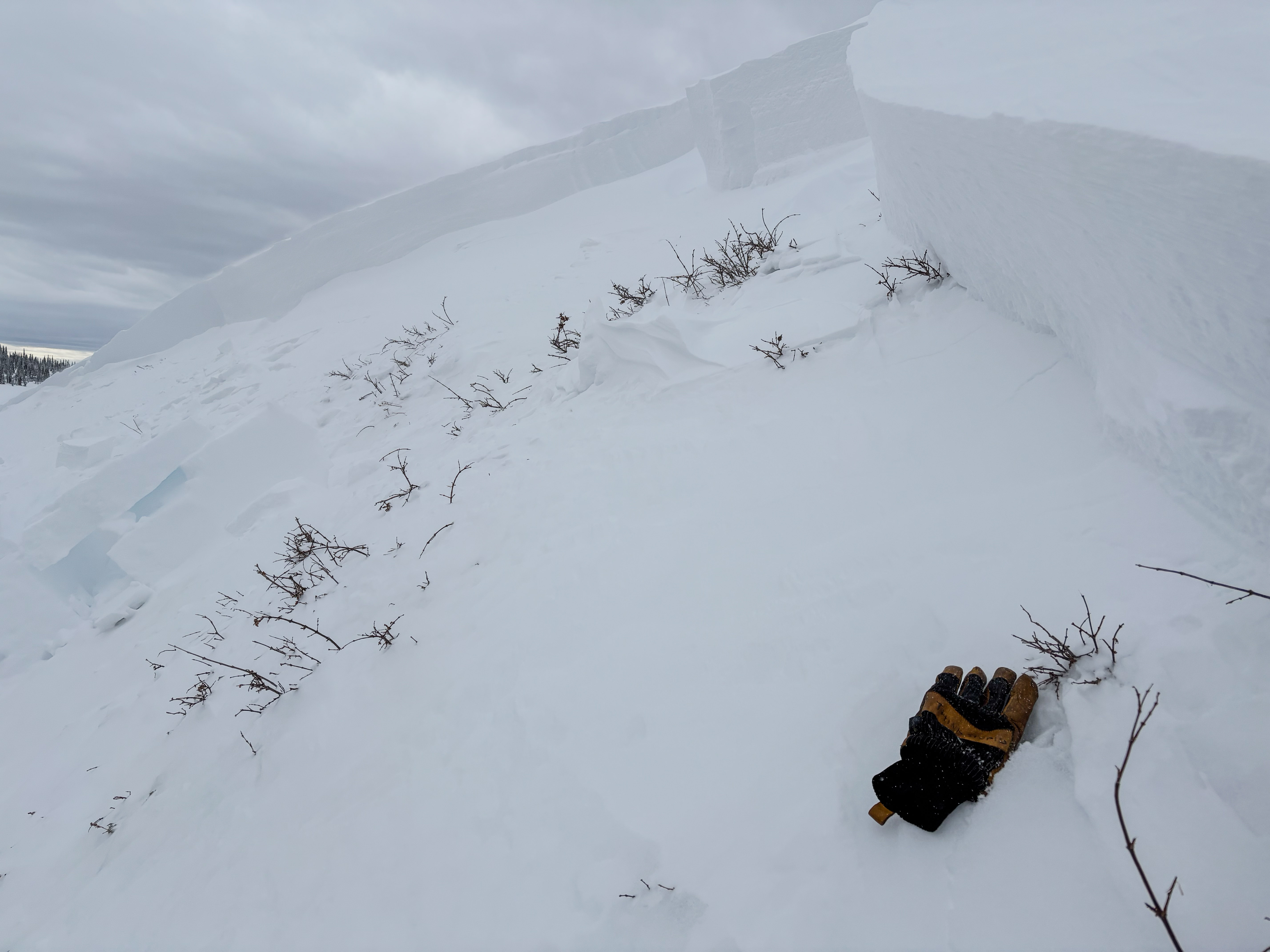
Avalanche activity has been widespread across the range for both natural and human-triggered avalanches. Many avalanches are failing on old, faceted snow buried up to 4’ deep on slopes with a northerly touch to them. Recent avalanches are breaking hundreds of feet wide and taking the entire season's snowpack with them when they go.
Ty S was towards the southernmost half of the range in Lake Creek near Heber Mountain and Bald Knoll noting multiple recent avalanches, and even witnessing a near miss – all the details found here.
Ted was on the North Slope, and saw lots of the same. He also observed nearly all five red flags, or obvious signs of instability, along his travels. His trip report can be accessed here.
9,800' -- NE -- 1-2' x 200' -- Remotely triggered
A crew was working towards some roadside attractions in the Wolf Creek area when they remotely triggered a chunk of snow a couple hundred feet wide, and about 1-2’ deep, you can check that out here.. More from Ty, Ted, and all those who have graciously submitted field obs and avalanches over the past week, can be found here.
9,750' -- ENE -- 1-2' x 200' -- Remotely triggered from the ridge.
Ad
Avalanche Problem #1
Persistent Weak Layer
Type
Location
Likelihood
Size
Description
Today is a bad day to gamble on our current snowpack as it is a hand of dangerous cards to play. At all elevations on the north half of the compass, we’re hearing about and seeing avalanches running fast and far breaking into faceted snow near the ground. Today’s avalanches will break hundreds of feet wide, snap timber along the way, taking you and the entire season's snowpack along for a nasty ride.
With additional snow and wind received overnight (4-8”/ .7” SWE), our avalanche problem is not different, it has only grown bigger and more reactive to our additional weight as a rider. Any slide triggered today has the potential to instantly ruin your day, as well as those waiting for you at home.
Avalanche Problem #2
Wind Drifted Snow
Type
Location
Likelihood
Size
Description
Westerly winds ripped overnight and formed stiff drifts at mid and upper elevations around the compass. Look for today's wind slabs to be most reactive in steep, thin, rocky areas on ridgelines and specific wind loaded terrain features, like rock outcroppings, convex rolls, and steep gully walls.
Remember, fresh wind drifts aren't always a manageable avalanche problem. Once triggered, today's drifts can get out of hand and break into deeper, faceted layers in the snowpack.
General Announcements
The Uinta weather station network was upgraded this summer and all that real-time info is found here. Simply click on the "Western Uinta" tab and then the "Weather Stations" tab to find all your weather needs.
We are always looking for snow and avalanche observations or just general riding conditions. So... if you see something, say something. You can reach our team directly by contacting: Craig at craig@utahavalanchecenter.org, 801-231-2170, or Andrew at andy@utahavalanchecenter.org, or 860-460-8142.
General Information
This forecast is from the U.S.D.A. Forest Service, which is solely responsible for its content. This forecast describes general avalanche conditions and local variations always occur. This forecast was issued on Monday, December 30th at 0500 AM and expires 24 hours after it was issued. We will update the forecast by 0700 AM tomorrow. But, in the meantime reach out to us with questions, or if you see anything in your travels.