Join us at our 2nd Annual Blizzard Ball

Forecast for the Uintas Area Mountains

Andrew Nassetta
Issued by Andrew Nassetta on
Monday morning, January 6, 2025
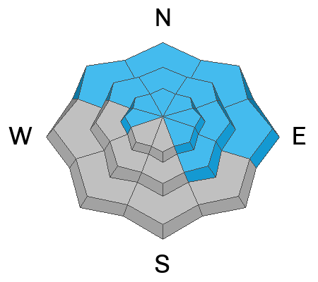
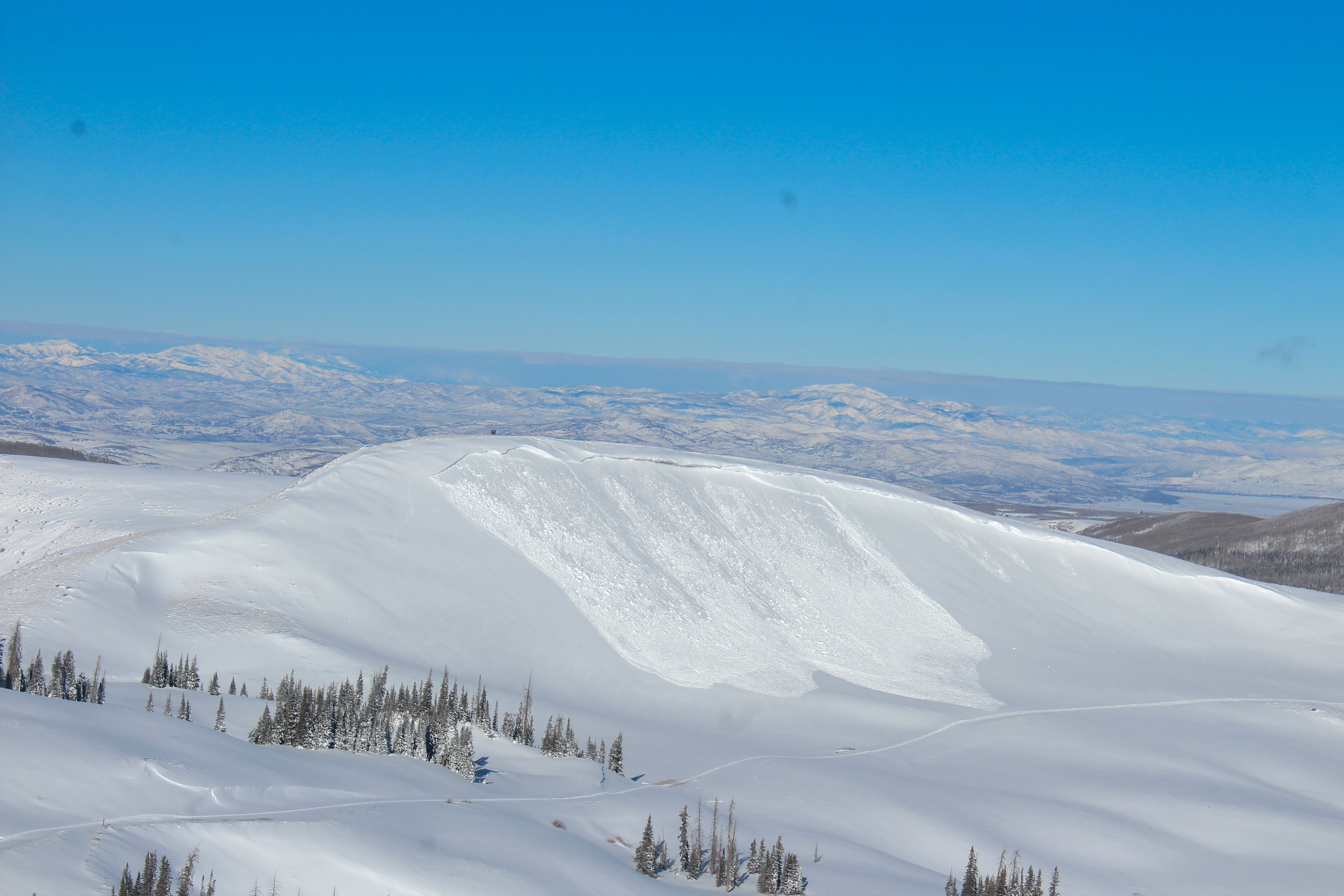
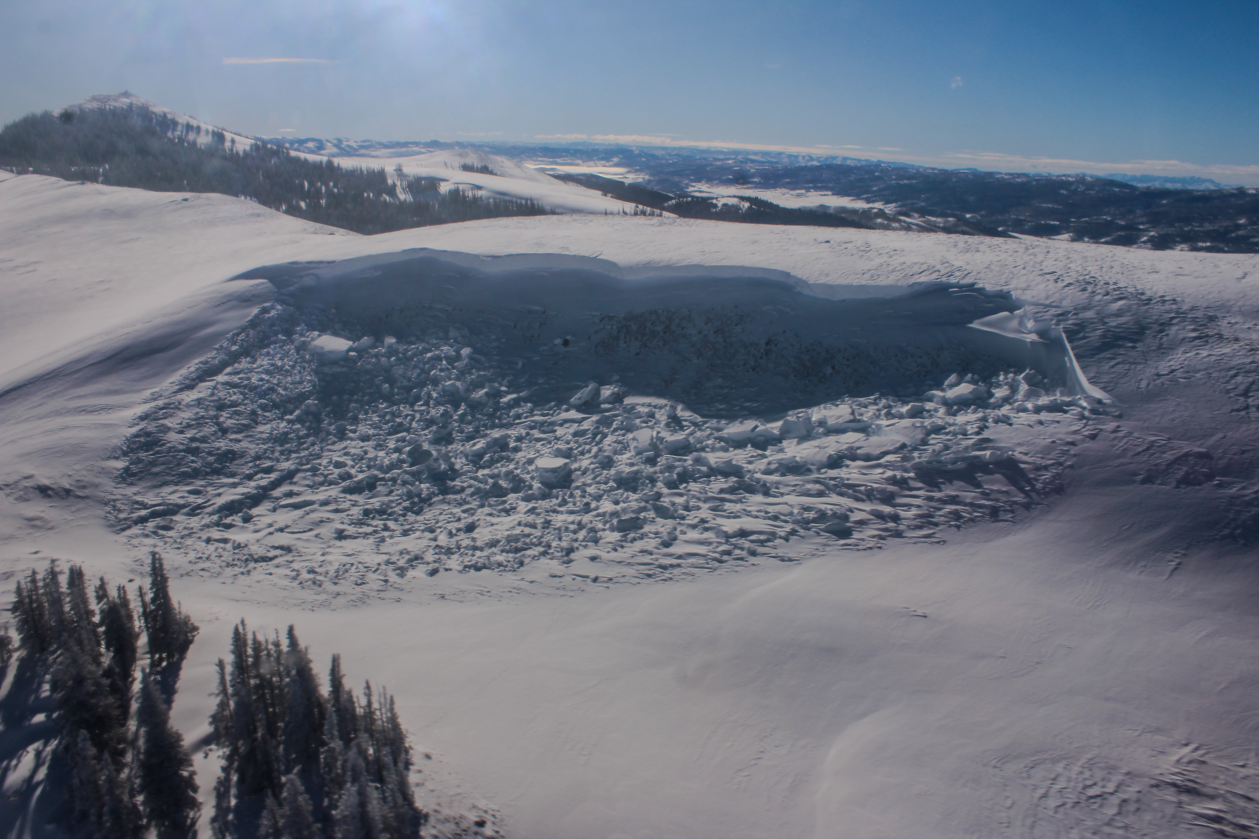
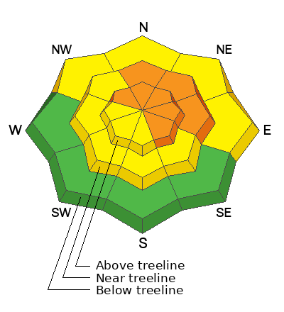
Today’s avalanche danger is CONSIDERABLE on mid and upper-elevation slopes facing northwest through southeast. Human-triggered avalanches are LIKELY and can be 2-4' deep, hundreds of feet wide, and be triggered remotely, or from a distance.

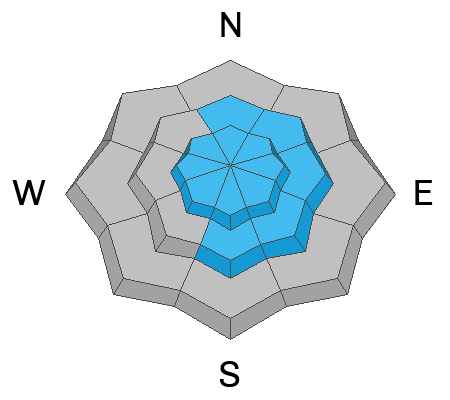
My strategy today is to find the best turning conditions while avoiding the greatest hazard... large, tree-snapping avalanches that I can remotely trigger. For that, I am taking advantage of MODERATE danger and quality riding conditions on the south half of the compass where my greatest risk is triggering a small wind-drift.
Low
Moderate
Considerable
High
Extreme
Learn how to read the forecast here
Special Announcements
We are deeply saddened to confirm two avalanche fatalities. The first involved a 38 year old man in Main Porter Fork of Mill Creek Canyon who went missing on Saturday. The second avalanche fatality occurred Tuesday and involved a 54 year old man off Davenport Hill into Silver Fork of BCC. Both individuals were traveling alone in the backcountry. Please know, our hearts are heavy for the family and friends of these riders.
Many thanks to those who responded to these accidents: search and rescue teams from AirMed, LifeFlight, Utah Dept Public Safety, Utah Department of Transportation, Salt Lake County Search and Rescue, Wasatch Backcountry Rescue, Alta Ski Area, and members of the Utah Avalanche Center.
Weather and Snow
Nowcast
As of 0500 AM we received a trace of snow on the stake last night, but nothing to write home about. Things are calm and cool this morning as winds are barely fluttering the flags at upper elevations and temperatures are in the high teens.
Forecast
For today, expect a few snow showers leaving behind a trace of snow later this morning while skies stay mostly cloudy. Temperatures climb out of the teens and hope to hit the low 20’s at lower elevations, while staying brisk with windchill in the single digits at upper elevation ridgelines and peaks.
Futurecast
We look to grab a few more inches of snow as the work week kicks off followed by mid-week sunshine and mild temps.
Recent Avalanches
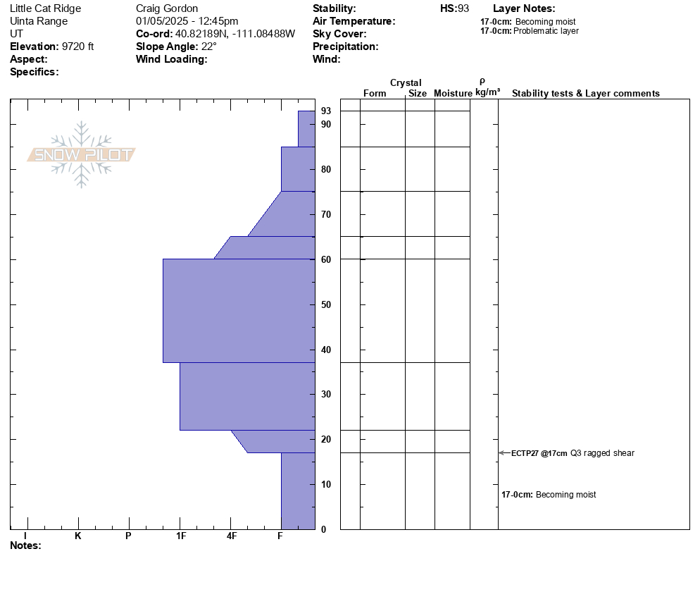
No significant avalanche activity to report from yesterday, but Craig was out in Upper Weber Canyon and managed to sneak in some product testing while tending to some weather station maintenance. He notes wisely, "Knowing the history of the snow and digging around gives you the full reveal of the setup (strong snow on top of weak snow) and faceted weak layers on the polars aren't healing anytime soon."All Uinta obs and trip reports can be found here.
Ad
Avalanche Problem #1
Persistent Weak Layer
Type
Location
Likelihood
Size
Description
A little bit of trickiness can add spice to life, but too much can lead to deception…As we see fewer recent avalanches and less obvious signs of instability (cracking, collapsing, whumphing), it may seem like the weak layer is strengthening, but there is still a likely chance of triggering a large avalanche remotely. Pull out your shovel or dig a trench with your track to reveal a dense slab atop the sugary facets, or junk in the trunk, as Craig says.
How am I managing this avalanche problem? Easy... I am avoiding it. These avalanches are big, scary, and pack a punch that can ruin your day and those waiting for you at home. I'm steering clear of avalanche terrain on the north half of the compass, changing aspects, and heading for the sunny slopes where cold snow is met with warm sunshine and less risk of remotely triggering large avalanches.
Avalanche Problem #2
Wind Drifted Snow
Type
Location
Likelihood
Size
Description
Today’s lingering wind drifts can be found in steep, mid and upper-elevation terrain where consistent westerly winds have packed in a slab. In many places,these will be stubborn to the additional weight of a rider, and may allow you to get out on slope before breaking above or below you. You can identify and avoid these drifts by looking for rounded, hard pillows that sound hollow like a drum. Don't forget, today's wind slabs can get out of hand quickly if they step-down into faceted weak layers that are now buried several feet deep in the snowpack.
General Announcements
The Uinta weather station network was upgraded this summer and all that real-time info is found here. Simply click on the "Western Uinta" tab and then the "Weather Stations" tab to find all your weather needs.
We are always looking for snow and avalanche observations or just general riding conditions. So... if you see something, say something. You can reach our team directly by contacting: Craig at craig@utahavalanchecenter.org, 801-231-2170, or Andrew at andy@utahavalanchecenter.org, or 860-460-8142.
General Information
This forecast is from the U.S.D.A. Forest Service, which is solely responsible for its content. This forecast describes general avalanche conditions and local variations always occur. This forecast was issued on Monday, January 6th at 06:00AM and expires 24 hours after it was issued. We will update the forecast by 0700 AM tomorrow. But, in the meantime reach out to us with questions, or if you see anything in your travels.