Join us at our 2nd Annual Blizzard Ball

Forecast for the Uintas Area Mountains

Craig Gordon
Issued by Craig Gordon on
Friday morning, January 17, 2025
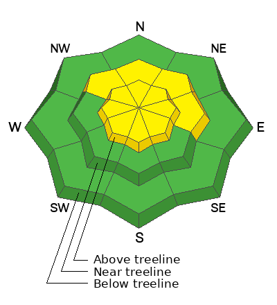
MODERATE avalanche danger continues today at and above treeline. Becoming pockety and harder to initiate, human triggered avalanches, breaking deeper and wider than you might anticipate are still POSSIBLE, especially in the wind zone on slopes facing northwest through north through southeast. In the more straight-forward and predictably manageable category... a handful of older wind drifts linger on steep, slopes around the compass and human triggered wind slabs are also POSSIBLE, especially in terrain with an east component to its orientation.
Note to self- I'm having a blast on wind sheltered, lower angle northerly (polar) aspects with no overhead hazard... yeah that's the ticket!
Low
Moderate
Considerable
High
Extreme
Learn how to read the forecast here
Special Announcements
Save the date and take a date!
Please join Craig Gordon, that's me, Tuesday January 21st from 6:00-7:30 PM at Alpha Coffee in Cottonwood Heights for a State of the Snowpack presentation. Reserve a spot and find out more deets HERE.
In addition, please join the UAC at Deer Valley on January 30th for the 2nd Annual Blizzard Ball Gala. The night will be full of fun including delicious cuisine, live music, an auction, and presentation by Bruce Tremper. More info found HERE.
Weather and Snow
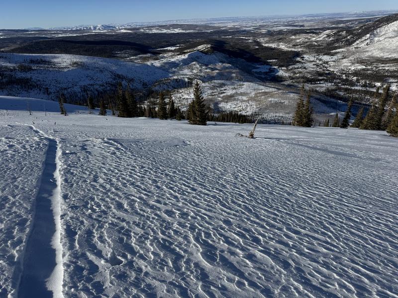
Nowcast- Severe clear skies overnight allowed temperatures to dive into the teens where they hover at the crack of o'dark thirty this morning. West and southwest winds decided to party at the turn of the new day and currently blow in the mid 20's near the high peaks. Recent strong sunshine wrapped its lips around the solars and I think you'll find a not-so-user-friendly breakable crust on the sunnies, but the snow surface on the shady slopes is cold and the polars are firing.
Forecast- Today look for slight warming... before cold storming. Expect temperatures to climb into the mid and upper 20's along with increasing clouds and westerly winds ramping into the 30's and 40's as the day wares on.
Futurecast- Light snow begins tonight and cold air filters into the region by early Saturday. The North Slope might be able to squeeze out 2"-4" of snow out of this storm, but I think the south half fo the range comes up short. An arctic blast blows through town late Saturday, delivering some of the coldest temperatures of the season into early next week.
Joey and I had an amazing midweek field day. We poked around low angle north facing terrain with no overhead hazard, tested some theories, and got to witness the phenomenon of weak snow forming in real time. Forecasters, product testers, scientists... all in our own backyard... such an amazingly fortunate and blessed existence :)
Recent Avalanches
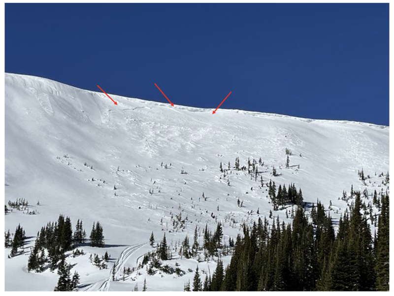
Most likely cornice triggered, our main man with the Uinta plan, Ted Scroggin, spotted this piece of snow yesterday peeling off a steep wind drifted slope on Double Hill in the Whitney Basin.
You can find trip reports and recent slides from across the range and beyond, here.
Ad
Avalanche Problem #1
Persistent Weak Layer
Type
Location
Likelihood
Size
Description
It feels like the snowpack is getting comfortable in its own skin and reaching a point of equilibrium. In fact, the snow feels like it's taking on that go-anywhere kinda base... and it is. Though there's a catch and a conundrum... these are exactly the type of snow conditions that allow us to start poking into high elevation, alpine terrain and onto steep slopes. But all we need to do is find a weak spot under the snow, like a hidden rock or bush, collapse the slope, and now we've got a connected piece of snow that breaks above us and quickly gets out of hand. While the chances of triggering a deep, dangerous avalanche have decreased slightly, the consequences remain severe. Likely suspect terrain I'm steering clear of are steep, rocky slopes, especially where the pack is slightly thinner and I could still knock the legs out from underneath the snow above me.
A frequent flyer (British spelling :) and super legit big mountain, backcountry adventurer, John Climaco visited the very eastern fringes of the western Uinta's and reports a deceivingly weak, sugary mess and adds... "Unfortunately, the whole thing is clearly sitting on some well protected weak layers and the surface facets are sparkling anyplace that’s protected. Note to self: almost any appreciable added water or wind is going to make this a very tricky place to operate indeed." More on John's travels here.
Avalanche Problem #2
Wind Drifted Snow
Type
Location
Likelihood
Size
Description
I think most of our fresh wind drift issues are largely put to bed for the minute, but the Uinta's are a huge range, and it wouldn't surprise me to find a rogue drift or two lurking on leeward slopes in the alpine. You know the drill... lose the wind and we lose the problem. Simply seek out wind sheltered, mid and lower elevation terrain and you'll score a great day of riding.
General Announcements
The Uinta weather station network was upgraded this summer and all that real-time info is found here. Simply click on the "Western Uinta" tab and then the "Weather Stations" tab to find all your weather needs.
We are always looking for snow and avalanche observations or just general riding conditions. So... if you see something, say something. You can reach our team directly by contacting: Craig at craig@utahavalanchecenter.org, 801-231-2170, or Andrew at andy@utahavalanchecenter.org, or 860-460-8142.
General Information
This forecast is from the U.S.D.A. Forest Service, which is solely responsible for its content. This forecast describes general avalanche conditions and local variations always occur. This forecast was issued on Friday, January 17th at 04:00AM and expires 24 hours after it was issued. We will update the forecast by 0700 AM tomorrow. But, in the meantime reach out to us with questions, or if you see anything in your travels.