Join us at our 2nd Annual Blizzard Ball

Forecast for the Uintas Area Mountains

Craig Gordon
Issued by Craig Gordon on
Thursday morning, January 16, 2025
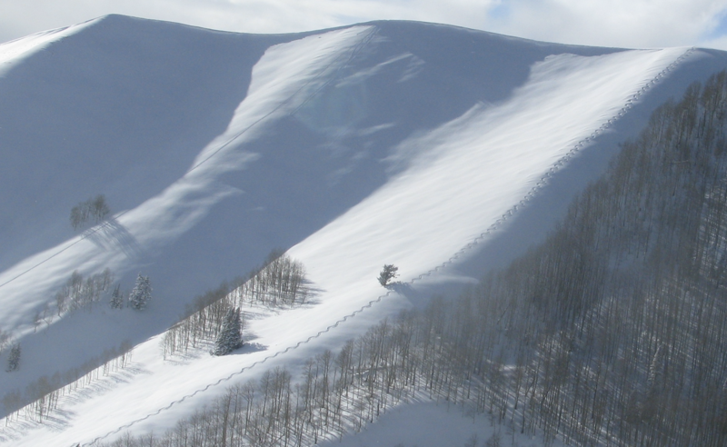
Expect MODERATE avalanche danger today at and above treeline. Human triggered avalanches, breaking deeper and wider than you might anticipate are still POSSIBLE, especially in the wind zone on slopes facing northwest through north through southeast. In the more straight-forward and predictably manageable category... a handful of older wind drifts linger on steep, slopes around the compass and human triggered wind slabs are also POSSIBLE, especially in terrain with an east component to its orientation.
Note to self- I'm having a blast on wind sheltered, lower angle northerly (polar) aspects with no overhead hazard.
Low
Moderate
Considerable
High
Extreme
Learn how to read the forecast here
Special Announcements
Please join the UAC at Deer Valley on January 30th for the 2nd Annual Blizzard Ball Gala. The night will be full of fun including delicious cuisine, live music, an auction, and presentation by Bruce Tremper. All the deets are found HERE.
Receive forecast region-specific text message alerts to receive messages about changing avalanche conditions, watches, and warnings. Sign up and update your preferences HERE.
Weather and Snow
Nowcast- High pressure building overhead delivers the usual round of valley junkin', humid funkin', while the mountains offer clear skies and fresh, clean air. It's ridiculously pleasant as you gain elevation, with light winds and temperatures registering in the upper 20's and low 30's. Yesterday's strong sunshine kissed the solars and I think you'll find a breakable crust on the sunnies, but the snow surface on the shady slopes is cold and the polars are firing.
Forecast- A stunning day is on tap with clear skies, brilliant sunshine, and temperatures climbing into the mid 30's. Winds blow in the teens and 20's from the south, but remain reasonable throughout the day.
Futurecast- Westerly winds ramp up the Friday, opening the door to a cold, yet mostly moisture starved system which slides through northern Utah early Saturday morning. I'm thinking storm totals in 2"-4" range with a blast of very cold air to follow.
Joey and I had an amazing midweek field day. We poked around low angle north facing terrain with no overhead hazard, tested some theories, and got to witness the phenomenon of weak snow forming in real time. Forecasters, product testers, scientists... all in our own backyard... such an amazingly fortunate and blessed existence :)
Recent Avalanches
The last slide triggered was four days ago, Sunday, Jan. 12th, near the Duchesne Ridge on a heavily wind loaded, northeast facing slope. Breaking 2'-4’ deep and a couple hundred feet wide, this avalanche highlights our problem child... the mid December drought layer now buried in the mid to lower portion of the snowpack.
You can find all travel observations and recent slides from across the range and beyond, here.
Ad
Avalanche Problem #1
Persistent Weak Layer
Type
Location
Likelihood
Size
Description
It feels like the snowpack is getting comfortable in its own skin and reaching a point of equilibrium. In fact, the snow feels like it's taking on that go-anywhere kinda base... and it is. Though there's a catch and a conundrum... these are exactly the type of snow conditions that allow us to start poking into high elevation, alpine terrain and onto steep slopes. But all we need to do is find a weak spot under the snow, like a hidden rock or bush, collapse the slope, and now we've got a connected piece of snow that breaks above us and quickly gets out of hand. While the chances of triggering a deep, dangerous avalanche have decreased slightly, the consequences remain severe. Likely suspect terrain I'm steering clear of are steep, rocky slopes, especially where the pack is slightly thinner and I could still knock the legs out from underneath the snow above me.
The snowpack structure is coming around, but it's a patience game. I'm not jumping into steep, shady terrain and I'm not hiding under the bed either. Instead, I'm ever so slightly and very cautiously, slowly nibbling on the edges of bigger terrain to get a feel for the pack and a finger on the pulse of which way we're trending.
Avalanche Problem #2
Wind Drifted Snow
Type
Location
Likelihood
Size
Description
I think most of our fresh wind drift issues are largely put to bed for the minute, but the Uinta's are a huge range, and it wouldn't surprise me to find a rogue drift or two lurking on leeward slopes in the alpine. You know the drill... lose the wind and we lose the problem. Simply seek out wind sheltered, mid and lower elevation terrain. We avoid the avalanche hazard and score a great day of riding to boot... scoot :)
General Announcements
The Uinta weather station network was upgraded this summer and all that real-time info is found here. Simply click on the "Western Uinta" tab and then the "Weather Stations" tab to find all your weather needs.
We are always looking for snow and avalanche observations or just general riding conditions. So... if you see something, say something. You can reach our team directly by contacting: Craig at craig@utahavalanchecenter.org, 801-231-2170, or Andrew at andy@utahavalanchecenter.org, or 860-460-8142.
General Information
This forecast is from the U.S.D.A. Forest Service, which is solely responsible for its content. This forecast describes general avalanche conditions and local variations always occur. This forecast was issued on Thursday, January 16th at 04:00AM and expires 24 hours after it was issued. We will update the forecast by 0700 AM tomorrow. But, in the meantime reach out to us with questions, or if you see anything in your travels.