Forecast for the Skyline Area Mountains

Brett Kobernik
Issued by Brett Kobernik on
Sunday morning, March 29, 2020
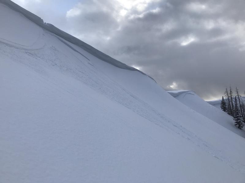
The avalanche danger is LOW in the majority of the terrain today. There is a MODERATE avalanche danger along the higher northwest through east facing slopes where a person could trigger a shallow avalanche within the new layers of snow. Watch for cracking of the new snow especially along the ridges where the wind has drifted snow.
Low
Moderate
Considerable
High
Extreme
Learn how to read the forecast here
Special Announcements
If you rely on the UAC forecasts each day you get out, consider making a donation during our Spring Awareness Campaign to help us continue providing the avalanche forecasts and education you rely on.
The UAC encourages everyone to follow direction from federal, state, city and county officicals. The following is from Joe Dougherty, spokesman for the Utah Division of Emergency Management:
Though outdoor recreation is still permitted under the governor’s Stay Safe/Stay Home directive, we recommend that people maintain a distance of at least 6 feet.
Be extra cautious to avoid injuries outdoors. We are working with our hospital systems to conserve as much personal protective equipment as possible in case of hospitalizations.
Most outdoor injuries can be prevented. Know the conditions and know your limits so you don’t end up in a hospital.
Weather and Snow
Current Conditions: Winter continues. A few more inches trickled in Saturday. Riding conditions remain excellent. There are some more details in this BACKCOUNTRY OBSERVATION from John Pikus. The southerly wind was drifting some snow during the day on Saturday but has slowed down overnight. Temperatures are in the mid teens this morning.
Mountain Weather: We have one more storm system moving through later today and tonight before we have a break for a few days. This is yet another storm system that is attempting to "split" off the main jetstream. The result for our area will be a southerly wind direction. It will shift southeast as the storm passes under us. We should see 3 to 6 inches of new snow. Given the storm track with the southeast flow, places on the east side of the range like upper Ferron canyon may receive the most snow.
Recent Avalanches
There was one small avalanche reported from Saturday. It was a skier triggered avalanche that involved the newer snow. It was along an upper ridge where the wind had been drifting and depositing snow. DETAILS HERE.
Ad
Avalanche Problem #1
New Snow
Type
Location
Likelihood
Size
Description
Your main concern today involves the newest snow from the past week. It most likely won't be as sensitive today as yesterday as it's had some time to settle which helps stabilize it. The most likely spots to trigger something are going to be just below the higher ridgelines on north through east facing terrain.
Here is something else to keep in mind. While it looks like we won't see a whole lot of snow stack up until later in the day, if it snows harder than anticipated, the avalanche danger can spike. This is not going to be a huge issue today but it's something to be aware of. Even small slides can ruin your day especially if you are in radical terrain where you might get flushed down a chute or into trees or rocks.
Additional Information
This forecast is from the U.S. Forest Service, which is solely responsible for its content. This forecast describes general avalanche conditions and local variations always occur.