Current Conditions: Skies have clouded up and temperatures have dropped from highs in the mid 30s on Saturday to overnight lows in the mid teens. The wind continued to blow from the west on Saturday drifting snow along the higher terrain. It has slowed down now. Riding conditions remain excellent outside of the wind affected zones.
Mountain Weather: A weak storm will impact our area today perhaps bringing a trace to a couple of inches of new snow to the Skyline. We'll see highs in the upper teens and wind will be light and variable in direction. The next significant storms will move through toward the end of the week.
There were three notable avalanches that released on Saturday. Two of them were snowmobile triggered. One of them caught two snowmobilers.
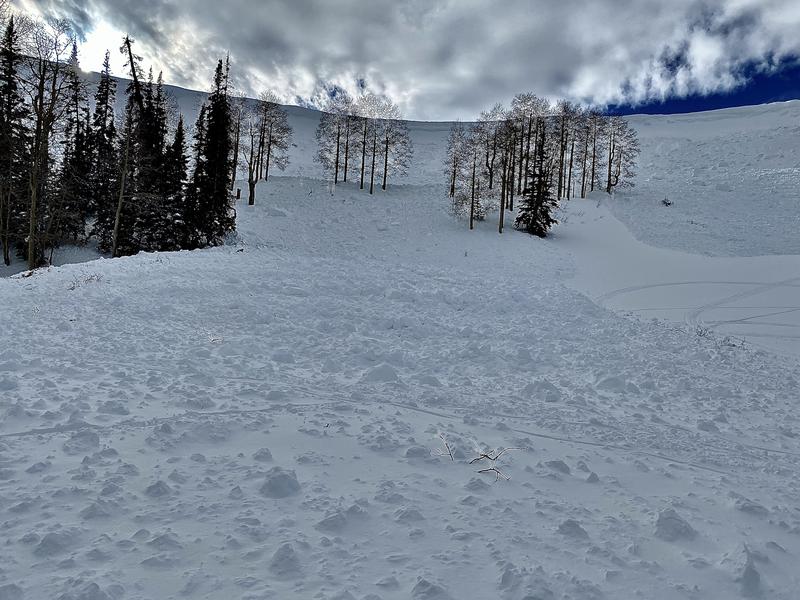
The first one was at The Big Drift where a snowmobiler climbed a steep northeast facing wind loaded slope and triggered it. There were a number of people in the area but no one was caught.
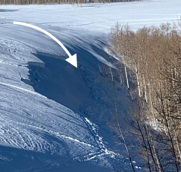
The second one was on a short but steep rollover just off the east side of the North Skyline Drive in Cabin Hollow. It was also recently wind loaded. The two snowmobilers that triggered it were caught but stayed on top of the debris and were uninjured.
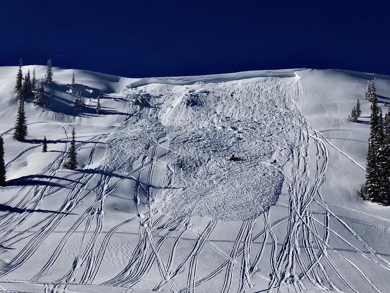
The third was a very large slide off Wedding Ring Ridge. This is perhaps the largest avalanche of the 2019-20 winter season so far. It was powerful enough to take down a pine tree. It most likely released naturally during the day as the wind continued to load the east facing slope. There were snowmobile tracks that the debris overran indicating that people were below the slope before it avalanched. It's possible that it was snowmobile triggered but my money is on the wind loading.