There's another great video out that highlights the importance of getting trained about avalanche safety. Klim put together this great video. The guys from
Snow Big Deal, one of our local Klim dealers, help us a great deal with avalanche safety and are always involved when we need help teaching people how to use avalanche gear.
Current Conditions: Friday was another nice day in the mountains although a bit windy. Riding conditions remain good in many locations. Overnights we picked up about 3 inches of new snow. It looks like it's been a bit windy again from the west. Temperatures plummeted overnight with most stations at 5˚F this morning.
Mountain Weather: We'll see clouds over the mountains today with somewhat windy conditions and the chance for snow this afternoon. I'm expecting a trace to a few inches of accumulation. It's going to remain cold with highs in the low teens. Sunday looks like a real nice day with sun and highs in the upper teens. I'm not seeing any significant snow storms in sight until around mid March. There is some sort of closed low pressure system moving in from the south around the middle of next week but I don't think it'll do anything for the Manti Skyline. Looks like the Tushar Mountains might pick up a good shot of snow.
There's been no new avalanche activity that I know of since early in the week. I did get one report about a potential partial burial when some snowmobilers triggered an avalanche in the Ephraim Canyon region. Details are vague about location, timing and what exactly happened. If you trigger an avalanche, please let us know so that we can spread the word that conditions are still touchy.
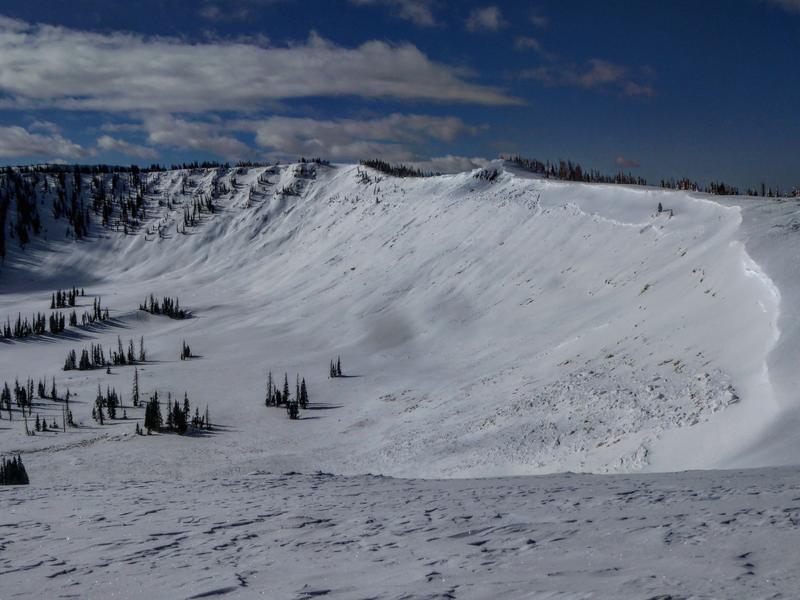
I've finished compiling all of the avalanche reports from the amazing recent natural avalanche cycle.
Highlights from the most recently published avalanche reports are avalanches in Jordan Canyon, one measuring 1 mile wide. This most likely ran Sunday or Monday with the spike in wind speeds.
There was a snowmobile fatality recently near Montpelier Idaho. Our forecasters from Logan went up to do the accident investigation. This is relative to our area because the snowpack is very similar. Below is a really well done video about what happened.