


Forecast for the Skyline Area Mountains

Issued by Brett Kobernik on
Monday morning, February 21, 2022
Monday morning, February 21, 2022
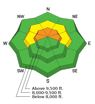
The avalanche danger has increased to CONSIDERABLE. Human triggered avalanches are likely today on steep upper elevation terrain that faces west, north and east. Avalanches can be triggered from a distance so stay out from underneath steep slopes also.
Low
Moderate
Considerable
High
Extreme
Learn how to read the forecast here
 Weather and Snow
Current Conditions
There's been just a dusting of new snow overnight. Southwest wind has been blowing strong overnight. This has no doubt drifted snow and will enhance the avalanche danger. Overnight temperatures stayed mild with most stations hovering in the upper 20s.
Mountain Weather
A storm is on our doorstep and the first part of it will move through today although it looks a little weaker to me today than it did yesterday. We should see snow during the day especially later this morning and afternoon with flurries lingering into tonight. Southwest wind should slow during the day and temperatures will drop into the teens by late afternoon. I'm thinking 4 to 7 inches is a decent amount to expect. The next part of the system moves through Tuesday night and Wednesday. I'm currently anticipating 6 to 8 inches out of that impulse.
 Recent Avalanches
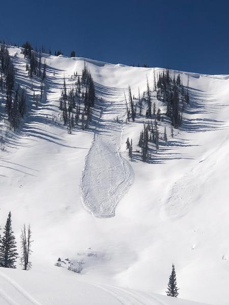
A couple more small natural avalanches were spotted that released during the tail end of last week's storm. This was a northeast facing slope in Pleasant Creek. These little guys are just another indicator of the weak snow that formed over the last month and is now buried. With more snow this week, these avalanches will get big enough to become a serious concern.
Photo: Brian Osborne

Avalanche Problem #1
Persistent Weak Layer
Type
Location
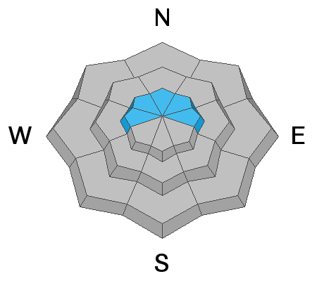
Likelihood
Size
Description
OK, things are starting to get more dangerous. The weak layer is in place. It formed over the last month and was buried by last week's storm. It has shown us enough indicators in small pockety avalanches as well as various snowpit tests to prove it is capable of being dangerous. The wind picked up overnight which will have formed some fresh slabs. We're expecting more snow during the week. It all adds up. It's time to back off of the steeper terrain and let the storms and weak snow take their course. Below is a video with info about the buried "Near Surface Facets":
Additional Information
General Announcements
This forecast is from the U.S.D.A. Forest Service, which is solely responsible for its content. This forecast describes general avalanche conditions and local variations always occur.