Forecast for the Skyline Area Mountains

Brett Kobernik
Issued by Brett Kobernik on
Monday morning, February 15, 2021
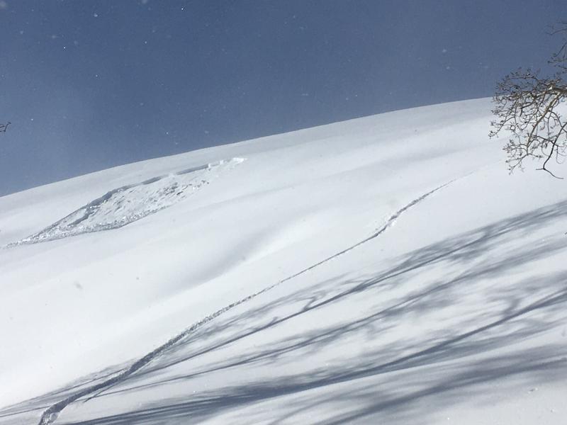
THE AVALANCHE DANGER REMAINS HIGH TODAY!!
Human triggered avalanches are almost certain.
It is imperative to avoid all steep slopes.
Low
Moderate
Considerable
High
Extreme
Learn how to read the forecast here
Avalanche Warning
What
THE AVALANCHE DANGER FOR THE WARNING AREA IS HIGH TODAY AND POSSIBLY EXTREME BY TOMORROW.
When
IN EFFECT FROM 6 AM MST THIS MORNING TO 6 PM MST TUESDAY
Where
FOR THE MOUNTAINS OF MUCH OF THE STATE OF UTAH, INCLUDING THE WASATCH RANGE...BEAR RIVER RANGE...UINTA MOUNTAINS...MANTI-SKYLINE...THE FISH LAKE REGION…PAHVANTS…TUSHARS…AND THE CEDAR CITY AREA MOUNTAINS.
Impacts
DANGEROUS AVALANCHE CONDITIONS EXIST IN THE BACKCOUNTRY. NATURAL AND HUMAN TRIGGERED AVALANCHES ARE LIKELY OVER THE NEXT SEVERAL DAYS. STAY OFF OF AND OUT FROM UNDER SLOPES STEEPER THAN 30 DEGREES.
Weather and Snow
Current Conditions: A cold unstable air mass in northwest flow delivered another 4 to 5 inches during the day on Sunday to areas orographically favored by that flow (ie roughly Pleasant Creek through Manti Canyon). This brings totals up to around 20 inches with two inches of water since Friday. Riding conditions are much improved but people need to be very careful to not get into avalanche terrain if you choose to recreate during the HIGH avalanche danger. Temperatures were in the low teens overnight and the west wind is pretty light.
Mountain Weather: Another pretty impressive looking storm is on tap for this afternoon into Tuesday. We'll see snowfall start out in a "warm air advection" pattern (ie warm front) with a west southwest flow sometime around noon. By tonight cold air moves in an the flow shifts northwest. It looks like we should see snow on Tuesday as well. Rough snow total estimates are a foot plus by Wednesday. Models are advertising upwards of an inch and a half of water so we could be well over a foot if things shake out right. This is going to be a bit windier event than the last storm especially when the flow switches northwest tonight. For today, just anticipate clouds with the chance of snow this afternoon. Temperatures should get into the low 20s by this afternoon and west southwest wind will be fairly light but increasing later.
Recent Avalanches
There was one small skier triggered avalanche on Sunday. It was near Huntington Reservoir off State Road 31. It was a small pocket only 60 feet wide or so. However, this is a huge indicator for me. I've seen this exact same pocket release a number of times over the years and it only does so when the snowpack is VERY unstable. This was remotely triggered by the skier from quite a distance away as you can see from his track compared to where the pocket released in the photo below. MORE DETAILS HERE
Ad
Avalanche Problem #1
Persistent Weak Layer
Type
Location
Likelihood
Size
Description
The base of the snowpack is weak sugary faceted snow grains.
A few layers of snow were added in early February.
We just added 15 to 20 inches of new snow.
We are about to add another foot or more of new snow.
If it is not obvious, we are stacking weight onto a very weak foundation. This is a very dangerous situation.