Join us at our 2nd Annual Blizzard Ball

Forecast for the Skyline Area Mountains

Brett Kobernik
Issued by Brett Kobernik on
Tuesday morning, December 17, 2024
The avalanche danger on the Manti Skyline is rated MODERATE.
The danger is increasing today and may reach CONSIDERABLE.
Wind drifted snow getting deposited on top of older weak snow is the big concern.
Avoid any fresh drifts on steep upper elevation slopes especially that face north through east.
Low
Moderate
Considerable
High
Extreme
Learn how to read the forecast here
Weather and Snow
Current Conditions: Recent wind has really decreased the quality of the riding conditions. You need to hunt around to find pockets of good carvable snow. It's quite inconsistent out there and today's wind won't help. Temperatures got close to 40˚F in the high country yesterday and only cooled to around 30 overnight. Wind has been fairly strong along the highest peaks overnight.
Mountain Weather: We'll see breezy conditions this morning with clouds that look like they'll dissipate a bit as the day goes on. Temperatures may not increase all that much during the day. The weather looks quite mild over the next few days. I'm not seeing any decent storms until at least Christmas.
Recent Avalanches
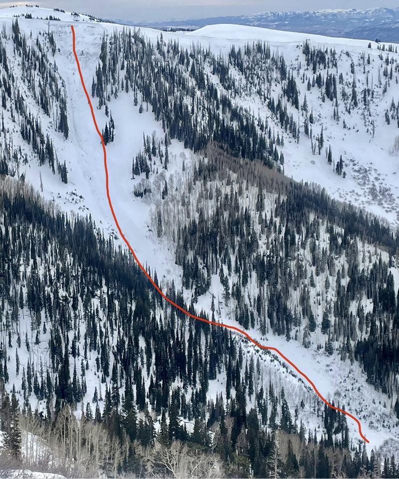
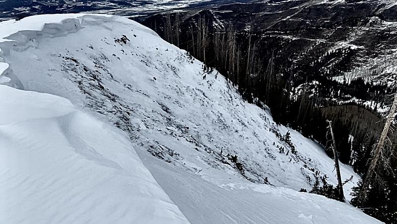
I stumbled onto a very large avalanche that released naturally on Sunday. It was in Pleasant Creek and broke 2 to 4 feet deep, 450 feet wide and ran 1100 feet vertical. It broke to the ground in weak sugary faceted snow. The debris stopped about 100 feet above the road. It was a result of heavy wind loading. What amazes me is that we received only 4 inches of new snow on Friday and the wind drifting on Sunday produced this large avalanche. There are two takeaways from this.
  1. Never underestimate how much snow can get transported by wind.
  2. This is a very clear demonstration of how weak our current snowpack structure is.
MORE DETAILS HERE
Ad
Avalanche Problem #1
Wind Drifted Snow
Type
Location
Likelihood
Size
Description
I was a bit surprised to see such a large avalanche from a small amount of snow and some wind. It goes to show how much snow wind can transport. For today, my thinking is that there is not as much loose snow available for transport as there was on Sunday so in theory, we shouldn't see as much wind loading. That said, I'm not screwing around on or below steep slopes where the wind has been depositing snow. No doubt, there will be some snow transport and some new loading. The areas where the snow gets deposited are suspect.
General Announcements
This forecast is from the U.S.D.A. Forest Service, which is solely responsible for its content. This forecast describes general avalanche conditions and local variations always occur.