Forecast for the Skyline Area Mountains

Brett Kobernik
Issued by Brett Kobernik on
Wednesday morning, December 16, 2020
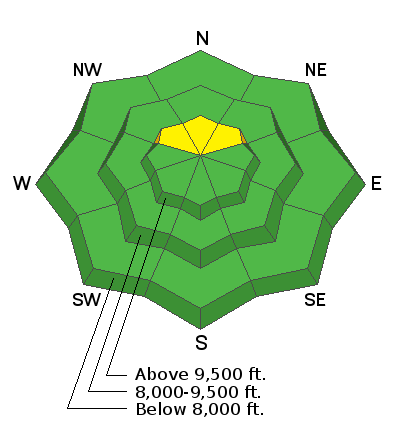
A MODERATE avalanche danger exists on steep upper elevation northerly facing slopes where the snowpack is more than a foot deep. Old weak faceted snow from November may collapse under the new snow and cause avalanches. If you hear a significant "WHOOMPING" noise while traveling, this is the old faceted snow collapsing under the weight of the new snow. This is an obvious sign of unstable snow.
Low
Moderate
Considerable
High
Extreme
Learn how to read the forecast here
Weather and Snow
Current Conditions: No big change in conditions since Tuesday. The snowpack is starting to settle and consolidate a little bit. This should make travel easier in the coming days.
Mountain Weather: We'll have partly cloudy skies today with light wind and high temperatures along the ridges in the low 20s. The next storm will move through Thursday and should produce 4 to 9 inches of new snow.
Recent Avalanches
On Tuesday, a snowshoer in Canal Canyon experienced a significant "WHOOMP" of the snowpack. This is caused by the weak sugar snow near the ground collapsing under the weight of the new snow and the snowshoer acting as a trigger. This was in a flat meadow. Had this been on a steeper slope, it would have avalanched. This is the first significant sign of instability this winter involving old snow and it probably won't be the last, unfortunately.
Ad