Forecast for the Skyline Area Mountains

Brett Kobernik
Issued by Brett Kobernik on
Monday morning, December 16, 2019
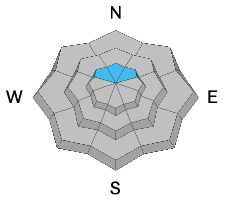
The majority of the terrain along the Skyline has a LOW to MODERATE avalanche danger. Keep in mind that the conditions are more dangerous on slopes approaching 40 degrees in steepness on northwest, north and northeast facing slopes where there is old weak snow present on the ground from October.
Low
Moderate
Considerable
High
Extreme
Learn how to read the forecast here
Weather and Snow
Wow! We received a nice little unexpected shot of snow overnight. It looks like we picked up about 6 inches of low density snow.
Unfortunately, it doesn't look like we have any more snow coming this week. We'll have cooler temperatures early in the week followed by warming later on. Wind will be northerly early in the week and switching more southerly later on.
Ad
Avalanche Problem #1
Persistent Weak Layer
Type
Location
Likelihood
Size
Description
I have concerns that the upper elevation northerly facing slopes still have the potential for an avalanche to break into old weak snow near the ground. It's possible that this issue could become a thing of the past if we could get a few more good storms to add some more snow to the pack. However, I'm very concerned that a week of high pressure and no snow will turn our currently decent snowpack into a big pile of weak sugar snow. Time will tell.
Additional Information
This forecast is from the U.S. Forest Service, which is solely responsible for its content. This forecast describes general avalanche conditions and local variations always occur.