Forecast for the Skyline Area Mountains

Brett Kobernik
Issued by Brett Kobernik on
Wednesday morning, December 15, 2021
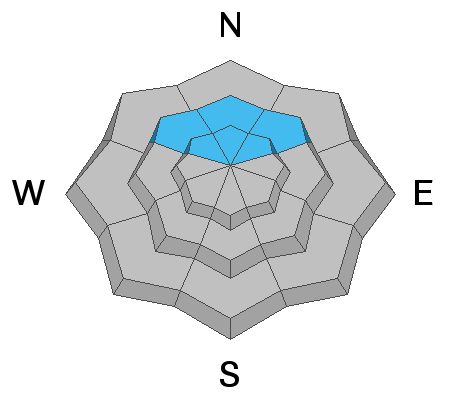
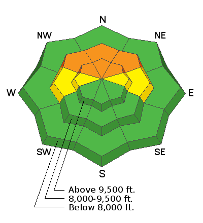
Strong southerly wind and new snow have increased the avalanche danger especially on northeast, east, and northwest slopes in the mid and upper elevations. A CONSIDERABLE avalanche danger exists there. Areas that didn't have any snow from October have a much lower avalanche danger but you will want to watch out for fresh drifts of wind blown snow.
Low
Moderate
Considerable
High
Extreme
Learn how to read the forecast here
Special Announcements
Get free batteries for your transceiver and a chance to win 1 of 10 Black Diamond Rescue Kits, 1 of 3 Mammut Barryvox transceivers, or 1 of 3 BCA Tracker transceivers. Stop at Big Pine Sports in Fairview or another participating shop, fill out our survey and get a free set of batteries. Don't need batteries, but still want a chance to win? Simply fill out the survey to be registered.
Weather and Snow
Current Conditions
A windy quick hitting storm brought 7 to 10 inches of new snow to the Skyline. It appears upper Ferron Canyon picked up the most new snow. The south wind was strong Tuesday night. It switched to the northwest and remained fairly strong overnight. It has slowed a little. Temperatures have been dropping since the wind shift and are now in the mid teens at most mountain locations.
Mountain Weather
We'll see cloudy skies with the slight chance of lingering snow flurries this morning. Clouds should break a bit later on. Northwest wind is going to stay pretty strong and slowly taper off later today. Temperatures will remain in the teens or even drop a bit late in the day. The next chance for snow is Thursday night when a weak system moves through and might bring a couple of inches of snow.
Ad
Avalanche Problem #1
Persistent Weak Layer
Type
Location
Likelihood
Size
Description
Your biggest concern is triggering an avalanche that breaks into weak sugary snow from October. The new wind drifted snow has made this situation more dangerous. The problem exists above about 9000' on northeast, north and northwest facing steep slopes. If you are going to get into that type of terrain (that is where people want to go since that is where the most snow is) keep your slope angles under 30 degrees and make sure there is nothing steep above you.