Forecast for the Skyline Area Mountains

Issued by Brett Kobernik on
Saturday morning, December 11, 2021
Saturday morning, December 11, 2021
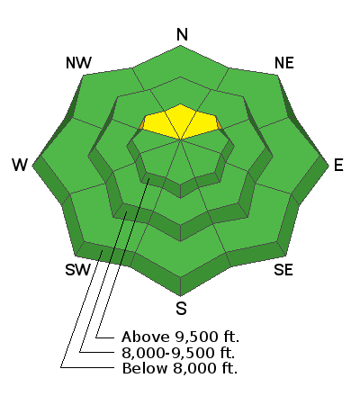
Overall, the avalanche danger is generally LOW.
There is a MODERATE danger in upper elevation northerly facing slopes that received around a foot of wind drifted snow on Thursday. Small human triggered slab avalanches are possible on these slopes.

Low
Moderate
Considerable
High
Extreme
Learn how to read the forecast here
 Weather and Snow
Current Conditions:
Temperatures remain cold this morning with most stations in the low single digits. Wind speeds have dropped off. There is a solid foot of new snow (10 to 15 inches) that accumulated on Thursday in the higher terrain. I found this new snow to be quite dense. It is "right side up" which makes it pretty user friendly for traveling on skis. There is probably enough to slide around with a snowmobile on some graded mountain roads.
Mountain Weather
We have a couple of mostly sunny days ahead with temperatures rebounding into the low 20s today and a bit warmer on Sunday. The next chance for snow looks like around Wednesday. This is not looking like a big storm but it might be good for 4 to 8 inches of new snow.
 Recent Avalanches
During mountain fieldwork on Friday, my partner and I found some natural avalanche activity that occurred during the tail end of the storm. We found a small avalanche and a number of adjacent slopes that had cracked and collapsed. Unfortunately, the culprit is a layer of loose sugary snow near the ground from the October storms. I've been speculating whether the early season snow on the ground would produce any avalanches once it got buried. I got my answer a little sooner than I expected.
The avalanche was about 125 feet wide, running only about 100 vertical feet. It averaged 14 to 16 inches deep but we measured the crown at 22 inches in the deepest location. The weak layer was faceted snow grains from October snow.
Avalanche Problem #1
New Snow
Type
Location

Likelihood
Size
Description
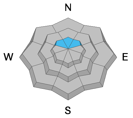
Your biggest concern is triggering an avalanche that breaks on old sugary faceted snow. It will be difficult for most people to actually get to a slope that has all the ingredients for an avalanche. That said, when there's a will, there's a way. If you are going to venture into avalanche terrain, these are the ingredients you'll need for an avalanche to occur:
- A slope that has old weak sugary snow near the ground. This will be upper elevation northerly facing slopes.
- A slope that received at least 10 inches of new snow.
- A slope that has had some wind affect, meaning the snow has been drifted.
- A slope that is over 35 degrees in steepness.
Watch for cracking of the snow around you as you travel and pay attention to any "whoomping" noise. These are clues that you are in an area that has this unstable sugary snow at the base. It is easy to dig down and distinguish it right now.


