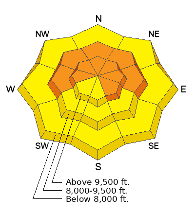
Avalanche Awareness Week continues!
Stop by Big Pine Sports in Fairview to get free batteries for your avalanche beacons and get registered for a drawing for free avalanche gear.
Current Conditions: Riding conditions remain quite good in many locations. You'll find that the wind has done some damage to the surface powder in exposed places. Temperatures got into the 20s on Friday and dipped back into the teens overnight. There was a period of moderate speed southwest wind Friday and it slowed again overnight.
Mountain Weather: We'll have increasing high clouds today with temperatures into the mid 20s. I'm expecting the southwest wind to increase a bit today. It looks like it may get fairly strong tonight. Sunday looks mostly cloudy with highs in the mid 20s and moderate to strong southwest wind. The next storm moves in Sunday night through Monday. This is not going to be a huge snow producer for the Skyline. We'll see a few inches accumulation early Monday morning in a southwest flow. It'll be showery at best during the day Monday with a better chance for some more accumulations Monday night as the flow shifts northwest. I'm anticipating 4 to 8 inches of total snow from this storm.


