Forecast for the Skyline Area Mountains

Brett Kobernik
Issued by Brett Kobernik on
Sunday morning, December 1, 2019
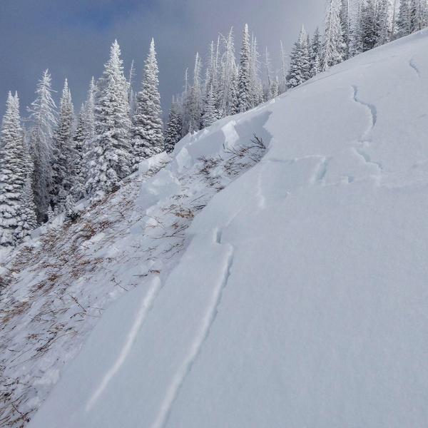
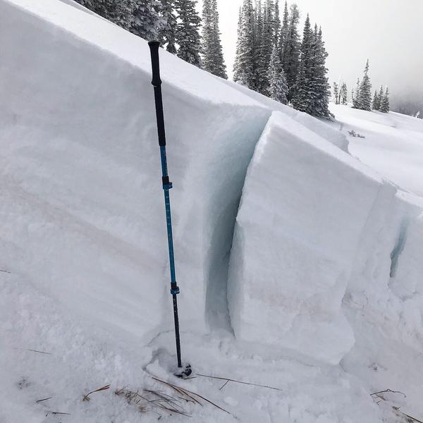
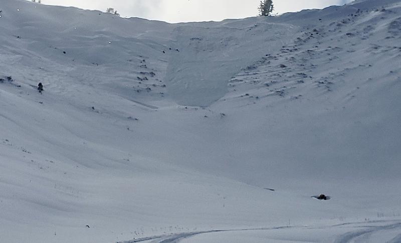
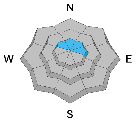
The avalanche danger is CONSIDERABLE in the high elevation northwest through east facing terrain. Avoid those steep high elevation more northerly slopes. If you stay out of this described terrain, the avalanche danger is much lower.
Low
Moderate
Considerable
High
Extreme
Learn how to read the forecast here
Recent Avalanches
There were at least two avalanches that released on Saturday. I triggered one remotely from over 100 feet away while traveling on skis on a safe low angled ridgeline. I was walking along looking at north facing terrain when the slope made a loud "whoomp" and collapsed causing the avalanche. It was about 3 feet deep, 150 feet wide and ran about 150 feet.
The other avalanche that was reported was from the upper main bowl of Pleasant Creek. Riders reported that it released during the day while they were up there. It is quite possible that they triggered it remotely from a distance away from the actual avalanche.
Ad
Avalanche Problem #1
Persistent Weak Layer
Type
Location
Likelihood
Size
Description
Well, I got the information I was looking for about the snowpack on Saturday when I triggered that avalanche. There is no doubt that the old weak sugary snow from October is acting as a persistent weak layer of snow. This weak layer is mostly present on northwest, north, and northeast facing slopes above about 9000 feet. It may be present on some east facing slopes also.
The avalanches that ran on Saturday were what I'd call "pockety" in that they weren't all that wide and didn't take out the entire avalanche paths.
Unanswered questions are:
  1. Will the avalanches remain "pockety" or is it possible to trigger wider avalanches?
  2. How long will this weak layer remain unstable? How long until it doesn't produce avalanches anymore?
Only time will tell. Continued backcountry observations and snowpack investigating hopefully will make this more clear over time. If you see anything of interest out there, please contact me to help with these forecasts.
Additional Information
Weather Outlook:
We'll have a couple of days of fairly nice weather with mostly clear skies and high temperatures in the mid 20s. Southwest wind will be light to moderate today and looks like it increases in speed on Monday. We'll see another storm move through Wednesday into Thursday. It doesn't look huge as of now but we might see 6 inches of new snow out of it. The extended pattern looks somewhat active with occasional small storms but nothing real big as far as I can see right now.

This forecast is from the U.S. Forest Service, which is solely responsible for its content. This forecast describes general avalanche conditions and local variations always occur.