Forecast for the Skyline Area Mountains

Brett Kobernik
Issued by Brett Kobernik on
Thursday morning, November 28, 2019
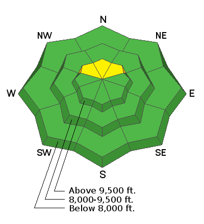
The avalanche danger is LOW to Moderate today. If you were to get into the highest elevation north facing terrain, there is a chance you could trigger a fresh wind drift. Hitting hidden rocks and logs is way more of a concern right now compared to triggering an avalanche.

Anticipate a rising avalanche danger this week as the next storm moves through.
Low
Moderate
Considerable
High
Extreme
Learn how to read the forecast here
Weather and Snow
The east wind really did a number on the snow. It really stirred things up on Wednesday. Plumes were coming off the peaks for most of the day. There will be places with hardly anything on the ground and places with deep drifts.

The storm has been stalled out in northern Utah over the Ogden and Logan mountains. Weather models still insist that it will shift it's focus to central Utah today and Friday. We're still looking at about a foot of new snow.
Ad
Additional Information
This forecast is from the U.S. Forest Service, which is solely responsible for its content. This forecast describes general avalanche conditions and local variations always occur.