Join us at our 2nd Annual Blizzard Ball

Forecast for the Skyline Area Mountains

Brett Kobernik
Issued by Brett Kobernik on
Sunday morning, January 5, 2025
The overall danger rating is CONSIDERABLE today on the Manti Skyline.
There were human triggered avalanches on Saturday and more are likely today if you are getting into steep terrain.
The most dangerous locations are slopes steeper than 30˚ above 8000 feet in elevation that face west, north, or east.
Low
Moderate
Considerable
High
Extreme
Learn how to read the forecast here
Weather and Snow
Current Conditions: The Skyline picked up about 6 inches of new snow on Saturday. Riding conditions should be quite good although there was some stronger wind along the higher terrain so you may find some wind crusts and drifts. The wind has been from the northwest and has been slowing. Temperatures have continued to cool and most locations are around 15˚ this morning.
Mountain Weather: Skies start out mostly clear but we'll probably see some clouds and slightly breezy ridgetop wind from the northwest which should continue to slow through the day. High temperatures will get into the low 20s. We'll see another small storm move through Monday into Tuesday which will bring a few inches of snow.
Recent Avalanches
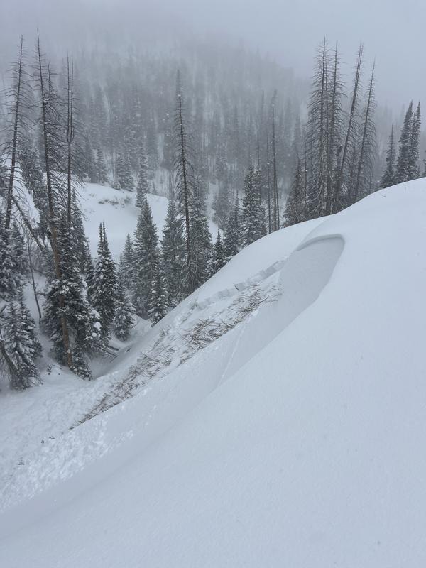
There were a couple of human triggered avalanches in Huntington Canyon on Saturday. These were remotely triggered (triggered from a distance away) and no one was caught. They were about 2 feet deep and broke into weak faceted snow near the ground. MORE DETAILS HERE
Ad
Avalanche Problem #1
Persistent Weak Layer
Type
Location
Likelihood
Size
Description
The avalanches triggered on Saturday tell us everything we need to know. The snowpack remains unstable in many locations. The buried faceted Persistent Weak Layer will slowly start to stabilize especially if we can continue to get more new snow. However, for right now, you will want to avoid steep terrain until we see more signs of stability. Recent avalanche are the biggest sign of unstable conditions. Collapsing or "whumpfing" of the snowpack underneath you is another big clue.
.
Avalanche Problem #2
Wind Drifted Snow
Type
Location
Likelihood
Size
Description
Because the wind was strong enough to drift the new snow during the storm, you will again want to watch out for areas where the snow has been deposited onto steep slopes and avoid those areas. Watch for cracking in the new snow which indicates the fresh drifts are sensitive.
General Announcements
This forecast is from the U.S.D.A. Forest Service, which is solely responsible for its content. This forecast describes general avalanche conditions and local variations always occur.