Forecast for the Skyline Area Mountains

Brett Kobernik
Issued by Brett Kobernik on
Sunday morning, January 31, 2021
TODAY IS THE TYPE OF DAY THAT AVALANCHE ACCIDENTS ARE LIKELY!!!
Here is why:
  1. Fresh powder - this allures people into the mountains
  2. Nice sunny weather - this also allures people
  3. A weak, unstable and dangerous snowpack - the danger is not necessarily obvious unless you know how unstable the snow is
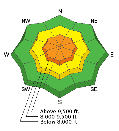
The danger rating is CONSIDERABLE today. Human triggered avalanches are likely. Use extreme caution and avoid steep slopes.
Low
Moderate
Considerable
High
Extreme
Learn how to read the forecast here
Weather and Snow
Current Conditions: Light snowfall continued on and off Saturday without much accumulation. The new snow certainly improved riding conditions but things remain variable. The biggest problem is the snowpack is so weak that you punch right through the loose sugary faceted snow to the ground in many places. This limits snowmobile travel drastically and is not great for skiing or snowboarding. Check out Darce Trotters report about what he found on Saturday. DETAILS HERE.
Overnight temperatures were in the mid to upper teens and the northwest wind really died off. It's basically calm out there right now.
Mountain Weather: We have a gorgeous day in store with plenty of sun and mild temperatures. Highs will get into the upper 20s and southwest wind will be light but perhaps increasing slightly in the afternoon. Another small storm will move through about Wednesday. Weather models are once again starting to back off larger water numbers they were originally advertising. This fits the pattern that has been going on all season. It's looking like about a 6 inch storm as of now.
Recent Avalanches
There was one natural avalanche reported from the Fairview Canyon zone on Saturday. DETAILS HERE. It broke into weak facets taking out the entire shallow snowpack. It was along a ridge where wind loaded snow was most likely a factor.
There were numerous other avalanche accidents that happened on Saturday in the Wasatch Range and the Uintas mountains.
Ad
Avalanche Problem #1
Persistent Weak Layer
Type
Location
Likelihood
Size
Description
The weak faceted sugary snow that our base is made up of is starting to show its cards. The natural avalanche reported from Saturday is a huge indicator. There are many areas that now have enough newer snow loaded on top of the old weak snow to make things unstable and dangerous.